|
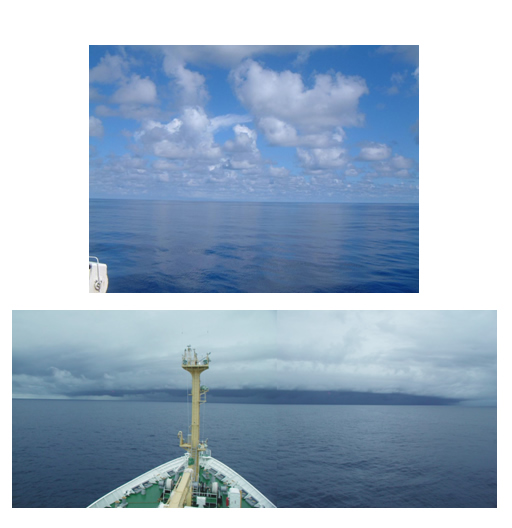
Figure 3 : Typical appearance of the sky before and after the onset of the MJO-convection. (top: taken on November 2; bottom: taken on December 4) Before the convection get active, many small cumulus of 2-3 kilometers high and 10 kilometers horizontally long are observed. The surface of the ocean is very calm and reflects clouds up the sky like a mirror. On the other hand, once the convection gets active, the entire sky is covered with clouds most of the time and each cloud spread horizontally, and then cloud bands often bring torrential rain. |