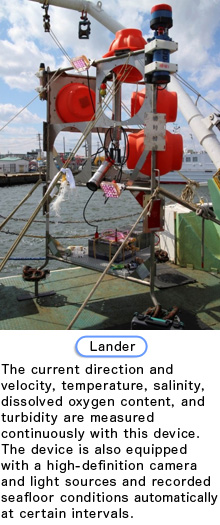
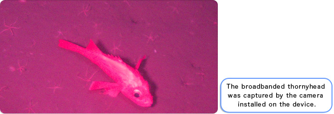
Current seafloor conditions will be determined by studying bathymetric features.
Just as a map is used when visiting a place you have never visited before, a detailed bathymetric map is essential for conducting an investigation on marine organisms and environments. No sufficient bathymetric data is available for the coastal region of Sanriku. In addition, landforms in some of the areas changed due to the earthquake. We are in the process of creating a detailed bathymetric map of the Sanriku coast after the earthquake by employing various techniques.
We investigated the distribution and decomposition processes of debris and elucidated the impacts of debris on marine ecosystems and fisheries.
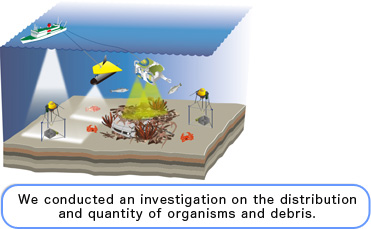
The tsunamis carried various onshore objects to the sea, some of which remain on the seafloor. It is likely that such debris has a significant impact on marine ecosystems and fisheries. We aim to investigate the type and location of debris and the extent to which it has been spread in hopes of providing information to promote the revitalization of fisheries.
We elucidated the impacts of the earthquake, tsunamis, and
restoration processes by conducting long-term monitoring of
marine environments from the sea surface to the seafloor.
The marine environment has changed significantly due to the inflow of soil and sand from coastal areas, submarine slope failures, and the suspension of sediments on the seafloor caused by earthquake and tsunamis. We aim to elucidate how the earthquake and tsunamis affected the marine environment and how it will be restored. In order to achieve that objective, it is essential to investigate continuously the physical, chemical, and biological marine environments from sea surface to seafloor sediments. Although this data may not directly and immediately be helpful for fishermen activity, it is essential to acquire basic data on marine environments to discuss future fisheries management strategies. Nothing would make us happier than knowing that our investigation led to the revitalization of the fisheries and that the individuals involved in fisheries found our work useful.
We represented the health of the ocean by
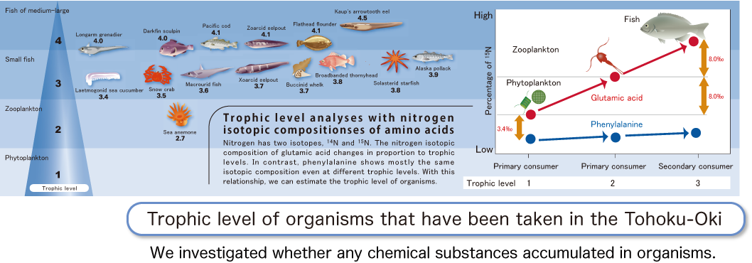
measuring chemical substances in organisms.
The tsunamis carried various objects from the land to the sea. Some of the objects contained the toxic substance PCBs (polychlorinated biphenyls). We aimed to elucidate the health of the ocean by measuring the level of PCBs contained in organisms and the sediments. Furthermore, we estimate trophic levels together with PCB analysis. Organisms at higher trophic levels play an important role in providing an overall picture of ecosystems. In other words, organisms at higher trophic levels tend to have increased longevity and serve as a useful monitor for understanding the levels of sea pollution via food chains. Therefore, it is very important to investigate trophic levels in addition to PCB concentration levels. Although PCB concentrations in sediments and organisms are currently below the reference values, we will continue to monitor the levels in the future.