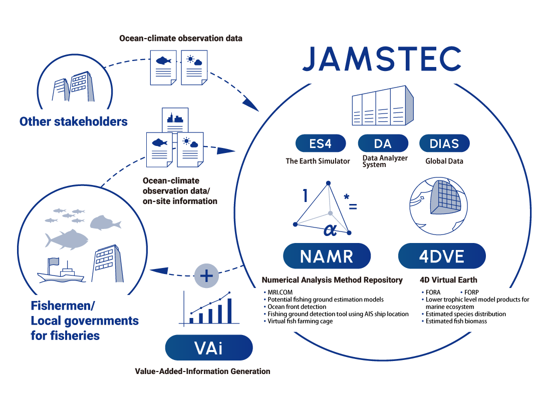
What is
“Marine life distribution prediction”
project?
Develop a variety of statistical models for estimating and predicting the biological
resources distributions of target species by integrating ocean environment data and
observation data of fish distributions, clarify the mechanism of changes in fisheries
resources, improve the model accuracy, and create information that contributes to fisheries
information services.
・FORA(Four-dimensional Variational Ocean
ReAnalysis for the Western North Pacific)
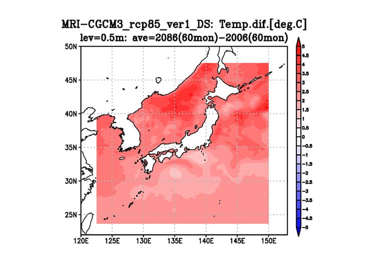
・FORP(Future Ocean Regional Projection dataset for coastal applications
in Japan)
・FORP(Future Ocean Regional Projection dataset for the Western North
Pacific)