Investigating the Seafloor
Multichannel Seismic Reflection Survey / Refraction and Wide-angle Reflection Survey
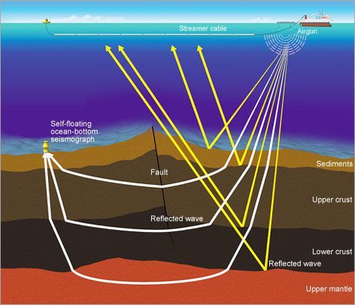
Studying the Underground Structure by Sound Waves
Multichannel seismic reflection survey
Man-made earthquakes are generated using equipment called an airgun which emits elastic waves in seawater. Processing the data from the airgun provides us with images of underground structures including geologic strata as well as faults ten to twenty kilometers deep.
Refraction and wide-angle reflection survey
Man-made earthquake signals generated from an air-gun are recorded by Ocean-Bottom Seismographs. Those signals are refracted and reflected from deeper parts of the crust, and generally provide us with deeper structural images than those obtained by the seismic-reflection survey. The data can be resolved down to more than 50 km deep, although resolvable depth depends on complexity of an underground structure.
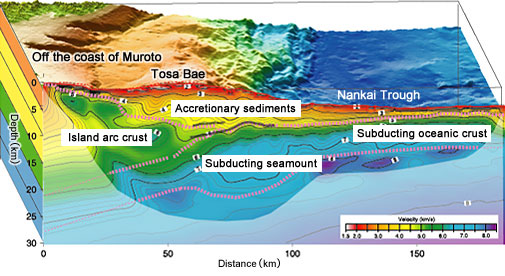
Subduction of the seamount in the Nankai Trough recorded by the seismic refraction system
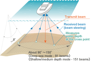
Multi-narrow Beam Echo Sounder
Measure the seafloor topography and strata by acoustic beam
An acoustic beam is periodically transmitted to the seafloor from the bottom of the vessel. Hydrophone array will receive the acoustic beams reflected from the seafloor in order to determine the distance between the vessel and the seafloor. The topography is determined based on this data. The sub-bottom profiler is equipped to reveal the subsurface strata at a depth of about several tens of meters. Since the seafloor is free from weathering or corrosion, its history is well preserved. Therefore, investigation of the seafloor topography will provide the history of volcanism and plate tectonics.
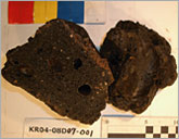
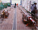
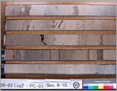
Piston Corer
Recovery of Marine Sediment
Plankton and other sediment flux are deposited on the ocean surface and form stratum gradually. The sediment stratum is layered sequentially from ancient to modern. The study of the sediment stratum offers a clue to understanding the history of global climatic change.
A piston corer consists of a heavy weight and a long pipe to collect the sediment core samples. The analysis of the sample by color, structure, physiology, fossils of microorganisms contained within, and rock fragments will provide information on the age of sedimentation, water temperature and living organisms at that age in addition to other information.
R/Vs MIRAI and KAIREI, JAMSTEC are equipped with piston corers which can penetrate a maximum of 20 m sediment by using a 1.2 ton-weight. Such a sample will cover the past several hundred thousand years for the study of climate change.
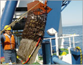
Dredge
Collecting rock samples
Dragging cylinder-like or box-type containers by ship connected by cable or chain it is possible to collect the sediment or rock on the ocean floor. The samples are collected non-selectively, unlike the pin-point sampling by the unmanned submersible. But this system is simple, and easily handled. A major advantage is that the dredge can be used on any ship.
We cannot take samples from deep Earth. The ocean floor is formed by the material transferred from the interior of the Earth through the movement of the crust. The composition of the rock and volcano on the ocean floor will provide information on the composition of the rock present near the core and activities of the Earth.