


September 30
Day:68
Location at 2400 is off Izu Oshima, Japan
Weather: Fine but cloudy
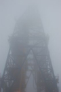
Expedition 337 officially finished as of 2400 h on Sep 30, but Chikyu is still at wait on weather until the sea conditions will allow re-birthing at Shimizu Port.

September 29
Day:67
Location at 2400 is on transit to Izu Oshima, Japan
Weather: Cloudy
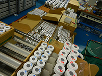
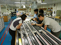
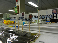
Chikyu left Shimizu port for typhoon evacuation at 1700, after loading and off-loading. Expedition 337 personal samples have been shipped out to each requester.
September 28
Day:66
Location at 2400 is Shimizu Port, Japan.
Weather: Cloudy
Loading and off-loading is ongoing. Typhoon evacuation from the port is expected.
September 27
Day:65
Location at 2400 is Shimizu Port, Japan.
Weather: Cloudy
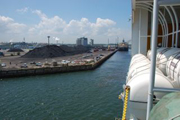
Port call at Shimizu port. Loading and off-loading has been ongoing.
September 26
Day:64
Location at 2400 is Shimizu Port, Japan.
Weather: Fine but cloudy
Sail back and Chikyu has arrived at alongside Shimizu Port at 06:00. Loading and off-loading has started.
September 25
Day:63
Location at 2400 is 34.952° N, 138.592° E
Weather: Cloudy
Sail to Shimizu port. Lab staffs continue to prepare for off-loading of samples and equipment at the port. Chikyu will be arrived at Shimizu port tomorrow early morning.
September 24
Day:62
Location at 2400 is 35.578° N, 141.197° E
Weather: Overcast
Sail to Shimizu port. Lab staffs are preparing for off-loading of samples and equipment during port call.
September 23
Day:61
Location at 2400 is 41° 10.5983' N, 142° 12.0328' E, Hole C0020A
Weather: Rain
Guests and the remaining scientists all disembarked. Chikyu is heading south to Shimizu port for next port call.
September 22
Day:60
Location at 2400 is 41° 10.5983' N, 142° 12.0328' E, Hole C0020A
Weather: Fine but cloudy
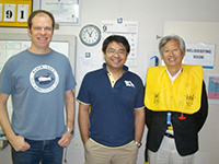
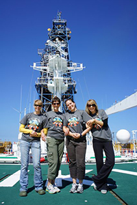
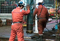
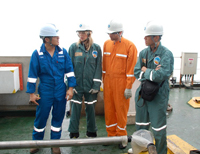
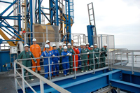
Rig down Riser running equipment. Maintenance. Guests from J. Craig Ventor Institute visited Chikyu. The photo shows the guests and co-chief scientist Fumio Inagaki on the heli-deck.
September 21
Day:59
Location at 2400 is 41° 10.5983' N, 142° 12.0328' E, Hole C0020A
Weather: Cloudy
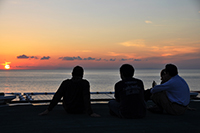
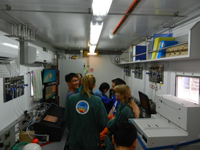
Rig down Riser running equipment. 18 scientists disembarked and all scientific work in the lab was closed. Some scientists stay onboard for packing their third party tools. The photo shows scientists ready to fly back to shore.
September 20
Day:58
Location at 2400 is 41° 10.5983' N, 142° 12.0328' E, Hole C0020A
Weather: Fine but cloudy
Continue recovering riser pipe and Blow-Out-Preventer. Due to a potential schedule change in helicopter flights on 21st, five scientists have disembarked today. Remaining scientists finished up all the reports and spent a relaxed night before disembarkation.
September 19
Day:57
Location at 2400 is 41° 10.5983' N, 142° 12.0328' E, Hole C0020A
Weather: Rain
Recover riser pipe. Set corrosion cap by ROV. Report writing and reviewing continues. CDEX director-general Wataru Azuma left Chikyu after talking with many of onboard staffs. Associate Logging Staff Scientists Moe Kyaw Thu and Yasuyuki Nakamura also disembarked after completion of preliminary processing of logging data.
September 18
Day:56
Location at 2400 is 41° 10.5983' N, 142° 12.0328' E, Hole C0020A
Weather: Fine but cloudy
Disconnect Blow-Out-Preventer from wellhead. Remove tensioner ring, moonpool hose and gooseneck. Report writing and reviewing continues. Physical Property Specialist Sumito Morita disembarked today.
September 17
Day:55
Location at 2400 is 41° 10.5983' N, 142° 12.0328' E, Hole C0020A
Weather: Fine but cloudy
Prepare for recover riser and Blow-Out-Preventer. Scientists continued drafting and revising the report. Curator and lab staffs are double checking all personal samples to be sent to sample requesters.
September 16
Day:54
Location at 2400 is 41° 10.5983' N, 142° 12.0328' E, Hole C0020A
Weather: Fine but cloudy
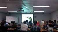
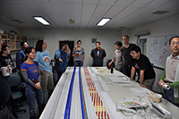
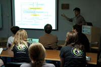
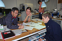
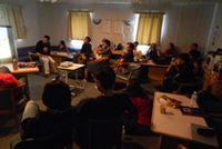
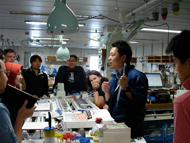
Prepare for recover riser and Blow-Out-Preventer. Science party is drafting and revising the report. The last series of measurements is ongoing. The photo shows the science party meeting on logging results.
September 15
Day:53
Location at 2400 is 41° 10.5983' N, 142° 12.0328' E, Hole C0020A
Weather: Fine but cloudy
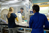
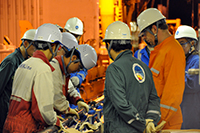
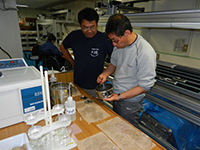
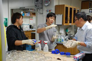
Transfer of downhole fluid samples was completed and fluid and gas samples were distributed to onboard measurements and personal samples. Science party is integrating the outcome from each group into a consistent interpretation of the results. The photo shows the scientists working on formation fluid samples in a glove box.
September 14
Day:52
Location at 2400 is 41° 10.5983' N, 142° 12.0328' E, Hole C0020A
Weather: Cloudy
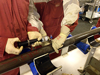
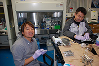
Wireline logging was completed and that is the end of scientific operation on the rig floor in this expedition. Analysis in the lab still continued with the newly obtained formation fluid sample from downhole tool. Scientists opened the pressurized bottle with care and started analysis. VSP (Vertical Seismic Profile) was completed successfully and scientists are working on preliminary interpretation. The photo shows formation fluid sample recovered on deck.
September 13
Day:51
Location at 2400 is 41° 10.5983' N, 142° 12.0328' E, Hole C0020A
Weather: Fine but cloudy
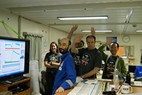
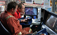
Continue run #4 wire line logging. Pressure measurements were carried out at 30 horizons, and fluid mobility data was also acquired. Based on the results, co-chief scientists determined candidates for in-situ fluid sampling. Fluid sampling started and the first bottle was filled successfully. The photo shows the scientists saying good bye at the end of Chikyu-TV live broadcast.
September 12
Day:50
Location at 2400 is 41° 10.5983' N, 142° 12.0328' E, Hole C0020A
Weather: Fine but cloudy
Wiper trip and wireline logging #4 run for in-situ fluid sampling.
Geochemists presented the preliminary results in a science party meeting to exchange the results of their analysis. Contamination of fluid sample was an issue, and the scientists look forward to receiving pristine fluid from the formation soon. The photo shows the co-chief scientists and logging scientist Yasuhiro Yamada wondering about the selection of fluid sampling locations.
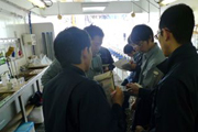
September 11
Day:49
Location at 2400 is 41° 10.5983' N, 142° 12.0328' E, Hole C0020A
Weather: Cloudy
Wireline logging operation #3 was completed and wiper trip is ongoing.
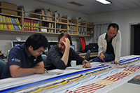
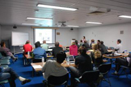
Logging scientist Yasuhiro Yamada presented preliminary interpretation of logging data from the first two runs. Scientists are selecting targets for formation pressure measurements in logging run #4. The photo shows the science party gathering around the rush print of wireline logging data.
September 10
Day:48
Location at 2400 is 41° 10.5983' N, 142° 12.0328' E, Hole C0020A
Weather: Fine but cloudy
Wireline logging operation started and the first data was acquired in morning hours. The second run to obtain borehole image is ongoing. Lab measurements of core and cuttings samples are getting close to the end. Second look of sections and additional sampling/measurements are planned. The logging data looked good and the caliper showed good hole conditions. Associate logging staff scientist Yasuyuki Nakamura got onboard to assist the science party with sonic data processing.
September 9
Day:47
Location at 2400 is 41° 10.5983' N, 142° 12.0328' E, Hole C0020A
Weather: Cloudy
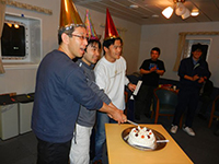
RCB core #32 was on deck at 03:54 and it was the end of coring operation at C0020A. Since Aug 25, we took 32 cores from a total of 263.5 m of drilling with average recovery of 76%. The last core was again good recovery. While the core processing has been going toward the end, co-chief scientists are wondering how we can utilize the last few cores. After pulling out of the hole, we rig up wireline logging tools. Microbiologist Changhong Liu was celebrated for winning the Chikyu cup Ping-Pong championship. The photo shows co-chief scientists watching over the processing of the last core carefully.
September 8
Day:46
Location at 2400 is 41° 10.5983' N, 142° 12.0328' E, Hole C0020A
Weather: Fine but cloudy
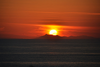
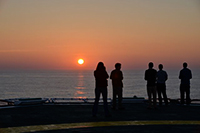
RCB cores #29 was recovered from 2400 meters below seafloor and co-chief scientists decided to take a pair of last cores #30 and #31 with 9.5 and 4.0 m of advance respectively, before reaching to the final depth of 2460 meters. However coring of #31 was stopped at less than 1 m advance due to possible jamming, while the scientists were observing unique features in CT image of #30. After recovery of short core #31, a full-length core #32 is going to be cut. Core #30 showed a wide variety of lithology in X-CT image and co-chief scientists are wondering how we can use the section to maximize the scientific outcome. This interval will also be covered with FMI data to capture the structure in borehole image. After completion of coring, wireline logging operation will have 5 runs including in-situ fluid sampling. Side-wall coring was included in the original plan but has been cancelled because we could get sufficient RCB cores from the target zone. It is also because additional measurement time is required to cover the extended interval of 2200 to 2466 meters. The photo shows beautiful sunset over the mountains (view from Chikyu).
September 7
Day:45
Location at 2400 is 41° 10.5983' N, 142° 12.0328' E, Hole C0020A
Weather: Fine but cloudy
RCB core #28 was recovered from 2300 meters below seafloor, and continued drilling down to 2400 m. Operation Superintendent changed from Tomo Saruhashi, who made the incredible core recovery of the coal bed, to Ikuo Sawada. Core and cuttings processing work caught up with the speed of coring, and more of discrete sample analysis is ongoing. Co-chief scientists announced the deadlines of report submission, and each group keep revising and producing the draft manuscript. Associate logging staff scientist Moe Kyaw Thu got onboard today and joined the preparation work of logging team.
September 6
Day:44
Location at 2400 is 41° 10.5983' N, 142° 12.0328' E, Hole C0020A
Weather: Overcast
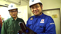
RCB core #26 was cut from 2110 meters below seafloor and this core turned out to be the sample from the deepest hole in scientific ocean drilling. We celebrated the core with more than 100% recovery. Drilling continues with spot coring at every 100 m. Core processing continued and cores #23 and #24 are on the table. Processing of cuttings samples was stuck during the continuous coring operation, but we are catching up with the speed of drilling during spot coring. Science party had a meeting on the logging operation plan. In-situ fluid sampling is the focused area that is new to science party members. The photo shows co-chief scientists Fumio Inagaki (left) and Kai-Uwe Hinrichs (right) celebrating the record breaking core.
September 5
Day:43
Location at 2400 is 41° 10.5983' N, 142° 12.0328' E, Hole C0020A
Weather: Overcast
Continued RCB coring and recovered cores #23 - #25. We have cored a total of 84.5 m from coal-rich interval with very successful recovery of 86.5%. We were able to observe and take samples through the interval, which turned out to contain a few massive coal beds and many of patchy or thin coal layers. As our primary objectives were to sample various lithologies within and around the coal rich formation, we believe we have fulfilled our operational mission in this interval at this point. For further investigation of the wider range of the hydrocabon system and the limits of deep subseafloor life, we are drilling down to 2110 meters below seafloor as the next target depth. Core processing continued and cores #20 and #21 are on the table. It is getting difficult to find microfossils for age control. Logging Staff Scientist Yoshinori Sanada is back onboard and started preparation of wireline logging operation together with engineers.
September 4
Day:42
Location at 2400 is 41° 10.5983' N, 142° 12.0328' E, Hole C0020A
Weather: Cloudy
Resumed RCB coring and recovered cores #19 - #22. As the coring operation has been going smoothly and the recovery has been better than expected, we will start drilling down to deeper target after a few more cores. Lab was busy with processing RCB cores recovered every 3 hours. The recovery was good containing organic rich sediments. Quick evaluation of the core material by X-CT image helps making sampling and analysis plan before splitting the core. Cores through #18 have been split and sampled. Lab technicians had regular crew change. Publication Assistant Rhonda Kappler from Texas A&M Univ got onboard. The photo shows void gas sampling at the core cutting area.
September 3
Day:41
Location at 2400 is 41° 10.5983' N, 142° 12.0328' E, Hole C0020A
Weather: Cloudy
Pulled out the bottom-hole assembly and run again with a new RCB drill bit. Sampling and analysis of RCB cores continued. Cores #15 to #17 have been split and are on the table in laboratory.
September 2
Day:40
Location at 2400 is 41° 10.5983' N, 142° 12.0328' E, Hole C0020A
Weather: Cloudy
RCB coring continued through the day, and we are entering the target coal interval.
After drilling down to 1919 meters below seafloor, the core #15 contained a thick coal bed. However the following cores #16 and #17 were mainly semi-consolidated sand. Coal was recovered again in Core #18. During cutting core #18, the drill bit was suspected to be worn out. Co-chief scientists and Operation Superintendent decided to retrieve the drill bit. It was also decided that we continue RCB coring and cancel Large Diameter Coring. RCB has shown unexpectedly high core recovery in coal bearing lithology. Core quality of coal recovered by RCB was also good enough to fulfill our scientific objectives. Sampling and analysis of RCB cores continued. Cores #13 and #14 have been split and are on the table. The sediments are getting dry and the recovered interstitial fluid is getting fewer.
September 1
Day:39
Location at 2400 is 41° 10.5983' N, 142° 12.0328' E, Hole C0020A
Weather: Misty
RCB coring continued through the day. Three consecutive cores #11 - #13 were recovered from 1737.5 meters below seafloor.
Core #14 was recovered after drilling down to 1820 meters. Good core recovery of mudstone was obtained through cores #11-#14. Sampling and analysis of RCB cores continued. The photo shows Operation Superintendent Tomokazu Saruhashi carefully watching over the drilling parameters with a driller during coring operation.

August 31
Day:38
Location at 2400 is 41° 10.5983' N, 142° 12.0328' E, Hole C0020A
Weather: Cloudy
Recovered two consecutive cores #9 and #10, followed by drilling down to next coring target.
The core #9 was is 4.0 m of drilling advance due to slow rate of penetration, but the recovery turned out to be 99%. Core processing of the large diameter core #8 was completed. Core
#9 is on the sampling table and Core #10 is ready to split.
August 30
Day:37
Location at 2400 is 41° 10.5983' N, 142° 12.0328' E, Hole C0020A
Weather: Fine but cloudy
Recovered 10.0 meters of industry-type large diameter core from 21.5 meters of advance.
Make up and run 10-5/8 inch RCB Coring assembly to open hole to 1625.5 meters below seafloor. Science Party received a good quality core of 10 m. The larger diameter of 10 cm than regular RCB core turned out to be intact and to have less concerns of contamination. Whole round sampling plan was determined by co-chief scientists after observation of XCT images.
August 29
Day:36
Location at 2400 is 41° 10.5983' N, 142° 12.0328' E, Hole C0020A
Weather: Cloudy
Run industry-type large diameter coring system and started cutting a 27-meters core.
Coring was stopped when increased pump pressure was observed at 1625.5 meters below seafloor. Retrieving the core from 21.5 m of advance. Science Party had a meeting to discuss sampling and analysis plan of large diameter cores. The measurement plan follows that of regular RCB cores, but larger diameter will allow more flexible sampling to allocate multiple sub-samples from the same horizon.
August 28
Day:35
Location at 2400 is 41° 10.5983' N, 142° 12.0328' E, Hole C0020A
Weather: Cloudy
Hard gravels were recovered in Core #7 and co-chiefs scientists requested to take an industry type large diameter core at this depth.
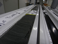
Target is Oligocene-Eocene unconformity, which was observed below low ROP (rate of penetration) interval at a nearby well. Science Party had a meeting to discuss handling of large diameter cores. As the sampling plan depends on lithology, sampling will not be started until co-chief scientists observe XCT image through the cored interval and confirm the position of the lithology boundary. The photo shows a working half section on the sampling table, flagged by each sample requester.
August 27
Day:34
Location at 2400 is 41° 10.5983' N, 142° 12.0328' E, Hole C0020A
Weather: Fine but cloudy
Recover two short advance (5 m) cores from 1490 meters below seafloor.
We drilled down but hit a low ROP (rate of penetration) layer before reaching to the next planned coring depth so that it was decided to take core sample. Science Party continued sampling and analysis of the cores #3 to #6. Core #7 was recovered. Scientists had a party to celebrate the delivery of the first cores, the midpoint of the cruise, and three birthdays this week.
August 26
Day:33
Location at 2400 is 41° 10.5983' N, 142° 12.0328' E, Hole C0020A
Weather: Cloudy
Drill down 10-5/8 inch hole to 1370 meters below seafloor and cut #3 and 4 RCB core. Core #3 was a short advance (5 m).
Drill down 10-5/8 inch hole to 1490 meters below seafloor. Science Party continued sampling and analysis of the cores #1 and #2. Core #3 is also ready to be split. Short advance (5 m) was attempted for coring the interval where low recovery was expected.
August 25
Day:32
Location at 2400 is 41° 10.5983' N, 142° 12.0328' E, Hole C0020A
Weather: Foggy
Run in hole 10-5/8 inch RCB coring bottom-hole-assembly.
Drill 10-5/8 inch hole and cut core sample. After a long wait, Science Party received the first core, which was 2.2 m long containing relatively soft sediments. Each of lab space got busy with the sampling and analysis of the real core samples. The photo shows a co-chiefs scientist Kai-Uwe Hinrichs (left) and Fumio Inagaki (right) anxiously watching their first core.
August 24
Day:31
Location at 2400 is 41° 10.5983' N, 142° 12.0328' E, Hole C0020A
Weather: Overcast
Leak off tests of the formation was completed and running RCB coring assembly.
Science Party had a meeting to confirm the core analysis plan. Core sections will be kept in an air-tight bag during whole round core processing to minimize oxidization before sampling. The photo shows a co-chiefs scientist Fumio Inagaki (left) and Sedimentologist Masafumi Murayama investigating cuttings material.
August 23
Day:30
Location at 2400 is 41° 10.5983' N, 142° 12.0328' E, Hole C0020A
Weather: Foggy
Running into the hole with 12-1/4 inch drill out cement assembly.
Casing pressure test was OK. Drill 12-1/4 inch hole from 1263 to 1265.5 meters below seafloor, 2.5 meters into formation. Displace seawater to drilling mud. Co-chiefs scientists adjusted the planned depth of coring following the depth correlation between seismic profiles and the observed cuttings. Logging Scientist Yasuhiro Yamada and Physical properties specialist Sumito Morita talked about the geological background of the drill site. Media visitors flew to Chikyu and had interviews with Operation Superintendent and a co-chief scientist.
August 22
Day:29
Location at 2400 is 41° 10.5983' N, 142° 12.0328' E, Hole C0020A
Weather: Foggy
Continue to run Seal Retrieving Tool assembly to set on well head. Tag on wellhead and pressure test on pack off seal and BOP were both OK. Pull out the tool to surface and set Wear Bushing with running tool. Pressure test of mud hose was conducted. Make up and run 12-1/4 inch drill out cement assembly. Sedimentologists Doris Reischenbacher and Rita Susilawati talked in the science cafe about coal and coal bed methane. Co-chief scientists discussed with Operation Geologist and Logging scientist about depth correlation between cuttings and seismic profiles to revise the planned depth of coring.
August 21
Day:28
Location at 2400 is 41° 10.5983' N, 142° 12.0328' E, Hole C0020A
Weather: Misty
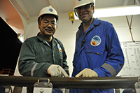
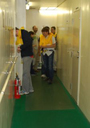
Cementing of 13-5/8 inch casing was carried out but pressure test for pack off seal was not fully successful. Tool was retrieved and seal retrieving tool is running. Science Party started drafting a report for the depth from 647 to 1263 meters below seafloor. Microbiologist Clemens Glombitza talked in the science cafe about sulfate reduction in the seafloor. There were crew changes of laboratory staff. The photo shows Laboratory officers Tomoyuki Tanaka (left) and Hiroaki Muraki (right) handing over the job at their crew change.
August 20
Day:27
Location at 2400 is 41° 10.5983' N, 142° 12.0328' E, Hole C0020A
Weather: Fine but cloudy
Run 13-3/8 inch casing and casing hanger with running strings. Science Party had a second meeting to summarize the lab activity so far. Group leaders of sedimentology, micropaleontology, physical property, and solid organic geochemistry presented the results from the 647 to 1263 meters below seafloor, and proposed plans for the analysis of the deeper sections. After the meeting, live broadcast from Chikyu lab to Korean Institute of Geoscience and Mineral Resources was carried out. Sedimentologist Young Soo Park was featured in the 1 hour program.
August 19
Day:26
Location at 2400 is 41° 10.5983' N, 142° 12.0328' E, Hole C0020A
Weather: Cloudy
Preparing for running casing. Science Party had a meeting to summarize the lab activity so far. Group leaders of inorganic geochemistry, microbiology, logging and gas organic geochemistry presented the results from the 647 to 1263 meters below seafloor, and proposed plans for the analysis of the deeper sections. Logging Staff Scientists Yoshinori Sanada and assistant Yukari Kido disembarked today.
August 18
Day:25
Location at 2400 is 41° 10.5983' N, 142° 12.0328' E, Hole C0020A
Weather: Foggy
Drilling 17-1/2 inch hole with sea water gel to 1263 meters below seafloor. Scientists continued cuttings analysis in the lab. From the interval that caused lost circulation, unconsolidated sediments were recovered. Sedimentologists are looking into details although the sample contains a lot of contaminants from LCM.
August 17
Day:24
Location at 2400 is 41° 10.5983' N, 142° 12.0328' E, Hole C0020A
Weather: Overcast
Countermeasure for lost circulation. Preparing for drilling with sea water gel. Scientists went through the sampling/measurement protocol to analyze the first sets of cuttings samples. Due to the delay in drilling operation, scientists were asked to prioritize the coming scientific operation and have decided to cancel the wireline logging for 647 to 1220 meters below seafloor.
August 16
Day:23
Location at 2400 is 41° 10.5983' N, 142° 12.0328' E, Hole C0020A
Weather: Cloudy
Drilling continued to 1166.5 meters below seafloor with frequent circulation and bottoms up. Encounter Lost Circulation at 2375meters below rotary table. Scientists are busily working on cuttings analysis. Mud gas monitoring and drill mud analysis are also ongoing.
Co-chiefs Scientist Kai-Uwe Hinrichs got onboard today.
August 15
Day:22
Location at 2400 is 41° 10.5983' N, 142° 12.0328' E, Hole C0020A
Weather: Cloudy
After displace and condition Mud, Formation Integrity Test was completed.
Started drilling 17-1/2 inch hole to 2171 m below rotary table (962.5 meters below seafloor). First cuttings samples were delivered before noon and science party started analyzing the samples.
Mud gas monitoring and drill mud analysis are also ongoing.
August 14
Day:21
Location at 2400 is 41° 10.5983' N, 142° 12.0328' E, Hole C0020A
Weather: Fine but cloudy
BOP pressure test has been completed and the bottom-hole-assembly with 17-1/2 inch drill bit entered the hole to start drilling out cement.
The hole has been renamed as a new IODP hole C0020A. New mud gas monitoring system has been started up during drilling out cement, and observed a variation in gas concentration. Gas team of scientists and lab technicians are ready to see data from fresh formation.
August 13
Day:20
Location at 2400 is 41° 10.5983' N, 142° 12.0328' E
Weather: Overcast
BOP function test is ongoing. Science Party carried out dry runs of cuttings work flow and confirmed detailed work assignments. Logging Staff Scientist Yoshinori Sanada presented a talk on wireline logging program of the expedition, then took scientists to the logging unit to show the tools.
August 12
Day:19
Location at 2400 is 41° 10.5983' N, 142° 12.0328' E
Weather: Misty
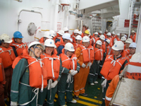
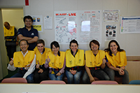
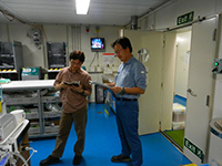
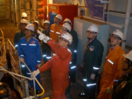
BOP turn test, installation and pressure/function tests of diverter were completed successfully. Running WBRRT. Final sampling and analysis plan for cuttings and mud gas have been posted and the Science Party is eager to receive samples soon. While preparing methodology chapter manuscript, the Science Party enjoys ping-pong tournament. The photo shows ship crew including scientists joining the abandon ship drill.
August 11
Day:18
Location at 2400 is 41° 10.5983' N, 142° 12.0328' E
Weather: Fine but cloudy
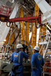
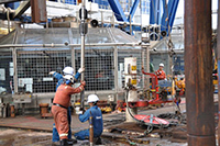
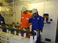
Continue to run BOP and Riser, with pressure test. Successful landing of BOP on wellhead has been confirmed at 2236. Screen of ROV Camera was shut down temporarily but already recovered. Heading turn test is ongoing. Science Party members were watching BOP landing of ROV image, but unfortunately missed the moment because the image transmission was lost just before landing. Each expertise group is preparing a draft manuscript of methodology of onboard analysis. The photo shows CDEX engineer Yasuyuki Yamazaki and Eigo Miyazaki watching over riser tensioner operation.
August 10
Day:17
Location at 2400 is 41° 10.5983' N, 142° 12.0328' E
Weather: Cloudy
Continue to run BOP and Riser, with pressure test of Aux line at 0600.
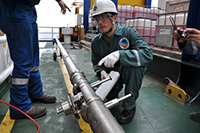
Install Moon pool hose at 1530. ROV dive and check BOP and Well head at 2215. Organic Geochemist Marshall Bowles got onboard and joined the science party today. In the lab, another organic geochemist Akira Ijiri presented about the cruises at Kumano Mud Volcano. Lab staffs are busy preparing for revised cuttings and mud analysis plan. The photo shows Organic Geochemist Akira Ijiri setting up his third party tools in the lab.
August 9
Day:16
Location at 2400 is 41° 10.5983' N, 142° 12.0328' E
Weather: Foggy
Running BOP and riser pipes goes smoothly to 1012 meters as of 24:00.
In the lab, there has been more discussion on sampling plan of cuttings and drilling mud. In particular, importance of drilling mud analysis to evaluate contamination from the drilling mud into core samples has been focused. Inorganic geochemists are trying to develop a method to measure fluid components within drilling mud.
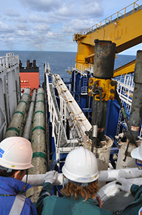
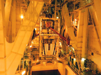
The photo shows riser pipes lowered through moon pool.
August 8
Day:15
Location at 2400 is 41° 10.5983' N, 142° 12.0328' E
Weather: Cloudy
Trouble shooting on blow out preventer and function test was completed at 8:00 and resumed lowering it into water. Science party continued lab preparation with focus on analysis planning on cuttings and drilling mud. Organic Geochemists Yu-Shih Lin and Stephen Bowden presented short talks on biomarker analysis, which is one of the focused and challenging part of this expedition. The photo shows science party gathering for a casual talk on biomarker analysis.
August 7
Day:14
Location at 2400 is 41° 10.5983' N, 142° 12.0328' E
Weather: Cloudy
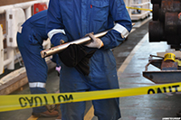
Blow out preventer (BOP) was lowered to moon pool at 0415, but soon retrieved for trouble shooting of control line. Due to the delay in operation, it is likely that we will drill down without coring from 647 to 1220 meters below seafloor. As cuttings and mud gas will be the only sample we will obtain from the interval, scientists are revising the measurement plan to focus on cuttings and mud gas samples. Assistant Expedition Project Manager Lena Maeda, who is in charge of lab preparation before the boarding of science party, has disembarked today. The photo shows BOP ready for lowering into moon pool.
August 6
Day:13
Location at 2400 is 41° 10.5983' N, 142° 12.0328' E
Weather: Cloudy
Trouble shooting and function test of BOP were finished. Pressure test of BOP has been completed as of 20:00. Moved BOP to the cart and prepare for running. Lab preparation continued and guidance for X-ray CT scan image processing and microscope users was provided. Each expertise group is discussing their work plan. The photo shows geochemists discussing in the mud gas monitoring unit.
August 5
Day:12
Location at 2400 is 41° 10.5983' N, 142° 12.0328' E
Weather: Fine but cloudy
Continue preparation and trouble shooting of BOP and riser tensioner. Assemble inner tube for RCB coring. PFC tracer was added to the drilling mud in the active tanks. Some of science party members went to a tour to the derrick and enjoyed the view from the top. Lab preparation continued and guidance for sampling method and report writing were provided.
August 4
Day:11
Location at 2400 is 41° 10.5983' N, 142° 12.0328' E
Weather: Misty
Continue preparation and trouble shooting of BOP and riser tensioner.
Science party is learning the measurement and sample processing protocol, and is getting detailed plan for each group’s task.
August 3
Day:10
Location at 2400 is 41° 10.5983' N, 142° 12.0328' E
Weather: Overcast
Continue preparation and trouble shooting of BOP and riser tensioner. Preparation of VIV monitoring system has been completed. Loading of wireline logging equipment, mud materials, mud logging equipment and lab materials was carried out.
Science party went out to ship tour and familiarize themselves with drilling facilities aboard Chikyu. In the lab, a technician demonstrated the use of onboard scientific database system. A microbiologist Yuki Morono got onboard today.
August 2
Day:9
Location at 2400 is 41° 10.5983' N, 142° 12.0328' E
Weather: Overcast
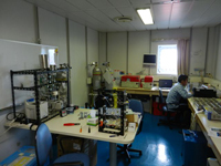
Continue to troubleshoot and function test for BOP. The morning meeting of the science party was continued. Publication Assistant provided some details of report writing schedule and contents of the report. Discussion on the shipboard analysis flow of cuttings and core was organized by Expedition Project Manager. In the afternoon, each expertize group had meeting with lab techs and started preparation for sample handling.
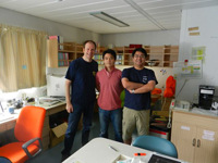
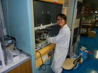
The photo shows preparation at Microbiology Lab.
August 1
Day:8
Location at 2400 is 41° 10.5983' N, 142° 12.0328' E
Weather: Cloudy
Continue to prepare for run BOP and Riser. Conduct BOP pressure test and trouble shoot on valves and pressure switches. Make up 13-3/8 inch casing pipe stand in auxiliary well.
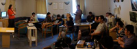
A science party meeting was held for introduction of scientific main targets with operation strategy presented by co-chief scientist Dr. Fumio Inagaki, and self-introduction of each science party members. Guidance of IODP sample/data policy and curatorial information of cuttings and coring were given by onboard curator.

July 31
Day:7
Location at 2400 is 41° 10.5983' N, 142° 12.0328' E
Weather: Fine but cloudy
Twenty-five shipboard scientists embarked on Chikyu with expedition project manager and logging staff scientist by helicopter transportation. Safety induction, general lab activity guidance and short lab tour were held. Continue to prepare for run blow out preventer (BOP) and riser. Conduct BOP pressure test. Prepare to vortex-induced vibration monitoring system equipment.
July 30
Day:6
Location at 2400 is 41° 10.5983' N, 142° 12.0328' E
Weather: Fog
Continue to prepare for run BOP and Riser pipe. Installation of riser tensioner ring, pressure test for BOP are ongoing. Make up emergency hanging assembly. Continue to rig up mud logging and gas monitoring system.
The photo shows one of lab activities: confirmation of cuttings handling procedure and preparation status by lab techs at Core Cutting Area.
July 29
Day:5
Location at 2400 is 41° 10.5983' N, 142° 12.0328' E
Weather: Fine but cloudy
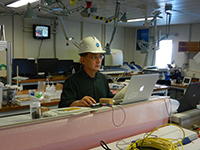
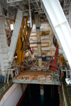
Move vessel to well center. Positioning calibrations and tests were completed. Continue to make up 8-1/2 inch drilling stands. Test and calibration for riser tensioner. Continue function test for BOP and prepare for run with Riser Pipe. The photo shows the rig in this morning.
July 28
Day:4
Location at 2400 is 41° 10.5983' N, 142° 12.0328' E
Weather: Fine but cloudy
Clean wellhead by ROV. Check wellhead and seabed survey 50 m radius to each N-S and W-E direction. Confirmed no objection around 50 m from wellhead. Recover ROV to surface. Deployment of 10 transponders was safely completed. Move vessel to calibration point. The photo shows ROV diving to the sea for transponder deployment.
July 27
Day:3
Location at 2400 is 41° 10.5983' N, 142° 12.0328' E
Weather: Fine but cloudy
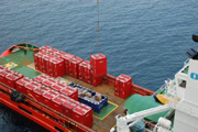
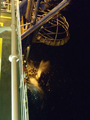
Dive ROV for recovering corrosion cap. Trouble shooting of repairing umbilical cable of ROV. Resume pay out ROV and standby. Corrosion cap was successfully retrieved. Survey well head by ROV, and confirmed the well head condition is good. Loading/off-loading work from the first supply boat.
July 26
Day:2
Location at 2400 is 41° 10.5983' N, 142º 12.0328' E
Weather: Fine but cloudy
Left Hachinohe port on 1200. Move vessel to the site. Maintenance and function tests on riser tensioners, BOP, Clean Cut Cuttings Blower, ROV, cementing unit. Set up mud logging and gas monitoring system.
Install screen of shale shaker. Prepare recovering assembly for corrosion cap. Set Dynamic Positioning mode.


