Development of real-time seafloor observation of crustal deformation in a large earthquake and tsunami source area

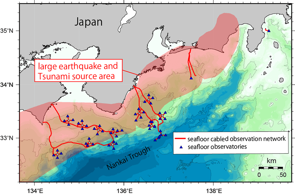
We will conduct research and development using seafloor observational technology that enabled us to monitor seafloor crustal deformation of a source area of large earthquakes and tsunamis in real-time. The initial R&D target area is the Nankai Trough, south of Japan, where a subducting oceanic plate accumulates and releases strain through earthquakes and slow slip along the plate boundary. The technology is based on a seafloor cabled observational network that has been recently developed that allows one to plug new sensors into the seafloor. We will develop technology to calibrate seafloor pressure sensors of the seafloor network to sufficiently improve their accuracy for use in monitoring the seafloor’s slow up and down motion over years, and we plan to calibrate the entire seafloor network. Development also includes precision deformation sensors that can monitor strain and tilt in the seafloor and in seafloor boreholes, which will be installed in ~ 10 locations in the seafloor cabled network to begin real-time observation by 2022. This development will enable us to assess the risks of devastating large earthquakes and tsunamis based on seafloor observational data.