


1.29, 2014
Day:139
Location at 2400: En route to Irago pilot station.
Weather: Fine but cloudy
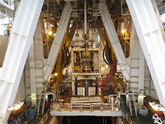
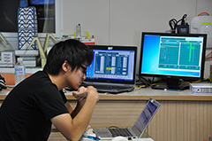
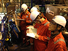
 IODP Expedition 348 came to a successful conclusion with port call in Aichi Prefecture. Site C0002, Holes C0002M, C0002N, and C0002P successfully tested the new small-diameter rotary coring barrel (SD-RCB), and successfully collected a full suite of logging data, a complete cuttings program, and spot coring within an interval of ca. 850-3058.5 mbsf. Not only does this establish a new depth record in scientific ocean drilling, but this expedition's core samples, recovered from deep within the Nankai accretionary prism, present in situ sampling unprecedented in ocean drilling.
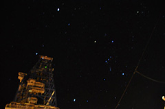
Today's photo shows the stars of Orinon and Winter Triangle above derrick on the way to Irago pilot station, taken by DE Sho Kataoka.

1.28, 2014
Day:138
Location at 2400: 33°41.00’N,136°33.00’E
Weather: Fine but cloudy
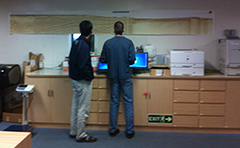
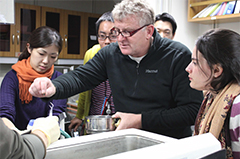
 Check rig equipment.
Deleted remained data in all lab PCs and checked status. Continued data check on JCORES.
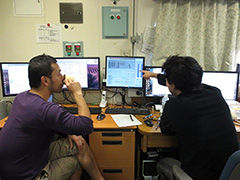
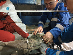
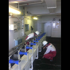
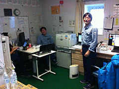
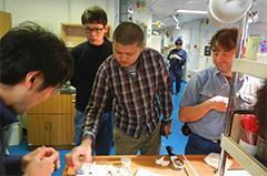
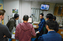
Today's photo shows Drilling Engineer Satoshi Yamada (left) and Sho Kataoka (right) cheking the monitor for the position of drill pipes laying down in aft pipe deck. They managed to get through a difficult situations from the beginning of this expedition.
1.27, 2014
Day:137
Location at 2400: 33°41.00’N,136°33.00’E
Weather: Blue sky
 Check rig equipment.
Worked on samples packing to complete the shipping forms and lists. Continued data check on JCORES. Increased volume of data memory of JCORES to install logging data.
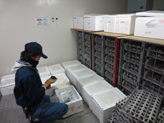
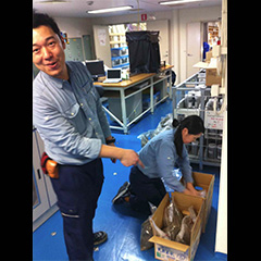
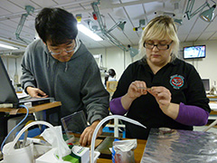
Today's photo shows MWJ Curator Toshikuni Yabuki filling the sample box with core and cuttings in the Cold Core Storage. All peronal samples will be shipped to scientists at the port.
1.26, 2014
Day:136
Location at 2400: 33°41.00’N,136°33.00’E
Weather: Fine but cloudy
 Recover transponders. Transit NNW 23 miles.
Final data check on JCORES.
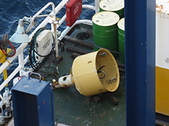
Today's photo shows recovered transponders.
1.25, 2014
Day:135
Location at 2400: 33°18.0507’N,136°38.2029’E
Weather: Fine but cloudy
 Recover riser, blow-out preventor (BOP) and transponders.
Continued data checking and uploading.
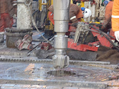
Today's photo shows decoupling recovered BOP at the moon pool.
1.24, 2014
Day:134
Location at 2400: Site C0002 Hole P (33°18.0507’N,136°38.2029’E)
Weather: Fine but cloudy
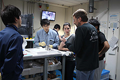
 Recover riser.
Continued data checking and uploading.
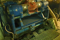
Today's photo shows GSC engineer and MWJ lab technician removed degasser from shale shaker.
1.23, 2014
Day:133
Location at 2400: Site C0002 Hole P (33°18.0507’N,136°38.2029’E)
Weather: Blue sky
 Recover blow-out preventor (BOP) and riser. Pressure test on conduit line.
Continued data checking and uploading.
Today's photo shows recovered Bumper joint covered with algae.
1.22, 2014
Day:132
Location at 2400: Site C0002 Hole P (33°18.0507’N,136°38.2029’E)
Weather: Fine but cloudy
 Recover riser and blow-out preventor (BOP) preparation. Disconnect BOP from Wellhead. Un-couple Tensioner ring.
Transferred cuttings jar from lab to core container. Continued data checking and uploading.
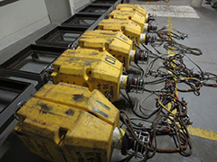
Today's photo shows Slip joint and Riser tensioner.
1.21, 2014
Day:131
Location at 2400: Site C0002 Hole P (33°18.0507’N,136°38.2029’E)
Weather: Fine but cloudy
 Pressure test on plug back cement plug. Displace inside riser pipes with seawater. Recover wear bushing and rig up riser handling tool.
Continue data checking and uploading was performed.
Today's photo shows Wear Bushing Running Retrieving Tool (WBRRT) and wear bushing.
1.20, 2014
Day:130
Location at 2400: Site C0002 Hole P (33°18.0507’N,136°38.2029’E)
Weather: Fine but cloudy
 Conduct #1 & #2 cement squeezes, set plug and abandon plug. Displace the hole with inhibition mud. Pulling out open hole (POOH).
Continue data checking and uploading was performed. EPM changed from Sean Toczko to Chiaki Igarashi.
Today's photo shows corrosion cap for wellhead.
1.19, 2014
Day:129
Location at 2400: Site C0002 Hole P (33°18.0507’N,136°38.2029’E)
Weather: Fine but cloudy
 Pulling out open hole (POOH) hanger running tool, Run in hole (RIH) diverter and leak off test (LOT). Spot cement plug for squeezing cement.
More data uploading was performed, especially regarding radon data from the Mud Gas Unit. The excess cuttings samples are being segregated and readied for disposal. The remainder will be curated at Kochi Core Center (KCC) at the end of the expedition. More figures were updated with the help of the now shore-based science party. Another round of checking the figures and tables found some small, minor errors. The final operations for cementing the 11-3/4-inch liner encountered a few snags, but cementing operations were successful for the first portion. The EPMs will change tomorrow, Sean Toczko will disembark and Chiaki Igarashi will board.
Much thanks goes to the MWJ Lab techs, the MQJ drillers and crew, and the CDEX Operations group, especially the OSIs and drilling engineers.
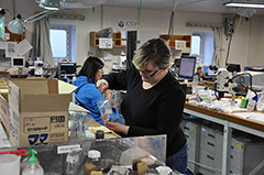
Today's photo shows MWJ Curator Masaru Yasunaga and MWJ Lab Tech Misato Kawahara working to consolidate and discard excess cuttings, as confirmed with the expedition co-chiefs.
1.18, 2014
Day:128
Location at 2400: Site C0002 Hole P (33°18.0507’N,136°38.2029’E)
Weather: Partly cloudy
 Run 11-3/4" liner. Set liner hanger, leak off test (LOT) and injection test, set liner packer and pressure test, pulling out open hole (POOH).
 The day was spent in reviewing text, tables, and figures submitted by the science party. Some revisions were received from the now disembarked science party. Radon data was finally downloaded, and QA/QC checks completed. The data will be forwarded to the science party. Some final decisions were made on the storage of cuttings samples; approximately 1/2 of the unwashed fraction will be archived and preserved at Kochi Core Center (KCC).
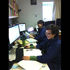
The photo shows the MWJ Publications Specialists, Yoko Okamoto and Eri Yamasaki, at work in their office managing the science reports.
1.17, 2014
Day:127
Location at 2400: Site C0002 Hole P (33°18.0507’N,136°38.2029’E)
Weather: Overcast
 Running 11-3/4-inch liner casing.
 Some updates have been made to the visual core descriptions (VCDs), after review found some discrepancies between the hand-written log sheets and the J-CORES entries; the lithologists have suggested how to resolve the differences. We are going to consolidate the unwashed cuttings collected during the hole opening reaming, and we will be saving a portion from each sampled interval to send to Kochi Core Center (KCC) for archiving. General cleaning continued, now that cuttings and mud gas are no longer being collected/sampled.
The photo shows MWJ Lab Techs Katsunori Sagishima and Emi Deguchi cleaning up the core cutting area now that cuttings are no longer being received.
1.16, 2014
Day:126
Location at 2400: Site C0002 Hole P (33°18.0507’N,136°38.2029’E)
Weather: Cloudy
 Circulate hole clean, Pulling out open hole (POOH). Rig up for running 11-3/4-inch liner casing.
Sample and data checks are nearing completion. Cores have all been moved to the core reefer container in preparation for back loading. Mud gas logging ended as soon as the underreamer bore hole assembly (BHA) was recovered on deck. The final drilling mud samples were collected and stored. One last natural gamma ray(NGR) measurement was run on one final drilling mud sample.
The photo shows Marine Works Japan Lab Officer Tomoyuki Tanaka and Assistant Lab Officer Toru Fujiki in the LO's office. We appreciate all the hard work and organizing that all the MWJ LOs and ALOs do on behalf of the science party.
1.15, 2014
Day:125
Location at 2400: Site C0002 Hole P (33°18.0507’N,136°38.2029’E)
Weather: Partly cloudy
 Wiper trip to 13-3/8-inch casing window. Wash and ream down to bottom.
Preparation for shipping personal samples is nearly complete. Mud gas sampling continues and is projected to finish soon. Data box packing. Editing of figures continues, as well as some final revision to the participant list. Data checks are continuing for some ship-board measurements.
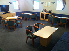
The photo shows the post-science party departure clean-up of the lounge. Scientist's comments will be used to improve and refurbish the common areas on the Lab Management Deck.
1.14, 2014
Day:124
Location at 2400: Site C0002 Hole P (33°18.0507’N,136°38.2029’E)
Weather: Overcast
 Ream and open hole to 14-1/2-inch. Pipe stuck; then work pipe. Pipe freed, circulation and bottoms up.
Preparation for shipping personal samples continues. Some limited sampling (e.g. mud gas) continues. The expedition reports continue to be reviewed, especially the figures. A list of figures needing some revision beyond the responsibility of the Publication Specialists is being compiled. Other scientific equipment no longer needed (e.g. GeniusPlug) is being packed and either stored onboard or readied for shipment.
The photo shows the overcast weather present all day yesterday.
1.13, 2014
Day:123
Location at 2400: Site C0002 Hole P (33°18.0507’N,136°38.2029’E)
Weather: Partly cloudy
 Continue cut and slip drilling line. Run in hole (RIH) and activate underreamer, Wash and ream 14-1/2-inch hole.
Science report figures and tables continue to be checked. The lab curator has been reconfirming the sample requests shipments in preparation for port-call.
The photo shows some images of a pod of whales that approached the ship yesterday.
1.12, 2014
Day:122
Location at 2400: Site C0002 Hole P (33°18.0507’N,136°38.2029’E)
Weather: Partly cloudy
 Pulling out open hole (POOH) Anderreamer underreamer bore hole assembly (BHA) and check condition. Run in hole (RIH) 2nd underreamer BHA. Drilling line cut & slip.
The Site Report figures and reports continue to be checked and verified. Some small errors in cuttings depths in the text were discovered and have been resolved. The Lab Techs continue processing cuttings samples collected during hole-opening operations.
The photo shows the cement head tool for cementing the 11-3/4-inch liner laid out in preparation on the forward catwalk rail transport system (RTS).
1.11, 2014
Day:121
Location at 2400: Site C0002 Hole P (33°18.0507’N,136°38.2029’E)
Weather: Partly cloudy
 Opening 12-1/4-inch hole to 14-1/2-inch. Ream up and down for hole cleaning. Resume opening to 14-1/2-inch hole.
Checking the contents of figures and tables submitted by science party continues. General lab area clean up. Data QA/QC(quality assurance/quality control) .
The photo shows the Lab Management Deck common spaces after extensive clean-up by the Lab Techs.
1.10, 2014
Day:120
Location at 2400: Site C0002 Hole P (33°18.0507’N,136°38.2029’E)
Weather: Partly cloudy
 Opening 12-1/4-inch hole to 14-1/2-inch. Ream up and down for hole cleaning. Resume opening to 14-1/2-inch hole.
Scientists submitted their 2nd draft revisions of the site chapters, and finalized sample requests and cuttings and mud gas sampling procedures for the remaining drilling time. The current plan is to extend the borehole to ca. 3400 mbsf (meter below sea floor) before running in the 11-3/8-inch liner.
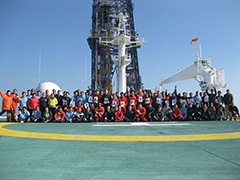
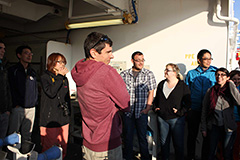
The shipboard scientific party Disembarked today, along with the remaining Logging Staff Scientists.
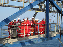
The photo shows the science party gathered on the helideck for the last morning together aboard Chikyu.
1.9, 2014
Day:119
Location at 2400: Site C0002 Hole P (33°18.0507’N,136°38.2029’E)
Weather: Partly cloudy
 Waiting on weather (WOW). Blow-out preventor (BOP) function test. Wash/ream down to bottom.
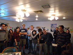
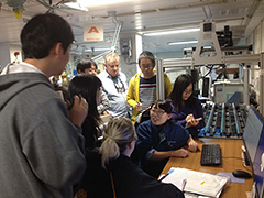
The shipboard scientific party held a final science meeting to discuss post-expedition research plans, potential conference and journal submissions, and end-of-expedition activities. The co-Chief Scientists wish to convey the following message:
We deeply appreciate the dedication and expertise of the excellent MQJ operations teams, MWJ laboratory technical staff, curators, and publications specialists, and of CDEX Logging Staff Scientists, Expedition Project Managers, and last but not least, Drilling Operations teams. Without their hard work, achievement of our scientific mission would simply not have been possible. Thank you very much for a very successful expedition. Even as we depart the ship, we wish Chikyu good luck in completing Hole C0002P for this expedition.
Harold Tobin, Takehiro Hirose, and the Expedition 348 shipboard scientific party
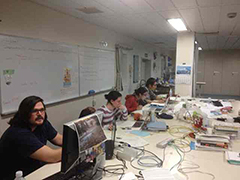
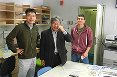
The photo shows scientists Brian Boston, Emilie Even, Ana Maia, and Makoto Otsubo working on finalizing the 2nd drafts of the site chapters.
1.8, 2014
Day:118
Location at 2400: Site C0002 Hole P (33°18.0507’N,136°38.2029’E)
Weather: Rainy
 Open hole to 14-1/2-inch. Pulling out open hole (POOH) for Waiting on weather (WOW).
Based on the reviews of 1st draft of site chapter reports by the co-chiefs and EPMs, the shipboard scientists revised and finalized the site reports. Meanwhile, some scientists continued to process intact cuttings recovered during underreaming operation in Hole C0002P.
The photo shows scientists Aisling Broderick and Chen Song working on cuttings in the lab.
1.7, 2014
Day:117
Location at 2400: Site C0002 Hole P (33°18.0507’N,136°38.2029’E)
Weather: Rainy
 Resume opening 14-1/4"hole. Swab on #2 mud pump. Resume openhole 14-1/2"hole.
With the end of the science party's time on board looming, the day was consumed with expedition report chapter drafting and editing. At the same time, new drill cuttings and portions of the processed logging while drilling (LWD) logging data were arriving in scientists' hands and being analyzed as rapidly as possible.
The photo shows the completed carbonate analysis samples for cuttings and core from Hole C0002P; initial drilling to 3058 mbsf.
1.6, 2014
Day:116
Location at 2400: Site C0002 Hole P (33°18.0507’N,136°38.2029’E)
Weather: Partly cloudy
 Open 12-1/4-inch hole to 14-1/2-inch from 4442 to 4590 mBRT (meter below rotary table) .
Based on presentation and discussion of Hole C0002N/P results in the science meeting yesterday, the shipboard science party revised and finalized their 1st draft of site chapter reports. Meanwhile, some scientists requested cuttings samples from the deep inner accretionary wedge for their postcruise research.
The photo shows Lab Tech and Co-Chief prepping core 5 section 4 half-round for epoxy resin impregnation.
1.5, 2014
Day:115
Location at 2400: Site C0002 Hole P (33°18.0507’N,136°38.2029’E)
Weather: Partly cloudy
 Short trip to the casing window, trimmed 12-1/4-inch hole to 14-1/2-inch below casing window, ream down to 4348 mBRT (meter below rotary table) and resumed opening 12-1/4-inch hole to 14-1/2-inch.
The shipboard scientific party met for presentation and discussion of their Hole C0002P near-final results, in anticipation of deadlines for completion of site chapter draft reports. Meanwhile, as the hole was opened for casing, cuttings samples continued to be collected and analyzed for physical properties, a process that is expected to continue right up to and after the scheduled scientific party departure from Chikyu in five days.
The photo shows some of the science party at the top of the derrick.
1.4, 2014
Day:114
Location at 2400: Site C0002 Hole P (33°18.0507’N,136°38.2029’E)
Weather: Partly cloudy
The shipboard scientists continued to write site chapter reports and prepare data presentations to be reported in a science meeting. Meanwhile, day shift scientists toured the derrick and enjoyed an ocean view.
Personal sampling of the fault section from core 348-C0002P-5R was completed.
1.3, 2014
Day:113
Location at 2400: Site C0002 Hole P (33°18.0507’N,136°38.2029’E)
Weather: Fine but cloudy
 Continue to open hole from 12-1/4 inch to 14-1/2 inch. As laboratory measurements neared completion for the cuttings collected to 3058 mbsf (meter below seafloor) in Hole C0002P, scientists compiled the results and prepared data presentations. Log analysis specialists worked with the resistivity, gamma and preliminary sonic velocity logs newly available after downloading from the logging while drilling (LWD) tools and initial processing.
The photo shows scientists on the derrick.
1.2, 2014
Day:112
Location at 2400: Site C0002 Hole P (33°18.0507’N,136°38.2029’E)
Weather: Fine but cloudy
 Pulling out open hole (POOH) 12-1/4 inch logging while drilling (LWD) bore hole assembly (BHA) to surface and lay out. Makeup and run in hole (RIH) underreamer BHA. Open 12-1/4 inch to 14-1/2 inch hole. The science party nearly completed descriptions and analysis of cuttings collected from Hole C0002P and continued hard work on writing site chapter reports. Immediately after the memory data was dumped from the logging tools, shipboard logging scientists and logging staff scientist started to process and interpret the logging data acquired.
The photo shows recovering the 12-1/4 inch bit from the hole.
1.1, 2014
Day:111
Location at 2400: Site C0002 Hole P (33°18.0507’N,136°38.2029’E)
Weather: Fine but cloudy
 Ream down to bottom. Pulling out open hole (POOH) 12-1/4 inch logging while drilling (LWD) bore hole assembly (BHA) to surface. After greeting the new year's first sunrise, the scientific party worked to complete observations of lithology, structure, and micropaleontology, as well as measurements of physical and chemical properties, on cuttings collected to the bottom of the drilled interval of 3058 mbsf (meter below seafloor). Meanwhile, we awaited return of the LWD bottom hole assembly to the rig floor and recovery of memory data from the logging tools.
The photo attached is new year greetings from Chikyu.

12.31, 2013
Day:110
Location at 2400: Site C0002 Hole P (33°18.0507’N,136°38.2029’E)
Weather: Fine but cloudy
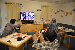
 Wiper trip. Ream down to bottom. The shipboard science party continued hard work on cuttings recovered from ~2700 to ~2900 mbsf (meter below seafloor) in Hole C0002P, as well as site chapter reports. After having special New Year's "Toshikoshi Soba (Japanese traditional noodle to wish for longevity)" in the mess room, the scientists enjoyed a small count-down party at midnight 2013-2014 in the lounge.
The photo shows origami cranes to celebrate new year and to pray for the success of the project.
12.30, 2013
Day:109
Location at 2400: Site C0002 Hole P (33°18.0507’N,136°38.2029’E)
Weather: Fine but cloudy
 Continue to drill 12-1/4 inch logging while drilling (LWD) hole.
The shipboard science party presented their findings from the cores C0002P 1R-6R and showed integration of data available from previous expeditions at Site C0002 in a science meeting. While LWD drilling continued progressing smoothly, a small group of scientists visited at shale shakers to observe untreated cuttings recovered from the hole.
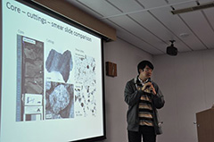
The photo shows a sedimentologist Kiho Yang giving a presentation at the science meeting.
12.29, 2013
Day:108
Location at 2400: Site C0002 Hole P (33°18.0507’N,136°38.2029’E)
Weather: Fine but cloudy
 Continue to drill 12-1/4 inch logging while drilling (LWD) hole. While LWD drilling proceeded smoothly all day, the shipboard science party was busy with description and measurements of new cuttings samples as well as in-depth analysis of the cores from Hole C0002P. Detailed plans for the sampling and preservation of the fault zone interval in Core-5R were made, as scientists also prepared to report on the findings from the cored interval.
The photo shows a mud-gas chemistry specialist Shigeshi Fuchida witnessing real time data of mud-gas.
12.28, 2013
Day:107
Location at 2400: Site C0002 Hole P (33°18.0507’N,136°38.2029’E)
Weather: Fine but cloudy
 Continue to drill 12-1/4 inch logging while drilling (LWD) hole. The scientific party ontinued to analyze the cuttings and real-time logging data derived from the cored interval from 2163 to 2218.5 mbsf (meter below sea floor), and worked on the integration of core, cuttings and LWD data from this interval. In the evening, Hole C0002P exceeded the depth of 2466 mbsf, thereby becoming the deepest hole below the seafloor drilled in the more than 50 years history of scientific ocean drilling.
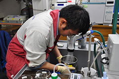
The photo shows a sedimentologist Anja Schleicher observing samples of core and cuttings with a microscope in a chilly lab.
12.27, 2013
Day:106
Location at 2400: Site C0002 Hole P (33°18.0507’N,136°38.2029’E)
Weather: Fine but cloudy
 Cut and slip drilling line. Run in hole (RIH) 12-1/4 inch, logging while drilling (LWD) and bore hole assembly (BHA). Open hole and drill 12-1/4 inch LWD hole.
A sampling party was held for cores C0002P-5R and -6R, as shipboard analyses continued on those cores. The fault zone identified in Core 5R was mapped with the X-ray fluorescence scanner (XRF). Meanwhile, measurement while drilling (MWD)/LWD drilling began, and logging scientists monitored the progress of reaming the cored interval and the real-time logging data derived from that zone in the borehole (2163.0 to 2218.5 mbsf(meter below sea floor)) and below.
The photo shows a sedimentologist Rina Fukuchi selecting her personal samples.
12.26, 2013
Day:105
Location at 2400: Site C0002 Hole P (33°18.0507’N,136°38.2029’E)
Weather: Cloudy
 Makeup and run in hole (RIH) 12-1/4" logging while drilling (LWD) bore hole assembly (BHA). Cut and slip drilling line.
After a midnight Christmas party on the 25th, shipboard scientists continued describing and making measurements on Cores C0002P-4R through -6R. A highlight was discovery of a >40 cm thick apparent fault zone in Core 5R, and scientists started considering research and sampling strategies for this feature.
The photo shows a scene of makeup LWD BHA.
12.25, 2013
Day:104
Location at 2400: Site C0002 Hole P (33°18.0507’N,136°38.2029’E)
Weather: Cloudy
 Pulling out open hole (POOH) coring bore hole assembly (BHA). Run in hole (RIH) jet sub and Wear Brushing Running Retrieving Tool (WBRRT). Blow-out preventor (BOP) test.
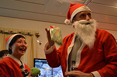
The scientific party spent Christmas Day describing, sampling, and conducting shipboard analyses on Cores C0002P-1R to -4R. The strongly deformed rocks in the cores elicited a great deal of excitement and interest. The day ended with an 11 pm Christmas party, featuring the surprise appearance of Santa Claus (and also his twin plus at least one elf).
The photo shows Santa Clauses at the party.
12.24, 2013
Day:103
Location at 2400: Site C0002 Hole P (33°18.0507’N,136°38.2029’E)
Weather: Fine but cloudy
 Cut RCB cores #4 - #6. Pulling out open hole (POOH).
Shipboard scientists appeared to see the arrival cores at the Core Cutting Area for every 6-8 hours, and were delighted at 88.5% recovery of the last core in Expedition 348. The scientists continued to closely observe CT images of the cores for finding remarkable structures and planning for whole-round sample locations.
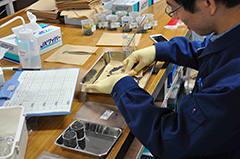
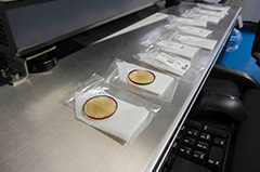
Today's photo shows geochemist Emilie Even supporting geochemist Jim Sample to sample a head space sample at Core Cutting Area.
12.23, 2013
Day:102
Location at 2400: Site C0002 Hole P (33°18.0507’N,136°38.2029’E)
Weather: Fine but cloudy
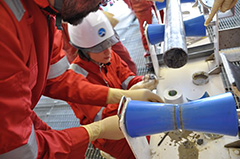
 Recover Core #1. Cut and recover rotary core barrel (RCB) cores #2 and #3. Cut RCB core #4.
Shipboard scientists turned out en masse at the Core Cutting Area to see the first cores from the deep inner accretionary wedge arrive on deck. When Core C0002P-1R turned out to have recovered just 40 cm, the group became a little nervous. However, this gave way to cheers smiles and many high-fives upon seeing the 6 meter length of the second core. By evening, core -3R was on deck and -4R was being drilled. Time-sensitive samples were collected and the core scans were closely examined for clues to their contents and planning for whole-round sample locations. The science party looks forward to core splitting and detailed work on the cores in coming days.
12.22, 2013
Day:101
Location at 2400: Site C0002 Hole P (33°18.0507’N,136°38.2029’E)
Weather: Fine but cloudy
 Rig up coreline blow-out preventor (BOP). Run in hole (RIH) rotary core barrel (RCB) coring bore hole assembly (BHA). Cut #1 RCB core.
The science party confirmed plans for core processes and core sampling again, and looked forward a first core to be recovered at the depth of 2163 mbsf from Hole C0002P.
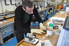
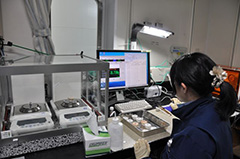
The photo shows a physical property specialist Matthew Josh checking sample shape to measure p-wave and impedance on a piece of cuttings.
12.21, 2013
Day:100
Location at 2400: Site C0002 Hole P (33°18.0507’N,136°38.2029’E)
Weather: Fine but cloudy
 Pulling out open hole (POOH) Kick-off bore hole assembly (BHA) to surface. Rig up coreline blow-out preventor (BOP).
Today the scientific party continued to analyze cuttings from Hole C0002P. We also met to discuss the plan for coring and logging of the next section of the hole, organization of the Expedition Report volume, and the timeline for the rest of Expedition 348. All specialty groups prepared reports on Hole C0002N results and submitted them by the midnight deadline.
Today's photo shows a physical property specialist Pierre Henry testing how to measure p-wave and impedance on a piece of cuttings.
12.20, 2013
Day:99
Location at 2400: Site C0002 Hole P (33°18.0507’N,136°38.2029’E)
Weather: Fine but cloudy
 Run in hole (RIH) to bottom. Resume drill 12-1/4” hole.
Scientists examined and analyzed the cuttings from drilling of Hole C0002P over the interval from 2060 to 2163 mbsf. EPM Sean Toczko departed by helicopter and we thank him for his hard work. The shipboard scientific party welcomed EPM Lena Maeda to Expedition 348.
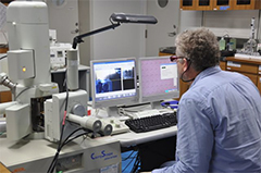
Today's photo shows a structure geologist Kevin Brown observing cuttings with Scanning Electron Microscope (SEM) at Paleontology/Petrology Lab
12.19, 2013
Day:98
Location at 2400: Site C0002 Hole P (33°18.0507’N,136°38.2029’E)
Weather: Cloudy
 Waiting on weather (WOW) Pulling out open hole (POOH) bore hole assembly (BHA) above blow-out preventor (BOP). Remove ball valve on HPS and install blind flange. Repair hydraulic hose of HPS.
The shipboard scientists continued to summarize the site reports of Hole C0002N, with first drafts due by midnight on 21 December. Expedition Project Manager (EPM) Sean Toczko disembarked and EPM Lena Maeda embarked today. Logging Staff Scientist (LSS) Moe Kyaw Thu disembarked and LSS Yoshinori Sanada also embarked today.
The photo shows scientists Manami Kitamura, Hiroko Kitajima, and Ana Crespo-Blanc on deck during a tour of the Remotely Operated Vehicle (ROV).
12.18, 2013
Day:97
Location at 2400: Site C0002 Hole P (33° 18.0507’N,136° 38.2029’E)
Weather: Rain
 Continue drill 12-1/4-inch hole. Work stuck pipe. Pulling out open hole (POOH) for waiting on weather (WOW).
Amid rising wind and waves, shipboard scientists analyzed cuttings from 3922 to 4035 mMBRT in the sidetracked Hole C0002P. Today marked the mid-way point ("Hump Day") of Expedition 348 for the scientific party. The science party bid farewell to Capt. Onda, who is leaving MQJ. We saw him off at the heliwaiting room just before his flight to shore.
The photo shows members of the science party seeing off Capt. Onda as he leaves Chikyu for the last time as captain.
12.17, 2013
Day:96
Location at 2400: Site C0002 Hole P (33° 18.0507’N,136° 38.2029’E)
Weather: Rain
 Drill 12-1/4-inch hole. Work stuck pipe. Condition mud. Resume drilling 12-1/4-inch hole.
The science party worked on descriptions and measurements of cutting samples collected during sidetrack drilling at the interval between 1954 and 1993 mbsf.
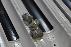
The photo shows the small diameter rotary core barrel (SD-RCB) cores laid out for Structural Geologist Yuzuru Yamamoto's personal sampling session.
12.16, 2013
Day:95
Location at 2400: Site C0002 Hole P (33° 18.0507’N,136° 38.2029’E)
Weather: Cloudy
 Make up and Run in hole (RIH) 12-1/4-inch kickoff Bore hole assembly (BHA). Slip & cut drill line. Continue RIH to window. Drill 12-1/4-inch hole.
Members of the shipboard scientific party completed draft reports on the C0002M and C0002N log and sample data, and prepared for the arrival of new cuttings and data from the resumption of drilling operations. A French television film crew arrived on board for a one-day stay and conducted interviews with scientists Pierre Henry and Takehiro Hirose as well as the Captain and other members of the MQJ staff.
The photo shows one of the MWJ Lab Techs preparing some cuttings samples for analysis.
12.15, 2013
Day:94
Location at 2400: Site C0002 Hole P (33° 18.0507’N,136° 38.2029’E)
Weather: Partly cloudy
 Continue cut casing. Circulation and bottoms up. Conducted two leak off tests (LOT). Condition drilling mud. Pulling out open hole (POOH) and lay down milling Bore hole assembly (BHA).
The science party continued to analyze logging, cuttings and core data, and prepare the site report for Hole C0002M. Logging Scientist Dr. Hiroki Sone, Co-chief Scientists Harold Tobin and Takehiro Hirose, and EPM Sean Toczko at the cement unit watched progress of a LOT conducted in the milled window rathole at 1954 mbsf.
The photo shows the Co-Chief scientists are in the cement unit, observing the LOT test runs.
12.14, 2013
Day:93
Location at 2400: Site C0002 Hole P (33° 18.0507’N,136° 38.2029’E)
Weather: Partly cloudy
 Run in hole (RIH) to top of B/P. Set whipstock. Window cut 13-3/8-inch casing.
The science party continued to analyze logging, cuttings and core data, and started preparing the site reports. Onboard scientist Dr. Maria Jose Jurado gave a lecture on analysis and interpretation of resistivity logging data. CDEX Logging Staff Scientists Moe Kyaw Thu and Yohei Hamada boarded in the morning.
The photo shows the scientists watching the window milling Bore hole assembly (BHA) entering the rigfloor.
12.13, 2013
Day:92
Location at 2400: Site C0002 Hole N (33° 18.0507’N,136° 38.2029’E)
Weather: Partly cloudy
 Run in hole (RIH) to top of B/P. Circulation and bottoms up and Pulling out open hole (POOH). Make up and RIH whipstock assembly.
Science party members prepared revisions of chapter reports and analyzed downhole, cuttings, and core results.
The photo shows Co-Chief Takehiro Hirose and Scientist Pierre Henry examining the large-scale seismic profile of the NanTroSEIZE transect.
12.12, 2013
Day:91
Location at 2400: Site C0002 Hole N (33° 18.0507’N,136° 38.2029’E)
Weather: Partly cloudy
 Continue to displace riser. Run in hole (RIH) Wear Brushing Running Retrieving Tool (WBRRT) and pressure test Lower Marine Riser Package (LMRP) connector. Pulling out open hole (POOH). RIH milling Bore hole assembly (BHA).
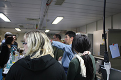
The science party presented their findings from Hole C0002M, updates from C0002N, and showed integration of data available from past IODP expeditions at Site C0002 in an afternoon science meeting. After the meeting, a small birthday party for onboard scientist Dr. Hiroki Sone was celebrated in the lounge.
The photo shows the science party celebrating scientist Hiroki Sone's birthday in the lounge.
12.11, 2013
Day:90
Location at 2400: Site C0002 Hole N (33° 18.0507’N,136° 38.2029’E)
Weather: Partly cloudy
 Drift to well center. Landing Lower Marine Riser Package (LMRP). Rig down riser running equipment. Displace riser.
During the waiting on weather (WOW) period and as preparations for the sidetrack operation proceeded, the science party had the opportunity to see the whipstock and milling assembly that will be used in the borehole, as well as getting tours of the Oceaneering Remotely Operated Vehicle (ROV) and its control systems. Meanwhile, work on write-ups of results from Hole C0002M cores and C0002N cuttings and logs continued.
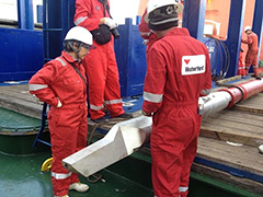
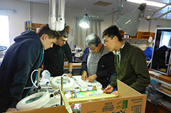
The photo shows the Weatherford Engineer Aung Din describing the whipstock's functions to Ana Crespo-Blanc.
12.10, 2013
Day:89
Location at 2400: Site C0002 Hole N (33° 18.0507’N,136° 38.2029’E)
Weather: Partly cloudy
 Planned disconnect (EDS #3), move vessel 1.2 miles north into low current area, waiting on weather (WOW), R/U riser handling gear.
The scientists continued to review and edit methods chapters and prepared to present their C0002M small diameter rotary core barrel (SD-RCB) core results to the group. The geochemists have been working on exploring new techniques for analyzing pore waters from the SD-RCB cores, with a view towards the cores expected from below 2000 mbsf.
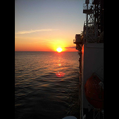
The photo shows sunset from Chikyu just after the passage of a storm front.
12.9, 2013
Day:88
Location at 2400: Site C0002 Hole N (33° 18.0507’N,136° 38.2029’E)
Weather: Cloudy
 Blow-out preventor (BOP) pressure test and function test with Wear Brushing Running Retrieving Tool (WBRRT). Waiting on weather (WOW).
Shipboard scientists remained occupied with completion of description and data analysis for the C0002M small diameter rotary core barrel (SD-RCB) cores, as well as making revisions of material for the Expedition Report chapters.
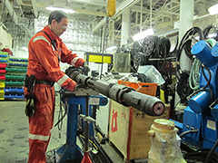
The photo shows the MQJ Core Tech, Simon Judge, demonstrating the mechanism of the coring barrel.
12.8, 2013
Day:87
Location at 2400: Site C0002 Hole N (33° 18.0507’N,136° 38.2029’E)
Weather: Partly cloudy
 Run 11-3/4-inch flat bottom mill assembly for tagging bridge plug. Pulling out open hole (POOH). Run plug tag wireline assembly to confirm plug set depth.
The scientific party completed descriptions and measurements on core samples recovered from 472 - 507 mbsf in Hole C0002M in the Kumano basin. Weekly shipboard drill let scientists realize the day of week.
The photo shows Structural Geology scientists Yuzuru Yamamoto, Ana Crespo-Blanc, and Physical Properties scientist Robert Valdez examining the SD-RCB core from Hole C0002M.
12.7, 2013
Day:86
Location at 2400: Site C0002 Hole N (33° 18.0507’N,136° 38.2029’E)
Weather: Partly cloudy
 Wireline operation (Junk basket, Bridge plug). Run 11-3/4-inch flat bottom mill assembly to tag the bridge plug.
Cores from Hole C0002M, collected earlier in the expedition as a test of the small diameter rotary core barrel (SD-RCB) coring system were sampled and split for core description and analysis by the scientific party. This system is designed to work with a smaller diameter bit, but paradoxically produces a larger diameter core than the RCB. Three cores were collected with plastic liners, and one with an uncut aluminum one; the X-CT scans indicate that the core in the aluminum liner is in better condition than the ones in the plastic liners. The scientific party worked on Cores C0002M-1R and -2R, from 472 - 490 mbsf in the Kumano basin section. Night shift scientists also visited the CoreTech shop, where they received a primer on wireline coring systems.
The photo shows the sedimentologists and paleontologist closely and intently examining the first section from core C0002M.
12.6, 2013
Day:85
Location at 2400: Site C0002 Hole N (33° 18.0507’N,136° 38.2029’E)
Weather: Partly cloudy
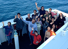
 Continue Run in hole (RIH) scraper Bore hole assembly (BHA), scrape bridge plug setting area, circulate bottom up, Pulling out open hole (POOH) to surface, rig up for wireline.
The scientific party finalized data analysis and drafting of a method chapter of the cruise report. In the afternoon Geoservice engineers introduced their services, products, and measurements on Chikyu, and conducted a tour to the Geoservice van for a small group of scientists. Co-chief Demian Saffer disembarked by the first chopper. Before that, the scientific party gathered at the helideck and took a group photo. Thanks, Demian, for your great contributions over the past several weeks.
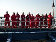
The photo shows the science party seeing off Co-Chief Demian Saffer before the helicopter flight to shore.
12.5, 2013
Day:84
Location at 2400: Site C0002 Hole N (33° 18.0507’N,136° 38.2029’E)
Weather: Partly cloudy
 Pulling out open hole (POOH) severed drill collars. Make up and Run in hole (RIH) 12-1/4-inch Bore hole assembly (BHA) and tag top of fish.
The scientific party's daily routine of data analysis and drafting of reports was broken up by a tour of the ship's bridge and navigational systems. Fine and sunny December weather was enjoyed by all.
The photo shows the scientists gathered on the starboard wing bridge after a bridge tour.
12.4, 2013
Day:83
Location at 2400: Site C0002 Hole N (33° 18.0507’N,136° 38.2029’E)
Weather: Partly cloudy
 Pulling out open hole (POOH) severed drill collars.
The science party continued to focus on finalizing their analyses of cuttings from 875-2330 mbsf, and reported on their findings in an afternoon science meeting. The group has made significant progress in defining best practices for cuttings measurements for physical properties and XRD based on "hand picking" of material to avoid drilling-induced aggregates. The geochemistry group continued to conduct interstitial pore water analyses from the large diameter Rotary Core Barrel (RCB) cores.
The photo shows Drs. Kevin Brown and Hiroko Kitajima demonstrating the methodology for hand-picking cuttings fragments for special analysis.
12.3, 2013
Day:82
Location at 2400: Site C0002 Hole N (33° 18.0507’N, 136° 38.2029’E)
Weather: Clear
 Wireline operation for Free Point Indicator Tool(FPIT). Run dummy tool. Run colliding tool and sever drill collars.
The science party has nearly completed analysis of the cuttings and logs collected from the 875-2300 mbsf interval, and continued to interpret and integrate those data. The geochemists started to analyze interstitial water (IW) samples taken from the Small Diameter - Rotary Core Barrel (SD-RCB) cores recovered from 475-503 mbsf in the Kumano basin on 21 September. The science party gathered at the core processing deck and enjoyed watching the SD-RCB cores cutting process.
The photo shows Dr. Jim Sample discussing IW sampling methodologies in the geochem lab with Geochemist Emilie Even and Marine Works Japan Lab Techs.
12.2, 2013
Day:81
Location at 2400: Site C0002 Hole N (33° 18.0507’N, 136° 38.2029’E)
Weather: Partly cloudy
 Working stuck pipe. Rig up Schlumberger wireline and run Free Point Indicator Tool(FPIT).
 The science party has now largely completed analysis of the cuttings and logs collected so far, and was busy with interpretation and integration of their data, as well as preparation of reports. Group leaders and co-Chiefs met to discuss initial results. Considerable effort and attention has gone into development of an advanced waste management system in the labs and lounges, enabling segregation of waste into extremely strictly defined classes of waste.
The photo shows an example of the classes of waste segregation in the lab spaces.
12.1, 2013
Day:80
Location at 2400: Site C0002 Hole N (33° 18.0507’N, 136° 38.2029’E)
Weather: Partly cloudy
 Run in hole (RIH) fishing Bore hole assembly (BHA), break circulation. Land and latch on to fish. Work stuck pipe.
The science party continued to work on cuttings measurements and descriptions, which are now nearing completion. The physical properties and lithostratigraphy groups also began analysis of hand-picked large cuttings likely to best represent true formation properties, and the initial results are promising. At 11:00, the Halliburton logging engineer and CDEX Logiing staff scientist (LSS) provided an overview of the Logging while drilling (LWD) string to be use in the next section of drilled hole, followed by a tour of the LWD tools.
The photo shows co-Chief Takehiro Hirose and scientists Yuzuru Yamamoto and Jim Sample standing by for the Halliburton logging tools tour.

11.30, 2013
Day:79
Location at 2400: Site C0002 Hole N (33° 18.0507’N, 136° 38.2029’E)
Weather: Partly cloudy
 Pulling out open hole (POOH) string; make up and Run in hole (RIH) fishing Bore hole assembly (BHA).
The shipboard scientists continued to analyze logs and cuttings from Hole C0002N, and reported initial findings to one another at a science party meeting. Day shift scientists toured the rig floor, engine room, and other areas of Chikyu.
The photo shows co-Chief Harold Tobin examining structural features on cuttings.
11.29, 2013
Day:78
Location at 2400: Site C0002 Hole N (33° 18.0507’N, 136° 38.2029’E)
Weather: Partly cloudy
 Running wireline Free Point Indicator Tool. Back-Off string. Circulation and bottoms up.
The science party continued to conduct analysis of logs, and measurements and description of cuttings, from the 875-2300 mbsf interval. The first daily group-leaders meeting started to report and exchange their work progress.
The photo shows the Co-Chiefs and group leaders discussing the initial lab results and plans for the day.
11.28, 2013
Day:77
Location at 2400: Site C0002 Hole N (33° 18.0507’N, 136° 38.2029’E)
Weather: Partly cloudy
 Rigging up and running the Free Point Indicator Tool.
The science party spent the morning in disciplinary groups finalizing plans for cuttings analysis, and began their shifts at 12:00. The day shift began analysis of logs, and measurements and description of cuttings, from the 875-2300 mbsf interval.
The photo shows Kiho Yang and Aisling Broderick working on cuttings on the Core Processing Deck.
11.27, 2013
Day:76
Location at 2400: Site C0002 Hole N (33° 18.0507’N, 136° 38.2029’E)
Weather: Overcast
 13-3/8-inch casing pressure test. DOC. Shoe bond test. DOC. Stuck pipe. Freeing pipe operations.
The scientific party was introduced to the labs, trained in shipboard analysis tools and methods, and held specialty group meetings to plan their work on core, cuttings, and logging data.
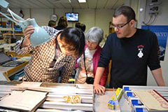
The photo shows MWJ Publications Specialist Yoko Okamoto demonstrating the XCT core viewer workstation to the Science Party.
11.26, 2013
Day:75
Location at 2400: Site C0002 Hole N (33° 18.0507’N, 136° 38.2029’E)
Weather: Partly cloudy
 Crew change for science party. Displacing riser with 1.13 sg mud, tagged top of cement. Performed a series of pressure tests, including cement shoe bond pressure test. Confirmed good cement job at casing shoe.
After a wait on weather due to passage of a cold front, operations today included drilling out cement to 3967 mBRT (10.5 m above 13-3/8-inch casing shoe) and conducting a pressure test of the casing. Co-chiefs and EPMs confirmed with the OSI team the procedures of cement shoe bond and leak off tests to be conducted at 4302 mBRT. The main group of the shipboard scientific party arrived on Chikyu by helicopter and had a safety induction, as well as a discussion of science and operation updates and onboard work assignments. The MWJ Lab officer and curator conducted a first lab tour. EPM Sean Toczko came onboard. EPM Yusuke Kubo disembarked. Thanks, Kubo san, for your arrangements and contributions over the past few weeks.
The photo show's MWJ Lab Officer Hirano-san leading a scientist's tour of the core processing deck.
11.25, 2013
Day:74
Location at 2400: Site C0002 (33° 18.0507’N, 136° 38.2029’E, water depth: 1939 mbsl)
Weather: Fine but cloudy
 Pulling out open hole (POOH) to top of cement (TOC). POOH above Blow-out preventor (BOP). Displace riser with seawater and waiting on weather (WOW). Displace riser with KNPP (KCl-NaCl/polymer/PPG) mud.
Operations today included making up the assembly for drilling out cement and running in the hole. We then suspending drilling operations at ~14:00 to wait on weather due to passage of a cold front. Operation resumed late at night. Co-chief scientists Demian Saffer and Takehiro Hirose, and EPM Yusku Kubo held detailed discussions about plans for the upcoming cement shoe bond and leak-off tests with the operation super intendent (OSI) and drilling engineer, and with CDEX operations onshore. The group also finalized a plan for paleomagnetic measurements in the absence of a shipboard paleomagnetic specialist; the plan will include shipboard measurement of discrete samples to allow re-orientation of structures, and rapid shore-based analysis to the data.
Today's photo shows cement head lifted up on the drill floor.
11.24, 2013
Day:73
Location at 2400: Site C0002 (33° 18.0507’N, 136° 38.2029’E, water depth: 1939 mbsl)
Weather: Fine but cloudy
 Continue Blow-out preventor (BOP) test. Release and Pulling out open hole (POOH) Wear Brushing Running Retrieving Tool (WBRRT). L/D 17"Drilling Bore hole assembly (BHA) and CMT stand. Pressure test IBOP and rotary hose, M/up 12-1/4"BHA & Run in hole (RIH).
After cementing the 13-3/8 casing, a WBRRT was run into the hole and pressure test of BOP was completed successfully. Co-chiefs Demian Saffer and Takehiro Hirose, and EPM Yusuke Kubo with onboard scientist Yuzuru Yamamoto discussed about remanent magnetization measurement on discrete samples to reconstruct orientation of core. The MWJ technicians assessed the usefulness of phenolphthalein solution to identify drilling cement in cuttings.
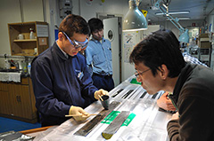
Today's photo shows Operation Geologists showing how to identify cements in cuttings samples to lab staffs and scientists.
11.23, 2013
Day:72
Location at 2400: Site C0002 (33° 18.0507’N, 136° 38.2029’E, water depth: 1939 mbsl)
Weather: Fine but cloudy
 Pulling out open hole (POOH) and lay out Pressure Assisted Drillpipe Running Tool (PADPRT). Change out IBOP and Saver sub of HPS. Make up and Run in hole (RIH) Wear Brushing Running Retrieving Tool (WBRRT). Set wear bushing. Blow-out preventor (BOP) test.
Today, preparations continued for upcoming drilling out of cement, leak-off tests, and coring. Operations involved making up and running the wear bushing and conducting tests on the BOP. Co-chief scientists Takehiro Hirose and Demian Saffer, and EPM Yusuke Kubo conducted a final review of sample requests for split core, and discussed observations made during the casing run that may provide information about formation integrity with the drilling engineer.
Today's photo shows lab staffs gathering for a bi-weekly department safety meeting.
11.22, 2013
Day:71
Location at 2400: Site C0002 (33° 18.0507’N, 136° 38.2029’E, water depth: 1939 mbsl)
Weather: Fine but cloudy
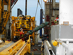
 Run in hole (RIH) 13-3/8"Casing (CSG). Landing 13-3/8"CSG hanger. 13-3/8"CSG CMTG. Pressure test packoff. Release and Pulling out open hole (POOH) Pressure Assisted Drillpipe Running Tool (PADPRT).
The 13-3/8”casing was successfully installed to a target depth of 3977.5 mBRT (2010 mbsf) as planned and then cemented. Co-chief scientists Demian Saffer and Takehiro Hirose, and EPM Yusuke Kubo continued to review plans for core flow and processing and a schedule for the first few days after the science party is onboard. Operations Liaisons Gaku Kimura disembarked today. Thanks, Gaku san for your suggestions for cuttings/core observation and contributions over the past ten days!
Today's photo shows Co-chief scientists Takehiro Hirose (left) and Demian Saffer (right) saying goodbye to Operation Liaison Gaku Kimura (center), tasting a piece of cuttings sample.
11.21, 2013
Day:70
Location at 2400: Site C0002 (33° 18.0507’N, 136° 38.2029’E, water depth: 1939 mbsl)
Weather: Fine but cloudy
 Lay out 25jts 13-3/8"Casing (CSG). Make up Pressure Assisted Drillpipe Running Tool (PADPRT) assembly. Run in hole (RIH) 13-3/8"CSG.
The 13-3/8 casing was recovered, shortened by 300 m, and re-run into the hole in the afternoon, with a target depth of 3977.5 mBRT (2010 mbsf). Co-chief scientists Takehiro Hirose and Demian Saffer, and EPM Yusuke Kubo reviewed detailed plans for core flow, processing, and sampling once the science party is on board, and discussed Logging while drilling (LWD) data recording options for the next phase of drilling with co-chief scientist Harold Tobin (currently on shore) and the logging group at CDEX.
Today's photo shows shale shaker where cuttings samples are collected.
11.20, 2013
Day:69
Location at 2400: Site C0002 (33° 18.0507’N, 136° 38.2029’E, water depth: 1939 mbsl)
Weather: Fine but cloudy
 Pulling out open hole (POOH) 13-3/8" Casing (CSG). Spot Lost Circulation Material (LCM) mud. Replace Pressure Assisted Drillpipe Running Tool (PADPRT). Rig up CSG handling tool.
It was decided the 13-3/8" casing was retrieved and shortened from ~2300 to ~2000 m in length. The new planned depth of the 13-3/8 casing shoe will be 3977.5 mbrt (2010 mbsf). Co-chief scientists Demian Saffer and Takehiro Hirose presented an overview of the NatroSEIZE and Exp. 348 at Science Cafe for ship crew.
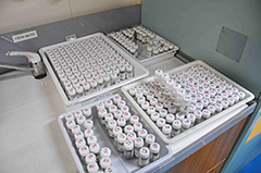
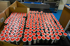
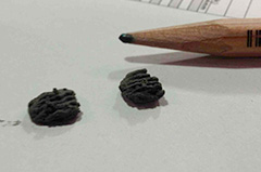
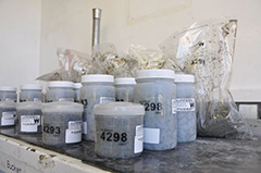
Today's photo shows many bottles of cuttings samples.
11.19, 2013
Day:68
Location at 2400: Site C0002 (33° 18.0507’N, 136° 38.2029’E, water depth: 1939 mbsl)
Weather: Fine but cloudy
 Continue to run 13-3/8" casing on landing string.
After encountering tight hole conditions at ~3990 mBRT, operations today focused on pulling back and circulating to clear the hole. Large (up to ~2 cm) cavings were returned, and with the increased circulation, casing was advanced to 4008 mBRT. Because of mud losses during circulation and casing advance, a decision to Pulling out open hole (POOH) was made at ~24:00. Co-chiefs Demian Saffer and Takehiro Hirose, and EPM Yusuke Kubo finalized a schedule for the first few days after the science party arrives, and discussed science party work assignments and shifts. The entire onboard science group also had a brief training for X-ray CT scan software.
Structural Geologist Yuzuru Yamamoto arrived this morning, to finish preparations for Anelastic Strain Recovery (ASR) measurements to be conducted on core samples. Welcome Yuzuru!
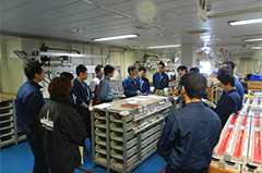
Today's photo shows lab technician Akihiko Fujihara demonstrating X-CT software to onboard scientists.
11.18, 2013
Day:67
Location at 2400: Site C0002 (33° 18.0507’N, 136° 38.2029’E, water depth: 1939 mbsl)
Weather: Fine but cloudy
 Continue to run 13-3/8" casing on landing string.
All 13-3/8 casing pipes had been assembled and connected with landing string, and then landing operation got started. Co-chief scientists and EPMs discussed about depth scales of core, cuttings and Logging while drilling (LWD) to be used in Exp 348 and running the PFC tracer to assess potential contamination of core and interstitial water. Specialty coordinator for Geochemistry, Geoff Wheat, recommended to run the tracer. Measurement plan of the contamination test will be made before first core arrives. Access to raw measurement/description data of Exp 338 for Exp 348 scientists through J-CORES was also confirmed.
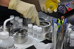
Today's photo shows bead samples after XRF measurements.
11.17, 2013
Day:66
Location at 2400: Site C0002 (33° 18.0507’N, 136° 38.2029’E, water depth: 1939 mbsl)
Weather: Overcast
 Continue to run 13-3/8"casing.
Running 13 3/8" casing continued through the day. MWJ technicians completed installation of the new degasser, and initial testing of the system was successful. Co-chief scientists Takehiro Hirose and Demian Saffer and EPM Yusuke Kubo developed the preliminary whole-round sampling distribution plan for coring, and finalized assignments and shifts for the science party. The group also finalized the plan for whole-round core flow and the time-sensitive measurements that will be completed prior to arrival of the science party.
Today's photo shows (from right) the Co-chief Scientist Takehiro Hirose, Operation Liaison Gaku Kimura, Co-chief Scientist Demian Saffer, a geochemist Sebastian Hammerschmidt observing cuttings samples.
11.16, 2013
Day:65
Location at 2400: Site C0002 (33° 18.0507’N, 136° 38.2029’E, water depth: 1939 mbsl)
Weather: Fine but cloudy
 Retrieve Nominal Sheet Protector. Prepare and run 13-3/8"casing.
The nominal seal protector was successfully recovered and then running casing operation has started. MWJ technicians have finished moisture and density (MAD) measurements of cuttings. Operation Liaison Gaku Kimura and co-chiefs observed cuttings with well-developed cleavages from fault zone at ~1600 mbsf, and compared with Logging while drilling (LWD) data collected from Exp 348. Sebastian visited mud gas van to check sampling method. Demian processed annular pressure data to find a possible lost interval of drilling mud at ~2000 mbsf. The interpretation will be discussed with operation super intendent (OSI).
Today's photo shows the cuttings samples showing cleavages.
11.15, 2013
Day:64
Location at 2400: Site C0002 (33° 18.0507’N, 136° 38.2029’E, water depth: 1939 mbsl)
Weather: Fine but cloudy
 Pulling out open hole (POOH) drilling assembly. Retrieve Nominal Sheet Protector.
After completing wiper trips today and POOH with no trouble, the 17" Bore hole assembly (BHA) was recovered and Logging while drilling (LWD) memory data downloaded. Operations continued with recovery of the Blow-out preventor (BOP) nominal seal protector in final preparation for running casing over the next few days. The MWJ technicians continued with shipboard measurements on cuttings, including MS, MAD, XRD, and XRF. Operations Liaison Gaku Kimura met with the MWJ technicians this afternoon to look at fabrics preserved in cuttings, and co-chief scientist Demian Saffer worked with the LWD data and comparison with previously collected data from Expedition #338. After a weather-related delay, Co-Chief Scientist Takehiro Hirose and EPM Yusuke Kubo came onboard, and EPM Lena Maeda disembarked. Thanks, Lena, for your hard work and contributions over the past few weeks.
Today's photo shows the degasser of Geoservice deployed on the mud pit.
11.14, 2013
Day:63
Location at 2400: Site C0002 (33° 18.0507’N, 136° 38.2029’E, water depth: 1939 mbsl)
Weather: Overcast
 Wash down and reaming. Short trip. Circulation and bottoms up. Pulling out open hole (POOH).
Wiper trips continued today, in preparation for running 13 3/8" casing. Some sticky zones were encountered near the bottom of the hole, and an additional short wiper trip was re-run in this section. The MWJ technicians easy-washed and sieved the last cuttings from the lower-most part of the hole today, and continued with time-sensitive moisture and density (MAD) measurements on the cuttings, as well as preparation of cuttings samples for other shipboard analyses. In the afternoon, the scientists (co-chief scientist Demian Saffer, operations liaison Gaku Kimura, and mud gas geochemist Sebastian Hammerchimdt) met with the MWJ technicians for introductions. Lena, Sebastian, and Demian also started working with the initial Logging while drilling (LWD) data, and opened to GeniusPlug to check its condition for possible contingency operations later in the expedition. There was no chopper flight today.
Today's photo shows a scene of sample powdering.
11.13, 2013
Day:62
Location at 2400: Site C0002 (33° 18.0507’N, 136° 38.2029’E, water depth: 1939 mbsl)
Weather: Fine but cloudy
 Drill to section TD. Circulation for hole cleaning, wiper trip to 20”Casing (CSG) shoe, and run back to bottom.
Riser drilling continued until reaching a TD of 4297.5 mBRT (2330 m MD) at 01:15, without any significant problems. Operations the remainder of the day featured sweeping out the hole and the first of two planned round trip and wiper trips up to the casing shoe at 2827.8 mBRT. The MWJ technicians continued processing the last cuttings from the bottom portion of the hole. Mud gas geochemist young Sebastian Hammerschmidt worked to compile the full set of mud gas data collected in the riser hole, in preparation for the shipboard science party. Lena and Sebastian also discussed the mud degasser configuration with the MWJ group, and finalized plans to install a second, new degasser immediately adjacent to the GeoServices system in an effort to address problems with atmospheric contamination of mud gasses. The new system arrived on the afternoon helicopter flight; it will be installed over the next few days, and will be tested at the next opportunity for mud gas collection when the 13 3/8" casing cement is drilled out. Today was also a crew change for our Operations Liaisons. Kyu Kanagawa disembarked today, and Gaku Kimura arrived this afternoon. Thanks, Kyu, for your leadership and hard work over the past two weeks, and welcome, Gaku!
The photo shows a lab tech is removing water on cuttings surface as preparation for moisture and density measurement.
11.12, 2013
Day:61
Location at 2400: Site C0002 (33° 18.0507’N, 136° 38.2029’E, water depth: 1939 mbsl)
Weather: Fine but cloudy
 Spot LCM (Lost Circulation Material) and countermeasure lost circulation. Drill 17”Logging while drilling (LWD) hole.
Riser drilling downward from 2005.5 mbsf continued, and reached 2293 mbsf by the end of the day. Drilling was, however, hampered twice by losing mud water at ~2036 mbsf and ~2115 mbsf. We got around these losses of mud water circulation by adding LCM, which are composed of muscovite, fibers and walnut powders. Real-time monitoring LWD data became available again after replacing the Measurement while drilling (MWD) pulser during waiting on weather (WOW). Gamma-ray values remain high below 2005.5 mbsf, indicating still being in Unit V. It was found that cavings caused the drags/over-pulls at two intervals of 1550-1650 mbsf and 1800-2005.5 mbsf. Some of the cavings found were rounded in shape and as large as 2 cm in size. It is unknown at present where these cuttings are from. Cuttings became accumulated again in the lab, and were kept washing and sieving by lab techs. Co-Chief Scientist, Demian Saffer and Geochemist, Sebastian Hammerschmidt embarked today, after four hours of waiting at the Minami-Ise Helibase due to a problem with the flight recorder in the helicopter they were going to flying with.
The photo shows cuttings sample retrieved around the TD.
11.11, 2013
Day:60
Location at 2400: Site C0002 (33° 18.0507’N, 136° 38.2029’E, water depth: 1939 mbsl)
Weather: Fine but cloudy
 Run in hole (RIH) and ream down to bottom. Resume drilling 17”Logging while drilling (LWD) hole.
We ran a newly assembled Bore hole assembly (BHA) down the hole. BHA was going smoothly down to ~1800 mbsf, but it became resistant to go down below that depth, likely due to the fragile borehole walls. It finally reached the bottom of the hole at ~21:30, where mud water was circulated there for a while, and then drilling resumed at ~22:15. moisture and density (MAD) analyses of cuttings have been completed, and XRS, XRF and carb analyses are still going on.
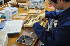
The photo shows a lab tech is weighing cuttings to make a bead for XRF measurement.
11.10, 2013
Day:59
Location at 2400: Site C0002 (33° 18.0507’N, 136° 38.2029’E, water depth: 1939 mbsl)
Weather: Fine but cloudy
 Pulling out open hole (POOH) Bore hole assembly (BHA) to rig floor. Dump Logging while drilling (LWD) data. Makeup 17” LWD BHA w/o RSS. During POOH for waiting on weather (WOW), BHA was stuck several times from the bottom of the hole to ~1550 mbsf due to an unstable hole condition. Because a rugged GeoPilot side-tracking tool possibly made drags/over-pulls during POOH, BHA was pulled up on the rig floor in order to get rid of the tool from BHA. Meanwhile Logging while drilling (LWD) data were recovered from memory, and Measurement while drilling (MWD) pulser was replaced.
All cuttings collected by yesterday were washed and sieved. Their moisture and density (MAD) analyses will be done tomorrow, because they have to be dried over 24 hrs.
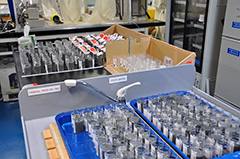
The photo shows 0.25-1 mm size-fractioned samples.
11.9, 2013
Day:58
Location at 2400: Site C0002 (33° 18.0507’N, 136° 38.2029’E, water depth: 1939 mbsl)
Weather: Fine but cloudy
 Drill 17” (inch) LWH hole. Circulation and bottoms up.
Riser drilling resumed last night, and continued down to 2005.5 mbsf by ~19:00 until the same depth as Hole C0002. Then BHA was pulled up above BOP for WOW tomorrow.
We lost LWD signals from ~1860 mbsf this morning, likely because the mud pump is introducing noises to the mud column or MWD pulser is not properly working. LWD data are believed to be recorded in memory, but we couldn't monitor Logging while drilling (LWD) data in real time. After discussions with operation super intendent (OSI) and Logiing staff scientist (LSS), a decision was made so as to keep drilling without monitoring LWD data until 2005 mbsf, and to fix the pump or Measurement While Drilling (MWD) pulser during WOW if possible.
Cuttings accumulated in the lab again, and lab techs kept busy with washing and sieving them as well as moisture and density (MAD) analyses, but will finish these jobs during waiting on weather (WOW) tomorrow. We are getting enough amount of cuttings of all size fractions from Unit V.
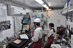
The photo shows lab techs are checking mud-gas data in Mud-gas Monitoring Lab.
11.8, 2013
Day:57
Location at 2400: Site C0002 (33° 18.0507’N, 136° 38.2029’E, water depth: 1939 mbsl)
Weather: Fine but cloudy
 Pulling out open hole (POOH) Blow-out preventor (BOP) to above BOP. D/L cut and slip. Run in hole (RIH) and ream down to bottom. Resume drilling 17” (inch) Logging while drilling (LWH) hole.
Riser drilling was halted yesterday evening, then Bore hole assembly (BHA) was pulled up above BOP. After a drill line cut and slip, BHA was back to the bottom of the hole, then drilling resumed at 22:00. Cuttings collected every 10 m by yesterday were all washed and sieved by early afternoon. MAD analyses of cuttings will be completed tomorrow. Somehow we got only a few amount of cuttings of >4 mm fraction from the fault zone interval of 1630-1650 mbsf. Some pieces from that interval have slickensides, but not much than expected. Onboard structural geologists should observe cuttings of this interval carefully.
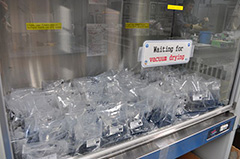
The photo shows the cuttings samples are waiting for the next step "vacuum drying."
11.7, 2013
Day:56
Location at 2400: Site C0002 (33° 18.0507’N, 136° 38.2029’E, water depth: 1939 mbsl)
Weather: Fine but cloudy
 Back ream to 20” (inch in diameter) Casing (CSG) shoe and Run in hole (RIH) to bottom. Drill 17”LWD hole. Riser drilling passed through the supposed fault zone (~1640 mbsf) and reached ~1675 mbsf by the evening, then Bore hole assembly (BHA) was pulled up above Blow-out preventor (BOP) for a drill line cut and slip. LWD shows a high resistivity interval of 1630-1650 mbsf corresponding to the fault zone, and high gamma ray values below ~1655 mbsf reflecting Unit V lithology. High concentrations of hydrocarbons were observed at ~1300 mbsf, as observed in Hole C0002F during Exp. 338. However, no noticeable change in mud gas has been observed at depths of the fault zone and Unit IV/V boundary. Cuttings from the fault zone are now on the core cutting deck, and will be washed and sieved by the end of the day.
We welcomed VIP visitors today, JAMSTEC Executive Director and CDEX Manager of Science Operations. The photo shows crews are on the way from Shale Shaker to Lab for delivering cuttings sample.
11.6, 2013
Day:55
Location at 2400: Site C0002 (33° 18.0507’N, 136° 38.2029’E, water depth: 1939 mbsl)
Weather: Rain
 Back ream to 20” casing (CSG) shoe and Run in hole (RIH) to bottom. Drill 17” Logging While Drilling (LWD) hole. After sidetrack drilling down to ~1220 mbsf and cleaning up the hole, drilling down vertically resumed and reached ~1400 mbsf by the end of the day. LWD and mud gas-monitoring continued. ~100th cuttings have arrived on the core cutting deck, and lab techs kept washing, sieving and sampling them. In order to get enough amount of cuttings of >4 mm fraction for personal samples, 4.5L instead of 2.5L of cuttings were sampled every 5 m from this afternoon. Moisture and density (MAD) analyses of ~20th cuttings have also been done.
The photo shows a lab tech is sieving cuttings into size fractions of 4mm, 1-4mm, and <1mm.
11.5, 2013
Day:54
Location at 2400: Site C0002 (33° 18.0507’N, 136° 38.2029’E, water depth: 1939 mbsl)
Weather: Fine but cloudy
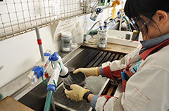 Continue sidetrack. Drill 17” Logging While Drilling (LWD) hole. Sidetrack drilling below the 20” casing (CSG) shoe (860.3 mbsf), LWD and mud-gas monitoring continued and reached ~1200 mbsf by the end of the day. Drilling direction is westward in azimuth and tilted by ~5° from the vertical, and has been tried to direct toward north before drilling down vertically. ~50th bottles of cuttings have arrived on the core cutting deck so far, and lab techs were keeping busy with washing, sieving and sampling them. They also started to do moisture and density (MAD) analyses of cuttings.
The photo shows a lab tech is easy-washing cuttings at Core Cutting Area.
11.4, 2013
Day:53
Location at 2400: Site C0002 (33° 18.0507’N, 136° 38.2029’E, water depth: 1939 mbsl)
Weather: Fine but cloudy
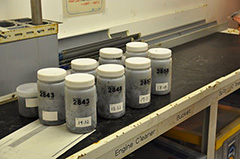 Drill out cement. Pressure test on 20” casing (CSG). Sidetrack 17” Logging While Drilling (LWD) hole.
Sidetrack drilling below the 20" CSG shoe (865.5 mbsf) started this morning, so Logging While Drilling (LWD) and mud gas monitoring also started today. The first bottles of cuttings mostly of cement arrived this evening, and then lab techs started to wash, sieve and sample those cuttings.
The photo shows the bottled cuttings at Core Cutting Area.
11.3, 2013
Day:52
Location at 2400: Site C0002 (33° 18.0507’N, 136° 38.2029’E, water depth: 1939 mbsl)
Weather: Rain
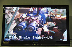 Displace riser with KNPP mud. Run in hole (RIH) 17” rotary steerable system (RSS) Bore Hole Assembly (BHA) to 2733 mBRT. Drill out cement. Pressure test on 20”CSG. CMT to the 20" CSG shoe (860.3 mbsf) was successfully drilled out, then calcium carbide was put into circulating mud water in order to know the lag time by detecting acetylene gas. LSSs, a mud-gas geochemist and lab techs were waiting for drilling below the 20" CSG shoe to start LWD, mud gas monitoring and cuttings procedure.
The photo shows crews is checking cuttings retrieved from the shallower cement plug at Shale Shaker.
11.2, 2013
Day:51
Location at 2400: Site C0002 (33° 18.0507’N, 136° 38.2029’E, water depth: 1939 mbsl)
Weather: Cloudy
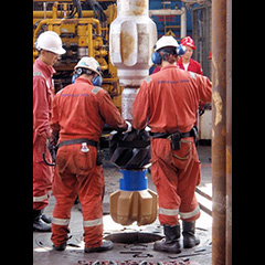 Pulling out open hole (POOH) Blow-out Preventor (BOP) isolation test tool. M/U and Run in hole (RIH) 17”RSS Bore Hole Assembly (BHA). Check Total organic carbon (TOC) of #2 CMT plug. Displace riser with KNPP mud. Continued operation training for cuttings/mud-gas handling. Instruction of lab mud-gas analysis systems and instruments for the mud-gas scientist.
The photo shows drill crews are connecting the 17"drill bit at the rig floor.
11.1, 2013
Day:50
Location at 2400: Site C0002 (33° 18.0507’N, 136° 38.2029’E, water depth: 1939 mbsl)
Weather: Fine but cloudy
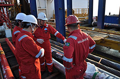 Repair dolly. Make up and RIH isolation test tool. Pressure test on Blow-out Preventor (BOP).
Continued preparation for cuttings/mud-gas handling in Lab. In the after noon, we had a tour to have a look Logging While Drilling (LWD) tools with guide by logging staff. A engineer embarked for taking care of mud-gas sampling and data evaluation.
The photo shows a scene of LWD tour.

10.31, 2013
Day:49
Location at 2400: Site C0002 (33° 18.0507’N, 136° 38.2029’E)
Weather: Fine but cloudy
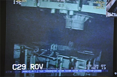 About operation, run Lower Marine Riser Package (LMRP) and riser while drifting vessel to Site C0002. Land LMRP. Install upper flex joint & diverter. Rigdown riser running equipment. Repair dolly.
For Science, a meeting for final check of each sampling bottle and tool based on sample distribution plan was held with all lab techs attendance. Detailed procedures were also discussed for making more efficient way and tools.
The photo shows a view from Remotely Operated Vehicle (ROV) while aligning LMRP.
10.30, 2013
Day:48
Location at 2400: Drifting to Site C0002 (1 miles NNW from Site C0002; 33°20’N, 136°36’E)
Weather: Fine but cloudy
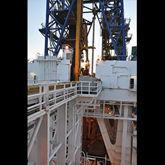 Run Lower Marine Riser Package (LMRP) and riser. Drifting vessel to Site C0002.
Continued preparations for cuttings handling and operation tests for mud-gas analysis instruments. Operation Liaison Kyu Kanagawa embarked.
The photo shows the telescopic joint being hung at the rig for installation.
10.29, 2013
Day:47
Location at 2400: Drifting to Site C0002 (9 miles NNW from Site C0002; 33°26’N, 136°33’E)
Weather: Fine but cloudy
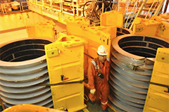 Run Lower Marine Riser Package (LMRP) and riser. Start drifting vessel to Site C0002.
Half of lab techs were exchanged, and hand-over meeting was held.
Operation tests for mud-gas monitoring instrument were continued.
The photo shows fairings on the moon pool deck.
10.28, 2013
Day:46
Location at 2400: 14 miles NNW from Site C0002 (33°29.9340’N, 136°29.7512’E)
Weather: Fine but cloudy
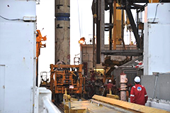 Run Lower Marine Riser Package (LMRP) and riser. Start drifting vessel to Site C0002.
Operation trainings for cuttings handling were continued to improve tools and procedures. Investigation for mud-gas monitoring instruments was also continued.
The photo shows a riser with "blue" buoyancy (middle depth part) was connected at the rig floor.
10.27, 2013
Day:45
Location at 2400: 15 miles NNW from Site C0002 (33°1830.9529’N, 136°37.713’E)
Weather: Fine but cloudy
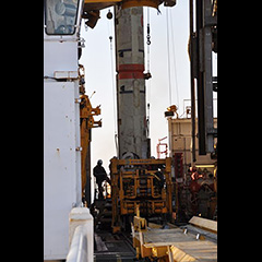 Run Lower Marine Riser Package (LMRP) and riser.
Continued lectures and trainings for cuttings handling and operation tests for mud-gas monitoring instruments.
10.26, 2013
Day:44
Location at 2400: 15 miles NNW from Site C0002
Weather: Fine but cloudy
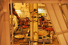 Waiting on weather (WOW). Observation of typhoon No. 27. Preparation for LMRP and riser running. Running Lower Marine Riser Package (LMRP) and riser.
Re-starting mud-gas analysis instruments. Continued lectures and trainings for cuttings handling.
The photo shows crews preparing pressure test at the moon pool working area.
10.25, 2013
Day:43
Location at 2400: 15 miles NNW from Site C0002
Weather: Rain
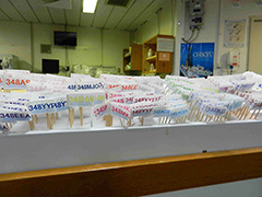 Waiting on weather (WOW). Preparation for deploying moon pool hoses onto Working cart.
Lab staffs continue preparation and planning of cuttings and core work flow. Today's photo shows sample flags waiting for boarding of science party.
10.24, 2013
Day:42
Location at 2400: 17.3 miles NNW from Site C0002
Weather: Overcast
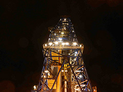 Waiting on weather (WOW). Lab staffs continue preparation and planning of cuttings and core work flow. Today's photo shows the derrick at night.
10.23, 2013
Day:41
Location at 2400: 17.3 miles NNW from Site C0002
Weather: Cloudy
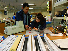 Waiting on weather (WOW). Moving Lower Marine Riser Package (LMRP) on Blow-out Preventor (BOP) cart to well center after maintenance work.
Lab staffs continue preparation and planning of cuttings and core work flow. Today's photo shows curator trying new sampling tool with her colleague.
10.22, 2013
Day:40
Location at 2400: 17.3 miles NNW from Site C0002
Weather: Cloudy
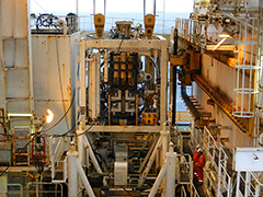 Waiting on weather (WOW). Tests of Moving Lower Marine Riser Package (LMRP).
Lab staffs continue preparation and planning of cuttings and core work flow. Today's photo shows the LMRP under maintenance.
10.21, 2013
Day:39
Location at 2400: 17.3 miles NNW from Site C0002
Weather: Cloudy
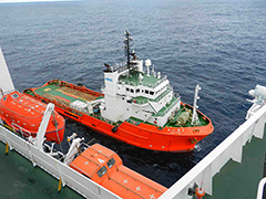 Waiting on Weather (WOW).
Lab staffs continue preparation and planning of cuttings and core work flow. Today's photo shows the arrival of supply boat Kaiyu.
10.20, 2013
Day:38
Location at 2400: 17.3 miles NNW from Site C0002
Weather: Overcast
 After suspension due to bad weather recovery of Lower Marine Riser Package (LMRP) was resumed and completed as of 2315 h. Waiting on Weather (WOW).
Lab staffs continue preparation and planning of cuttings and core work flow. Today's photo shows the catwalk in rain.
10.19, 2013
Day:37
Location at 2400: 17.3 miles NNW from Site C0002
Weather: Rain
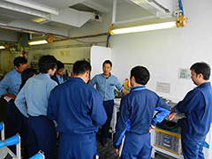 Continue recover riser. Attempted recovery of Lower Marine Riser Package (LMRP) but suspended due to bad weather.
Lab staffs continue preparation and had dry run of cuttings flow in each shift. Today's photo shows onboard Curator Masaru Yasunaga showing sample distribution plan to lab staffs.
10.18, 2013
Day:36
Location at 2400: 17.3 miles NNW from Site C0002
Weather: Cloudy
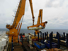 Continue recover riser for Waiting on Weather (WOW).
Lab staffs continue preparation and planning additional tests. Today's photo shows riser pipe handling on the aft deck.
10.17, 2013
Day:35
Location at 2400: 17.3 miles NNW from Site C0002
Weather: Fine but cloudy
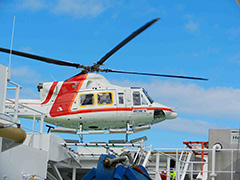 Recover riser for Waiting on Weather (WOW) at 17.3 mile NNW of C0002F.
There was a crew change in the Lab, including Lab Officer and Curator, and handover to incoming staffs is ongoing. LSS Yoshinori Sanada disembarked. Today's photo shows landing of a chopper on the heliport of Chikyu.
10.16, 2013
Day:34
Location at 2400: 17.3 miles NNW from Site C0002
Weather: Fine but cloudy
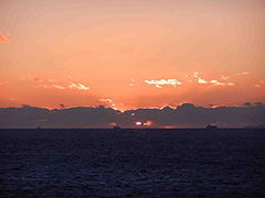 Waiting on Weather (WOW). Stand by at 17.3 mile NNW of C0002F. Prepare recovering Lower Marine Riser Package (LMRP). The sea conditions were calming down after passage of the typhoon, but we kept stand by as it was forecasted that another strong typhoon would hit the area next week.
Lab staffs restarted instruments after the sea conditions calmed down. Today's photo shows dusk after passage of the typhoon.
10.15, 2013
Day:33
Location at 2400: 17 miles NNW from Site C0002
Weather: Rain
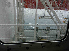 Waiting on Weather (WOW). Stand by at 17 mile NNW of C0002F.
Lab staffs preparing for rough weather. Many of instruments were shut down tentatively. Today's photo shows stormy weather through a window.
10.14, 2013
Day:32
Location at 2400: 15 miles NW from Site C0002
Weather: Fine but cloudy
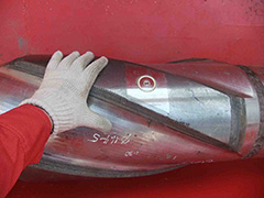 Waiting on Weather (WOW). Stand by at 15 mile NW of C0002F and then moving further 5 mile to NNE. Lab staffs preparing for crew change and rough weather. Today's photo shows Logging While Drilling (LWD) tool of highr-esolution resistivity image.
10.13, 2013
Day:31
Location at 2400: 15 miles NW from Site C0002
Weather: Fine but cloudy
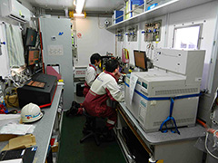 Arrived at 15 miles NW of Site C0002 at 1:00 in midnight. Hanging riser and Blow Out Preventer (BOP) and stand by.
Lab staffs continued lab preparation. Gas monitoring software was updated and we keep watching the conditions. Today's photo shows lab technicians double checking the measurement setting in mud gas monitoring unit.
10.12, 2013
Day:30
Location at 2400: Site C0002, Lat: 33°18.0507’ N, Lon: 136°38.2029’ E
Weather: Fine but cloudy
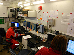 Lower Marine Riser Package (LMRP) was disconnected at 1:20 in midnight. After disconnect inspections, started moving to low current area at 0.8 knot.
Lab staffs continued lab preparation. X-ray diffract meter (XRD) measurements of reference material were carried out and the results will be reported to Specialty Coordinator.
Today's photo shows field engineering specialists working in their unit to prepare for directional drilling.
10.11, 2013
Day:29
Location at 2400: Site C0002, Lat: 33°18.0507’ N, Lon: 136°38.2029’ E
Weather: Fine but cloudy
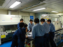 A tropical depression changed to a new typhoon, and was expected to approach the drilling site in a week. We had to start preparation for disconnecting Blow Out Preventer (BOP).
Lab staffs continued lab preparation. LSS Yoshinori Sanada got onboard together with LWD engineers. Today's photo shows onboard curator and lab staffs confirming sampling and processing plan of cuttings.
10.10, 2013
Day:28
Location at 2400: Site C0002, Lat: 33°18.0507’ N, Lon: 136°38.2029’ E
Weather: Fine but cloudy
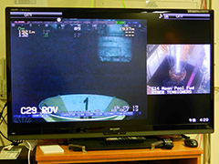 Blow Out Preventer (BOP) landed on wellhead at 1830. Various tests and BOP preparation is ongoing.
Lab staffs continued lab preparation and are getting ready to receive cuttings samples by preparing log sheets and sample lists.
Today's photo shows TV display before the moment of BOP landing.
10.9, 2013
Day:27
Location at 2400: On transit. 1.6 miles NW from C0002 site
Weather: Fine but cloudy
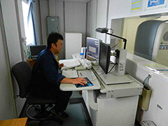 Continue to run Blow Out Preventer (BOP) and riser. BOP is approaching to the seafloor and goosenecks was installed on termination Joint.
Lab staffs continued lab preparation and figuring out details on cuttings processing and sample distribution before boarding of science party.
Today's photo shows assistant lab officer carrying out regular maintenance of X-CT in the laboratory.
10.8, 2013
Day:26
Location at 2400: On transit. 6 miles NW from C0002 site
Weather: Cloudy
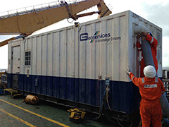 Continue to run Blow Out Preventer (BOP) and riser to green joint #2. Install SDVL, pressure test Aux line per tally.
Lab staffs continued lab preparation and figuring out details on cuttings processing before boarding of science party. Today's photo shows rig up of another mud gas logging unit for drilling safety monitoring. The unit is connected to the unit for scientific mud gas logging for data sharing.
10.7, 2013
Day:25
Location at 2400: On transit. 11 miles NW from C0002 site
Weather: Fine but cloudy
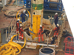 Continue to run Blow-Out Preventer (BOP) and riser to green joint. Install Surface Drillstring Vibro-acoustic Logging (SDVL), pressure test. ROV conducted test dive -confirmed all functions are working ok.
Lab staffs continued laboratory preparation such as double check of mud gas sample line and preparation of X-ray diffractometer (XRD) reference material.
Today's photo shows deployment of a fairing to a riser pipe, as a countermeasure against the ocean current.
10.6, 2013
Day:24
Location at 2400: Blow-Out Preventer (BOP) running point 15 miles NW of Site C0002
Weather: Fine but cloudy
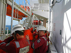 Continue to run BOP and riser. Install Surface Drillstring Vibro-acoustic Logging (SDVL), pressure test. Lab staffs continued lab preparation. Debug of mud gas monitoring software and updating documents for science party.
Today's photo shows ship crew moving to the lifeboat in abandon ship drill. This is a regular HSE activity aboard Chikyu.
10.5, 2013
Day:23
Location at 2400: Blow-Out Preventer (BOP) running point 15 miles NW of Site C0002
Weather: Cloudy
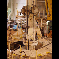 Running BOP after WOW. Lab staffs continued laboratory preparation. Curator has been contacting sample requesters to clarify missing details of their requests.
The photo is of riser pipes equipped with sensors and cables for monitoring of vortex-induced vibration.
10.4, 2013
Day:22
Location at 2400: Blow-Out Preventer (BOP) running point 15 miles NW of Site C0002
Weather: Overcast
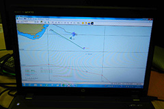 BOP was moved to moon pool while continue Waiting on weather (WOW).
Lab technicians continued lab preparation. Debug of updated software for mud gas monitoring has been completed and further test operation is going to be carried out.
Today’s photo shows monitoring of ocean current, displaying data from Chikyu and supply boats.
The accompanying photo is of the ocean current monitoring software showing data from Chikyu and supply boats.
Onboard EPM changed yesterday and Yusuke Kubo will stay onboard for the next three weeks.
10.3, 2013
Day:21
Location at 2400: BOP running point 15 miles NW of Site C0002
Weather: Partly cloudy
 Waiting on weather (WOW) due to tropical Storm Fitow and storm front watch. Install ROV cursor rail. Lab technicians performed two "wet runs" with cuttings samples today. Toured lab and mud gas unit to confirm readiness status of all equipment.
Today's photo shows sunrise over the Pacific.
10.2, 2013
Day:20
Location at 2400: BOP running point 15 miles NW of Site C0002
Weather: Partly cloudy
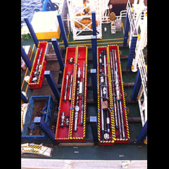 Waiting on weather (WOW) due to tropical Storm Fitow and storm front watch. Logging While Drilling (LWD) tools were loaded from the supply vessel. Casing pipes were rearranged on the aft pipe rack.
The sample requests were summarized and forwarded to the Co-chiefs and specialty coordinators to begin the review process by the Sample Allocation Committee. Some minor, but important, house-keeping activities were completed in the lab.
The photo is of the Halliburton LWD tools loaded in the forward pipe rack.
10.1, 2013
Day:19
Location at 2400: BOP running point 15 miles NW of Site C0002
Weather: Overcast
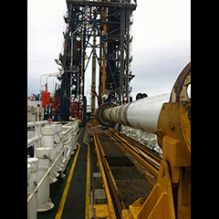 Sail to BOP running point; begin Waiting on weather (WOW) (Tropical Storm Fitow and storm front watch). We set in DP mode while observing weather. A long discussion with the OSI, OIM, CDEX, Captain,
and others concluded that the impending weather forecast for this Friday/Saturday precluded running the BOP until the predictions became more solid. Therefore, WOW until further notice. The co-chief and EPM teleconference confirmed the operational schedule, and the sampling request processing for Sample Allocation Committee (SAC) review.
Sail to BOP running point; begin Waiting on weather (WOW) (Tropical Storm Fitow and storm front watch). We set in DP mode while observing weather. A long discussion with the OSI, OIM, CDEX, Captain,
and others concluded that the impending weather forecast for this Friday/Saturday precluded running the BOP until the predictions became more solid. Therefore, WOW until further notice. The co-chief and EPM teleconference confirmed the operational schedule, and the sampling request processing for Sample Allocation Committee (SAC) review.The photo shows riser joints undergoing maintenance; looking forward from the aft RTS and view of the derrick.

9.30, 2013
Day:18
Location at 2400: Pilot station outside Mikawa Bay
Weather: Partly cloudy
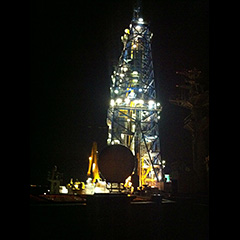 Sail to pilot station. Anchorage in Mikawa-bay. Load riser tools, and then move vessel to BOP running point.
We conducted a safety patrol in the lab stack with the OSI, the LO, and the EPM. Some minor items were discussed and marked for improvement, and referred to the appropriate departments.
The photo shows the derrick lit up while at anchor in Mikawa Bay.
9.29, 2013
Day:17
Location at 2400: Pilot station outside Mikawa Bay.
Weather: Partly cloudy
 Pick up moonpool hose. Sail to pilot station.
Lab technicians prepared handover documents for incoming MWJ crew change. Routine maintenance and consumable inventory checks. The photo shows bunkering operations en-route to Mikawa Bay.
9.28, 2013
Day:16
Location at 2400: 15 miles NW of Site C0002; BOP running point.
Weather: Partly cloudy
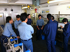 Weather continues to be fine. Pressure testing auxiliary line on riser joints. Lower riser joints and continue pressure testing auxiliary line. Recover BOP. Replace seal of Riser. Troubleshooting data connection issues in mud gas unit. Dry runs for cuttings collection and processing for each lab shift.
The attached photo shows the Lab Techs running through a cuttings processing dry run in the core cutting area.
9.27, 2013
Day:15
Location at 2400: 15 miles NW of Site C0002; BOP running point.
Weather: Partly cloudy
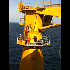 Pressure test of kill and choke line. Secure centralizer joint fin. Lay out IRJ. Lower BOP with centralizer and 30 ft pup joint.Preparations for mud gas sampling and other lab maintenance and maintenance continue.
9.26, 2013
Day:14
Location at 2400: 15 miles NW of Site C0002; BOP running point.
Weather: Partly cloudy
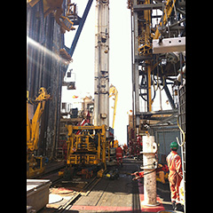 The 26 Sept 2013 daily science report is attached. Today's photo shows the roughnecks working on the centralizer joint on the rig floor.
9.25, 2013
Day:13
Location at 2400: Enroute to BOP running point 15 miles NW from Hole C0002F
Weather: Overcast
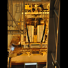 Today was a relatively slow day. Between helicopter operations and BOP preparation, things were very low key. The attached photo shows the BOP on the running cart above the moon pool, ready for running.
9.24, 2013
Day:12
Location at 2400: Standing by at Shionomisaki for waiting on weather (WOW)
Weather: Partly Cloudy
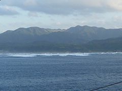 Work continued with prepping the risers and BOP for running. Chikyu remains in a sheltered location for wait on weather (WOW). EPM Sean Toczko will be boarding on 25 Sept 2013.
9.23, 2013
Day:11
Location at 2400: In transit to Shionomisaki; standby point for waiting on weather (WOW)
Weather: Partly Cloudy
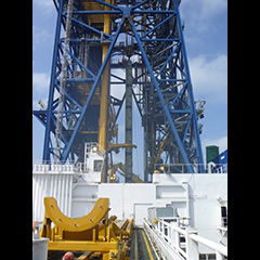 Today was a slow day, with only routine maintenance operations in the labs. The attached photo shows the riser joints being run into the moon pool. All operations ceased for evacuation from the approaching typhoon.
9.22, 2013
Day:10
Location at 2400: Site C0002 (33°18’N,136°38’E, Water depth: 1937.5 mbsl)
Weather: Partly Cloudy
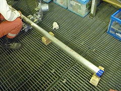 The SD-RCB operations, including the initial core scans with X-ray CT & MSCL-W are complete. preparations for running the riser continue. Lab preparation and troubleshooting continue.
 The attached photo shows the SD-RCB aluminum core liner in the core cutting are, prior to cutting.
9.21, 2013
Day:9
Location at 2400: Site C0002 (33°18’N,136°38’E, Water depth: 1937.5 mbsl)
Weather: Partly Cloudy
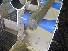 Saturday's operations saw 4 successful coring runs with the SD-RCB coring system. However, core recovery does not seem any better than with other riserless coring systems. Upon completion of coring, operations to continue the riser preparations restarted.
 The weather continues to be fine. The attached photo shows the SD-RCB core in the core cutting area.
9.20, 2013
Day:8
Location at 2400: Site C0002 (33°18’N,136°36’E, Water depth: 1939 mbsl)
Weather: Partly Cloudy
 The operations yesterday included drilling with the SD-RCB. The weather continues to be fine, and the current is cooperating as well. The photo shows the rigging up of the SD-RCB.
9.19, 2013
Day:7
Location at 2400: 2 miles west from planned SD-RCB test hole (Site C0002; 33°18’N, 136°36’E)
Weather: Fine but cloudy
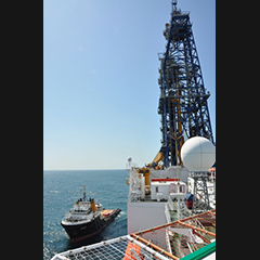 We have continued pressure testing the riser joints, and are finishing the preparations for running the small diameter RCB coring tool at Site C0002, as an engineering test.
The photo shows the supply boat in good weather.
We have continued pressure testing the riser joints, and are finishing the preparations for running the small diameter RCB coring tool at Site C0002, as an engineering test.
The photo shows the supply boat in good weather.
9.18, 2013
Day:6
Location at 2400: Site C0002 (33°18.0507’N, 136°38.2029’E, Water depth: 1939 mbsl)
Weather: Fine but cloudy
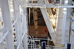 We completed seabed survey for all approaching routes, and deployed 7 transponders.
Several pressure tests for riser joints were also conducted to confirm the seal condition.
The photo shows a riser joint hung at the rig for the pressure tests.
We completed seabed survey for all approaching routes, and deployed 7 transponders.
Several pressure tests for riser joints were also conducted to confirm the seal condition.
The photo shows a riser joint hung at the rig for the pressure tests.
9.17, 2013
Day:5
Location at 2400: Site C0002 (33°18.0507’N, 136°38.2029’E, Water depth: 1939 mbsl)
Weather: Fine but cloudy
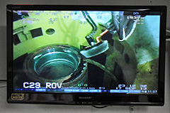 After arrival at Site C0002, we deployed the ROV for wellhead cleaning.
Two dives were carried out for the cleaning, and we confirmed the wellhead was all cleaned.
The photo shows the top surface of the wellhead is cleaned with a brush handled by ROV.
After arrival at Site C0002, we deployed the ROV for wellhead cleaning.
Two dives were carried out for the cleaning, and we confirmed the wellhead was all cleaned.
The photo shows the top surface of the wellhead is cleaned with a brush handled by ROV.
9.16, 2013
Day:4
Location at 2400: Transit to Site C0002. (32°22’N, 135°19’E)
Weather: Fine but cloudy
 Wait on weather (WOW) was continued by 1800h yesterday while some maintenance work on rigfloor and lab preparation were continued.
Chikyu arrived at Site C0002 on around 0700h today. Weather condition is very nine now.
The photo shows a color boundary on the sea surface. Brown comes from the land side, and it included lots of drift wood.
Wait on weather (WOW) was continued by 1800h yesterday while some maintenance work on rigfloor and lab preparation were continued.
Chikyu arrived at Site C0002 on around 0700h today. Weather condition is very nine now.
The photo shows a color boundary on the sea surface. Brown comes from the land side, and it included lots of drift wood.
9.15, 2013
Day:3
Location at 2400: Evacuation site to Typhoon No. 18. (Yuasa bay, 34°01’N, 135°02’E)
Weather: Rain
 We continue to wait on weather (WOW) at evacuation site. The maximum wind period by typhoon No 18 at the evacuation site has already passed by early in the morning (gust wind speed: 33.7 m/s).
We will stay here a half day more until the wave condition in outside of evacuation area becomes calm.
Today's photo shows a view at the evacuation site.
We continue to wait on weather (WOW) at evacuation site. The maximum wind period by typhoon No 18 at the evacuation site has already passed by early in the morning (gust wind speed: 33.7 m/s).
We will stay here a half day more until the wave condition in outside of evacuation area becomes calm.
Today's photo shows a view at the evacuation site.
9.14, 2013
Day:2
Location at 2400: Evacuation site to Typhoon No. 18. (Yuasa bay, °25’N, 136°13’E)
Weather: Rain
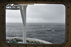 After arrived at Site C0002, seabed survey for approaching routes and removing corrosion cap from the wellhead were conducted. Before starting wellhead cleaning, weather became rough due to the typhoon No.18.
Chikyu has passed between Shikoku and Kii Peninsula just before.
So we are now wait on weather (WOW) at an evacuation site.
Today's photo shows rough sea in this morning.
After arrived at Site C0002, seabed survey for approaching routes and removing corrosion cap from the wellhead were conducted. Before starting wellhead cleaning, weather became rough due to the typhoon No.18.
Chikyu has passed between Shikoku and Kii Peninsula just before.
So we are now wait on weather (WOW) at an evacuation site.
Today's photo shows rough sea in this morning.
9.13, 2013
Day:1
Location at 2400: Shimizu port: 35°02’N, 138°31’E
Weather: Fine but cloudy
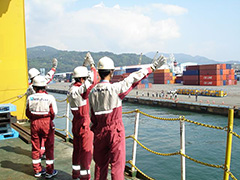 Hello from Chikyu! Exp. 348 has started since 00:00 Sep 13, 2013.
Chikyu departed Shimizu port at 10:00 am as planned, and already arrived at Site C0002.
Some maintenance work for BOP, function tests, and preparation for seabed survey were continued during transit time.
Hello from Chikyu! Exp. 348 has started since 00:00 Sep 13, 2013.
Chikyu departed Shimizu port at 10:00 am as planned, and already arrived at Site C0002.
Some maintenance work for BOP, function tests, and preparation for seabed survey were continued during transit time.


