
Ensemble Kalman filter data
assimilation and storm surge
experiments of tropical cyclone Nargis
Nargis was a severe storm which formed in Bay of Bengal in April 2008 and made landfall in the Irrawaddy delta, resulting in massive damage and loss of life in Myanmar. Some studies using high resolution limited area models have been conducted to investigate the predictability of Nargis. The question whether an early warning message could have been disseminated is the main concern. All forecasts in these studies showed a northward bias in the track together with early landfall time.
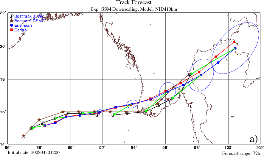
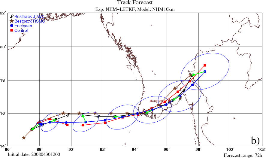
This study has innovated the previous works by the above authors on the predictability of Nargis. The problem was approached using a method that can generate both the initial condition and the initial perturbations for an ensemble forecast, namely the Local Ensemble Transform Kalman Filter (LETKF). For this purpose the NHM-LETKF data assimilation system developed at Japan Meteorological Agency has been adopted. The control experiment resulted in a track forecast close to the observed one. This forecast outperformed GSM downscaling especially in the landfall location and time (Figures 1, 2).
|
Figure 1: The 72-h forecasted tracks of Nargis initialized by: a) GSM analysis, and b) NHM-LETKF analysis in the control experiment. The ellipses represent the forecast error covariances of TC positions.
|
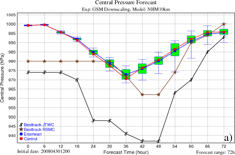
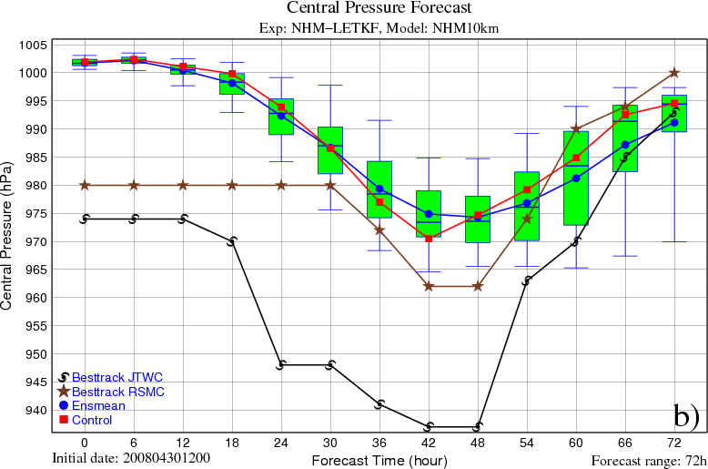
Figure 2: As Figure 1 but for the forecasted intensities. The ends of the whiskers represent the 5th and 95th percentiles.
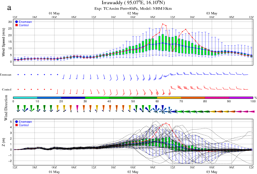
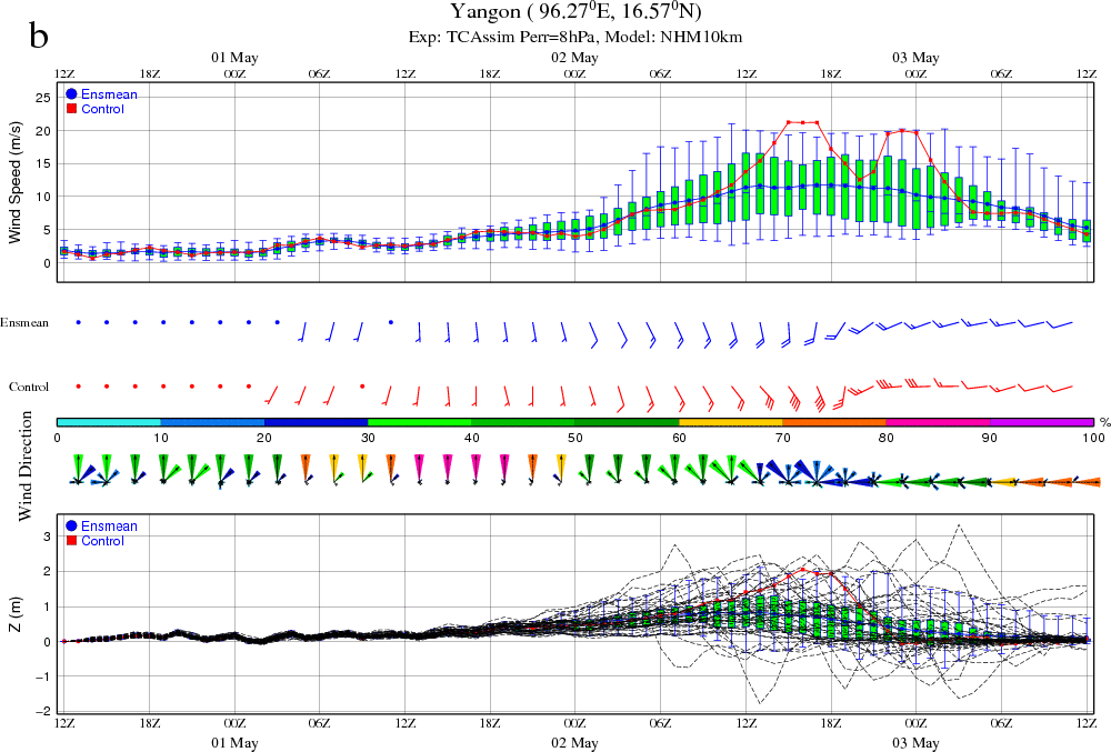
The use of assimilation of TC advisories was considered by choosing the observational error of central pressure as 8 hPa in the final NHM-LETKF that provided meteorological forcings for a subsequent storm surge forecast using the Princeton Ocean Model (POM). Forecasts of the water levels at Irrawaddy and Yangon have significantly improved the results in the previous studies (Figure 3). The Nargis’ forecasted trajectory and its associated storm surge are depicted in Figure 4.
|
Figure 3: Forecasts of wind speeds, wind directions, and water levels based on the NHM-LETKF using assimilation of TC advisories with Perr = 8 hPa at: a) Irrawaddy point, and b) Yangon point.

Figure 4: Simulated cloud images, and water levels based on the NHM-LETKF using assimilation of TC advisories with Perr = 8 hPa.
Duc, L., T. Kuroda, K. Saito and T. Fujita, 2015: Ensemble Kalman Filter data assimilation and storm surge experiments of tropical cyclone Nargis. Tellus A, 67, 25941, doi: http://dx.doi.org/10.3402/tellusa.v67.25941
Contacts:
Japan Agency for Marine-Earth Science and Technology/
Meteorological Research Institute
Le Duc( )
)
Meteorological Research Institute/
Japan Agency for Marine-Earth Science and Technology
Kazuo Saito( )
)
Japan Agency for Marine-Earth Science and Technology/
Meteorological Research Institute
Le Duc(
)Meteorological Research Institute/
Japan Agency for Marine-Earth Science and Technology
Kazuo Saito(
)