
Development of an earthquake and tsunami prediction method and provision of information contributing to disaster prevention and reduction
Huge earthquakes and tsunamis can pose a threat to not only our country but also the world. To realize a reduction in the damage caused by disasters and the early rescue of victims, it is very important to monitor and predict crustal deformation and rapidly provide useful information to national and local governments.
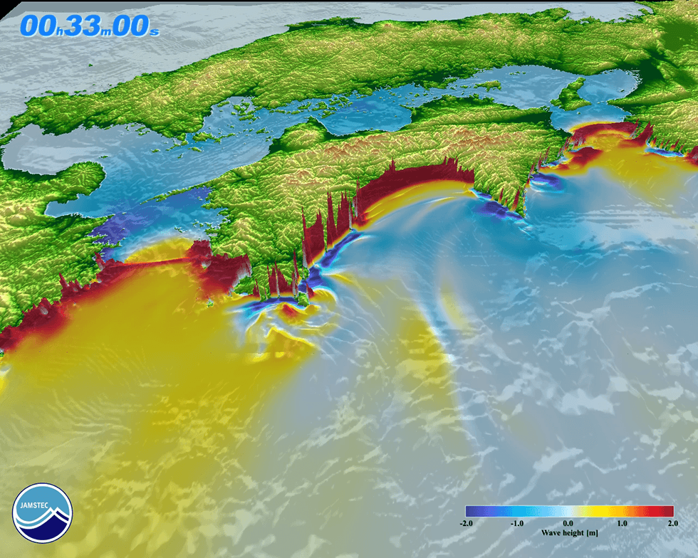
As a disaster risk, we will focus on great earthquakes and resultant tsunamis in subduction zones. We will develop a method for monitoring the earthquake preparation state (interplate coupling and sliding) with subsurface structural information and information of past disasters. We also will develop methods to examine possible scenarios of megathrust earthquakes and resultant tsunamis and forecast spatio-temporal variation in interplate coupling and sliding based on these monitoring results.
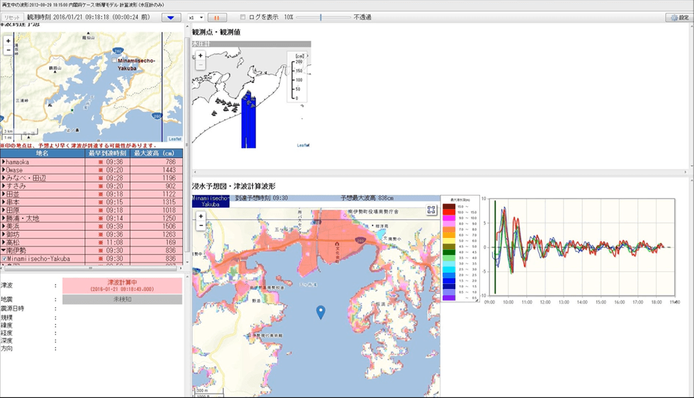
The "" Tsunami inundation early warning system"" can predict not only the arrival time and the height of the tsunami but also the inundation area when a tsunami occurs by utilizing real-time observational data of a cabled observation system termed the Dense Oceanfloor Network system for Earthquakes and Tsunamis (DONET). It is already in operation in some local governments and it is also used for forecasting work.
JAMSTEC has completed clarification of faults around Nansei Island and the Izu-Ogasawara islands in the Sea of Japan. We are currently working on the interpretation of the subsurface structure and fault distribution in the Nankai Trough area, and intend to construct an online database system to offer information on well-integrated offshore faults around Japan, related data, and interpreted results.
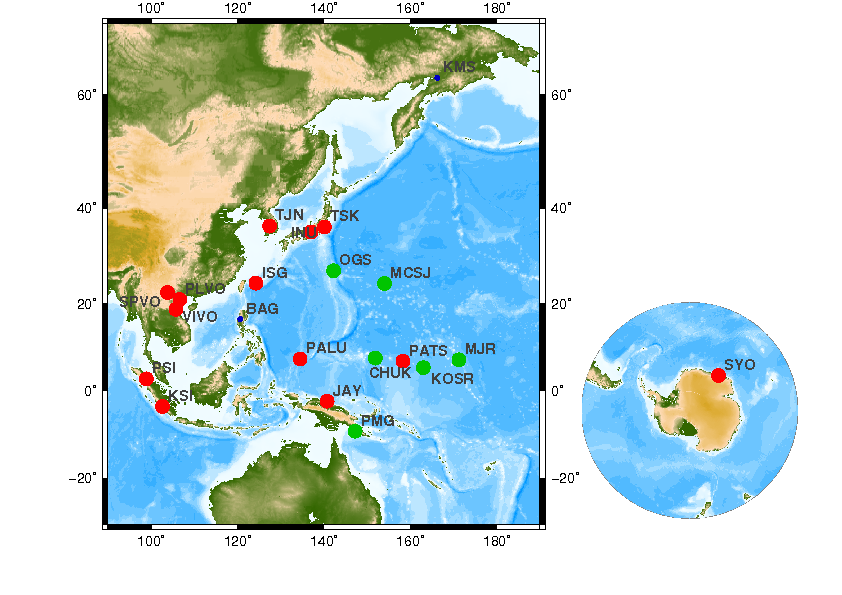
We operate a seismic network in the Pacific and Southeast Asia that continuously provides data and contributes as part of a global network association of seismic monitoring organizations. Our network has also functioned as a hub of data communication to promote mutual data exchange for each national seismic network.
Research Institute for Marine Geodynamics (IMG)
Subduction Dynamics Research Center (SDR)
Research Institute for Marine Geodynamics (IMG)
Research and Development Center for Earthquake and Tsunami Forecasting (FEAT)