


Better Luck This TimeJuly 16, 2012
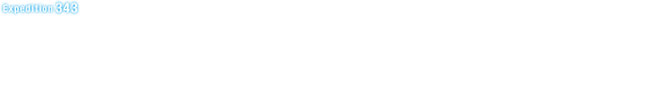
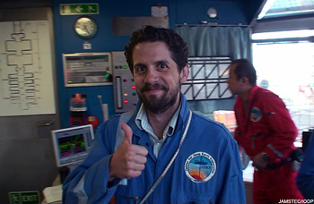
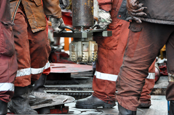
Everyone was elated and relieved when the temperature observatory was successfully installed on Monday evening, completing one of the main objectives of JFAST. In about a week's time of Expedition 343T ('T' for technical) we were able to drill the borehole to 855 meters below seafloor and install the temperature sensors across the plate boundary - something that we could not accomplish in over 50 days of operation a few months ago.
"Everything in life is luck"
Donald Trump
"In my experience, there's no such thing as luck"
Obi-Wan Kenobi, in Star Wars by George Lucas.
There are many steps in the deployment of the observatory, such as preparation of the underwater camera system, running the long pipe to the ocean floor, setting the wellhead, borehole re-entries, underwater instrument releases, borehole drilling, casing installation, temperature instrument programming. During the original expedition last April and May, it seemed at almost every step of the way there was some problem or delay. Also there were many concerns about operations in nearly 7000 meters of water, for which Chikyu and other IODP platforms had no experience. This time in July, things were quite different and each procedure went surprisingly smoothly. The reasons are better weather, gained technical experience from the previous attempts, and a lot of good luck.
"Luck can only get you so far"
Hermione Granger, in Harry Potter and the Half-Blood Prince by J. K. Rowling.
"The winds and waves are always on the side of the ablest navigators"
Edward Gibbon
Experience helps. Detailed knowledge of the actual drilling conditions and instrument performance, which are gained from experience, contribute immensely to success. Actually, CDEX engineers know this and told me so last year. At the time, they felt that all the technical challenges of the project could be met, it was just a matter of how many tries it would take and if there was enough time. We were very fortunate on this project that additional expedition days were provided so that we had the opportunity to try again. Also, it is a great credit to the drilling engineers and planning staff at CDEX that they were able to solve the many problems. Finally, luck often swings the balance between failure and success and we got lucky this time (I am getting more superstitious for these kinds of things).
"Those who have succeeded at anything and don't mention luck are kidding themselves"
Larry King
The deployment of the temperature sensors has been an exciting technical accomplishment, but the real scientific results come when we see the recorded data. The next challenge will be in several months when we try to extract the instrument string from the borehole, using a remotely operated vehicle (ROV) in the very deep water. These data should help us understand the huge amount of slip that occurred in the 2011 Tohoku earthquake.
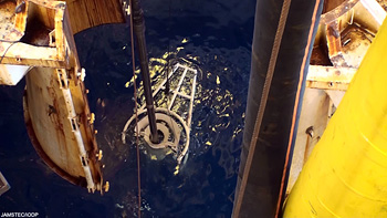
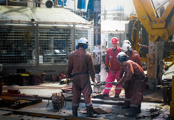
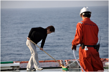
Release of the instrument string from the drill pipe, which was the final step of the temperature observatory installation at 18:15 on July 16 (photo by Patrick Fulton).
More photos from the expedition at
http://www.jamstec.go.jp/chikyu/e/exp343/gallery.html

Drilling through the Japan Earthquake faultJuly 13, 2012
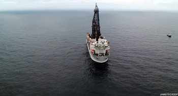
Drilling began out here on the JFAST2 expedition after successfully reentering the wellhead on the seafloor 6926 meters below the ship on the edge of the Japan Trench. The goal: to drill ~850 m below the seafloor across the plate boundary and through the fault that slipped more than 50 m at this location during the March 2011 Tohoku earthquake causing the enormous tsunami. We will then try installing a temperature observatory down into the hole to measure the remaining frictional heat across the fault.
Instead of using the standard top-drive drilling system on the ship to rotate the entire drill stem and create the torque on the drill bit 7 - 8 km below, as in the previous drilling at the site, this time we used a mud-motor located just above the bit to create the torque at the bit. The mud-motor causes rotation of the bit from pumping drilling mud (in our case the mud is actually sea-water) through the motor and out of the jets at the bit (see video above). Drilling with the mud motor has been incredibly effective and we quickly reached our target depth. We could see from the drilling parameters measured on board that when we started to drill through a hard chert we had previously encountered, confirming that we had successfully crossed the plate boundary fault and well into the down-going Pacific Plate.
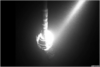
The great water depth here is much deeper than conventional wells, and the total depth drilled for the observatory joins our other holes as part of JFAST project in being the deepest below the sea ever drilled for scientific ocean drilling. Our TD (total depth), as shown by the driller’s console in the picture below: 7780.81 meters below the ship’s rig floor!
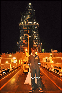
Lastly, here I am in the picture below, happy for the great depth we were able to obtain. The depth of this deep borehole will provide space for us to install the observatory that will include temperature sensors that straddle the fault zone.
Next, the hole will be cleaned out and the all the drill pipe returned to the surface. We can then start assembling the observatory and lowering it down to the seafloor for the final, most difficult task of carefully installing it all the way down into the hole.
Wellhead reentry deep within the Japan Trench ? like threading a needle 7 km awayJuly 12, 2012
The goal we are working towards on the JFAST2 expedition is to install an observatory of temperature sensors across the fault zone that slipped more than 50 m during the March 2011 Tohoku Earthquake. The temperature sensors will allow us to measure the frictional heat and determine the strength of the fault. To accomplish a critical step of the installation, we must first find the wellhead we installed last May on the seafloor 7 km below the ship, reenter it with the drill bit, and then drill down ~850 m through the plate boundary fault.
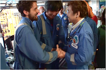
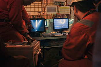
The only way we are able to reenter the wellhead on the seafloor, which will allow us to install the observatory into hole after drilling across the fault, is by finding it with an underwater television camera system (UWTV), slowly moving the 8.5 inch drill bit above the 20 inch opening, and then lowering to pipe down into it. An added challenge is that only way to move the drill bit towards and above and well head opening is slowly moving the ship a few meters at a time and then waiting for the 7 km long string of drill pipe to swing beneath us.
Once we were positioned above the GPS location of the wellhead, we slowly lowered pipe down the nearly 7 km below our drilling ship, Chikyu, one 40 m stand at a time. We then attached the UWTV around the drill pipe and lowered it down (see photograph) to just above the drill bit. Last May, the stress of raising and lowering the fiberoptic cable connecting the UWTV to the ship in such deep water created some damage to the cable, and prevented us from seeing anything or installing the observatory. Now, at the start of this expedition, the cable was repaired and we attempted using it at depth again for the first time.
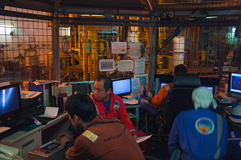
It was a long, tense night in the Doghouse (the small enclosure on the rig floor shown in the photograph) trying to find and position ourselves above the wellhead and wondering whether the UWTV would work okay. Luckily things went well, we found the wellhead with the help of the cameras and a small sonar device on the UWTV, and successfully reentered the hole.
The next critical step is to recover the UWTV, and then drill about 850 m through the fault zone and into the subducting plate below...
Return to the Japan Trench ? JFAST 2July 9, 2012
Greetings from the scientific deep sea drilling vessel Chikyu and the second part of the Japan Trench Fast Drilling Project: JFAST2 - IODP Expedition 343T. The focus of the JFAST project has been to quickly drill into and study the fault that slipped more than 50 m at shallow depths during the March 2011 M9.0 Tohoku Earthquake and caused the devastating tsunami.
In April and May, we (an international team of ~30 shipboard scientists along with a number of engineers, ship/drilling crew, and onshore support) successfully drilled across the plate boundary fault at ~820 m (0.5 miles) below the seafloor in water depth nearly 7 km (4.3 miles) deep. This ended up being the deepest below sea level any scientific ocean drilling project has ever gone. We actually did it twice! - the first time we used logging tools to map the geology as we drilled allowing us to pinpoint the fault, we then drilled another hole and collected spectacular core samples through the fault zone. The analysis of the rocks and data are already providing important insight into the mechanics of large earthquakes and tsunamis and will undoubtedly continue to be fruitful for many years to come.
Now I have returned to Chikyu to help undertake the other main goal of the JFAST project, to install a subsurface observatory that will measure the frictional heat signal remaining from the Tohoku earthquake. By measuring the extra heat across the fault at depth we can back out how much frictional resistance the fault had during the earthquake and possibly gain insight into why it slipped more than 50 m at our study location.
Together with the other JFAST analyses this unique and important data will not only help us understand the fault and earthquake here, but may also help us understand the potential hazards at other large faults like the Cascadia subduction zone fault off the Pacific Northwest of the United States and British Columbia, Canada.
During the first JFAST expedition, we had many technical problems associated with trying to drill in such deep water for the first time and many delays from weather that prevented us from installing an observatory in the time window we had. We now have been fortunate enough to be given the opportunity to return for one last try.
After flying on board Chikyu by helicopter and transiting North for a couple days, we are now on site and starting to lower pipe down to the seafloor. We plan to then drill across the plate boundary fault once again and then install our observatory of subsurface temperature sensors in the remaining hole. There are many unique challenges with installing such an observatory and with drilling in such deep water depths, but we are all ready and excited to try our best on this difficult mission so we can continue to learn as much as we can from the devastating Tohoku earthquake.
Stay tuned . . . more to come shortly.

Preparing for coreMay 16, 2012
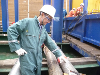
The expedition is now gearing up to retrieve core samples from the interval of rocks that surround the plate boundary fault surface at the Japan Trench. Core samples will be retrieved from an approximately 200m long interval at a depth of almost 8km below sea level. These will become some of the deepest core samples retrieved by the Scientific Ocean Drilling Program. The coring process is like sticking a straw into a bowl of Jello, and then pulling up the bit of Jello stuck in the middle (the rock core). To think of the process at a scale comparable to the drilling operations here, however, you would have to imagine standing on the roof of the Empire State Building with a straw that extends down to street level.
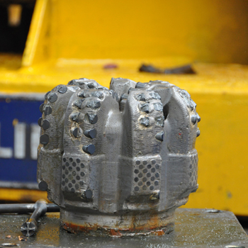
To retrieve the core, about 8 km of drill pipe are assembled and lowered from the rig floor to the sea floor. The pipe has a drill bit attached at the tip that has a hollow center, where the core sample is preserved. The drill bit will advance through the rock until a ~10m interval has been sampled. This core remains in the core barrel inside the drill pipe until it is brought back to the surface by a wire line.
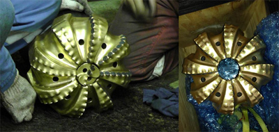
< There are many different types of drill bits for coring. Here is the kind that we are now using for the Chikyu drilling. The hollow tube in the center is where the core is preserved >
Once the cores arrive on deck, the samples will be measured, catalogued, cut into 1.5m sections, and split in half lengthwise. The core is described visually for sedimentologic, mineralogic, and structural components, as well as drilling induced damage. Samples are taken from the core to determine the physical and chemical properties of the rocks, and for study of microbiologic activity. Many of these samples will be analyzed in ship-board laboratories for properties that include electrical resistivity, porosity, moisture content, chemistry of pore waters, paleomagnetism, Hydrogen and Methane content, and thermal conductivity. Many additional samples will be sent back with the scientists to their respective labs for continued experiments and analyses after the cruise.
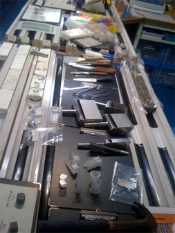
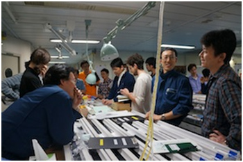
All the core sampling tools were laid out on the work bench as the scientists were trained in sampling methods
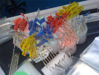
Small flags are placed to mark the location in the core where samples are taken. Each flag has a code for the type of sample
Analysis of the core requires the expertise of a wide range of scientists and laboratory technicians. All of the core data will be logged in IODP reports that become publicly available (you can see past reports at http://www.iodp.org/scientific-publications/). These data will provide invaluable information about the physical properties of the rocks in and around the fault zone and the processes that lead to the occurrence of large magnitude earthquakes.

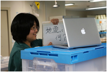
高校生との船上ライブ授業!May 12, 2012
みなさん、こんにちは。わたしは東北大学で研究(理学)を多くの方に紹介するためのアウトリーチ担当として働いています。そしてわたしは、火山の研究をしていた経験も持っており、地学はなじみの深い研究分野でもあります。そんなこともあり、昨年の3月13日に東北地域の高校生とその保護者の方々約20名と一緒に、八戸港に停泊中だった「ちきゅう」船内を見学する予定でした。しかし、それは実現できませんでした。
2011年3月11日、わたしは仙台市にある大学の職場で同僚と電話をしていました。地震の揺れはじめは、2日前に起きた大きな地震と同じだと思いましたが、揺れが変わっていくことに気づき、「大きそうですね。いったん切りましょう。」と受話器を置いた途端に、大きい揺れにおそわれ、急いで机の下に潜りました。
しばらく電灯はついたまま、途中おそらく瞬間停電3回、そして、その後に完全に停電。揺れが収まりかけたときに、2度ほど携帯電話をかけようとしましたが、また揺れが大きくなり切ったこと、揺れている間も本棚越しに友人と声をかわしていたこと、揺れの途中「また大きくなった」「(地震)いくつおこるの?」「(揺れの)向きが変わった!」と叫んだこと(「実況聞きながら地震を体験した。」とは友人談。)「東海・東南海・南海」の連動地震の地図が頭に浮かび、東北に重ね合わせていたこと、そんな記憶が残っています。
長い揺れがおさまり、それでも余震が次々起きる中で建物から退避しながら気になったのは、市街地の火事でした。遠く海の方に黒い煙をみましたが、見渡した市街地には煙がなかったので、つかの間、ひと安心しました。しかし、退避場所で、近くにいた方が携帯電話の動画ニュースを見ながら、「津波3m、6m、10m」の声をあげました。思わず「予報ですか?到達ですか?」と聞き返していました。かえってきた答えは「到達です。」というものでした。
そのとき、自分が津波のことを失念していたことに気づくとともに、とんでもないことが起こったという思いと、当面の家族の生活をどうするかという妙に冷静な考えと、一方で、何が起こっているのか、とにかく知りたいという感情が、どっと押し寄せてきました。
震災からのこの1年あまり、地震や津波について「知りたい」という声が聞こえると、自分の「知りたい」という感情とも重なり、協力くださる研究者に声をかけつつ、大学としてできる限り伝える機会を作ってきました。そんな中、「ちきゅう」による震源域の掘削の計画が聞こえてきました。一方で、「ちきゅう」のこのミッションを、震災を経験した高校生にこそ伝えたいという「ちきゅう」関係者の思いがあり、そして、同じように震災を経験した人と一緒に取り組んではどうだろうという意見があがり、そして、今回、私がその講義を行う機会を得ました。
私の「ちきゅう」への乗船は約1週間でした。すでに海上で掘削調査中の「ちきゅう」にはヘリコプターで向かうしかありません。あいにく天候が悪く乗船が数日遅れましたが、乗船期間中に衛星回線を通じた船上ライブ授業を宮城県と福島県の1校ずつと取組むことができました。
これも何かの縁、「ちきゅう」への乗船計画を立てる前から、高校生の課題研究のテーマの一つとして、震災に向き合い、そしてわたし久利と意見交換の機会のあった、古川黎明高校と福島高校と取り組むことになりました。両校とも大変興味を持ってくださり、実施に向けて、すぐに動き始めてくださいました。(授業でのネット中継も初めての経験とのことで、その練習から始めていただきました!)
ネット中継による講義は私にとってもはじめての体験。内心、どうなるかと不安も抱えつつ望んだ古川黎明高校のみなさんとのモニター越しの顔合わせ。お互い緊張していました。
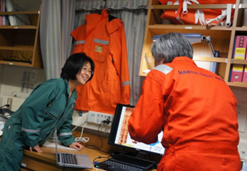
船外にて櫓を背景に自己紹介&スタッフ紹介し、船内研究を紹介(X線CTスキャン、コア半裁室、古地磁気分析、カメラ、観察スペース)、それに乗船研究チームの林博士から、地層の電気の流れやすさについて掘削孔内をぐるりと360度測定することで、地層の力のかかり具体が分析できるという研究を紹介いただき、最後に生徒のみなさんからたくさんの質問をいただきました。
「船上生活は?」(やっぱり気になるよね。)「宮城県沖地震はまたおこるの?」(みんな不安だよね。)授業が終わり、ほっとしたと同時に、あれを伝えればよかった、これも伝えたかったとの思いでいっぱいでした。下船後の学校への出前授業を待っていてくださいね。
そして迎える2回目の授業は、福島高校と。事前に質問が届いていたこともあり、少し順序をかえ、質問の多かった断層の摩擦熱についての講義を、これまた乗船研究チームの林博士から紹介していただきました。
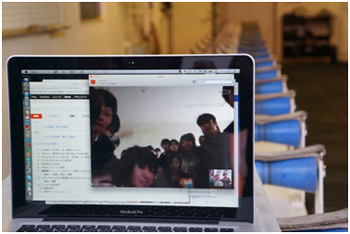
授業では質問が次々に!「コアサンプルってどんな形?」(すかさず見本を見せる。)「古地磁気測定で何がわかるの?」(さっきタオ博士が研究室を見せてくれたばかりだから気になるよね。)「ドリルで掘るときはどれくらい力がいるの?」(掘り方から説明しなきゃ!)「どれくらい固いの?」(けっこう本質的!)「サンプルをとったらどんな分析をするの?そして何がわかるの?」(船上にはたくさん研究室があったものね。今度ゆっくり説明するね。)、「断層の割れと掘削による割れは見分けがつくの?」(するどい!そのための専門家集団。)
などなど、うれしい悲鳴を上げつつ、「ちきゅう」スタッフに時間延長をお願いしつつ、高校生の皆さんと時間を共有しました。最後に、高校生の皆さんがモニターにかけよってバイバイと手を振ってくださったのがとても印象的でした。
船の上では、調査のために次々に作業が行われています。邪魔にならないよう相談しつつ、作業の様子や掘削のための施設などもたくさん写真を撮らせていただきました。船上には、研究者だけでなく、研究を円滑に進めるためのスタッフ、ドリラー(掘削のスペシャリスト)、看護師さんなども働いています。そんな方々にもインタビューをお願いし、高校生へのメッセージをお預かりしてきました。下船後の出前授業で紹介したいと思います。
この地震は多くの人の生活をおびやかす大変なことでした。それでも、いえ、それだからこそ、何が起きたのかを調査すること、それもできる限りはやく調査してデータやサンプルを得ることは、研究者がやらなくてはいけないことです。その現場を、私は直接目にする機会を得ました。船上からのライブ講義は2校のみでしたが、下船後の出前講義はそれ以外にもたくさん足を運びたいと思います。そして、少しでも多くの人に伝えていきたいと思っています。

「生命は地震から生まれた!」仮説に挑むMay 11, 2012
<その1 「ちきゅう」に紛れ込んだワタクシ>
*本レポートは、Webナショジオにて連載中の「青春を深海に賭けて」 からの転載です。
もちろん今回のタイトルも相変わらず適当なパクリ仕様で申し訳ないのですが、フランソワーズ・サガンの小説「悲しみよこんにちは」から寸借しました。決して、元祖不思議ちゃん系アイドル斉藤由貴のシングル曲からの着想ではない(キリッ)、と力強く宣言しても、もしかして「誰それ?何それ?」と言う若い人が大半だったりして。
逆に「あー、あった、あった、そんな曲」という読者が多い場合、この連載企画の「若い人にぜひ読んで欲しい」という儚い夢はもはや完全に崩壊したことになるでしょう。そんなことは知らない方が幸せです。みなさん知らないふりをしておいてください。
さて、今話がウェブに掲載される頃、ワタクシは「巨大屋形船」とも言われる「地球深部掘削船ちきゅう」に乗り込み、「統合国際深海掘削計画(IODP)第343次研究航海東北地方太平洋沖地震調査掘削」(漢字だらけの水泳大会、もとい正式名称ですみません)の特殊工作員として活動しているはずです。
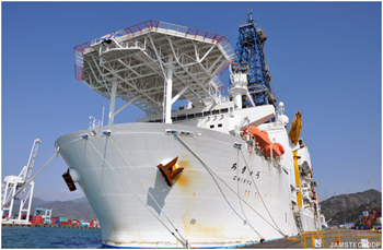
掘削調査航海に出航する前の地球深部探査船「ちきゅう」
この掘削調査航海の全貌は、日々更新されるJAMSTECのホームページでご覧になれます。興味のある方はぜひ覗いてみてください。
またWebナショジオのサイトでも、ついに「ちきゅうつぶやき編集長」による掘削調査航海の現場レポ企画が始まったようですね( 深海7000メートル! 東日本大震災の震源断層掘削をミタ! )。第53次南極観測隊員、渡辺佑基さんと田邊優貴子さんによる「南極なう!」のように臨場感溢れるナショジオらしい透明感のあるレポートと勘違いして、みなさんがうっかりクリックすることを大いに期待しています(笑)。
この航海の研究目的を簡単に要約すると、ワタクシの連載の特別番外編「しんかい6500、震源域に潜る」でも触れたように、「2011年3月11日に起きた東北地方太平洋沖地震がどのようにして起きたのかを明らかにすること」に尽きます。
もちろん東北地方太平洋沖地震が起きてからこれまで、日本はもとより世界中の研究者が、多くの調査や解析を通じて、どのようにしてあの地震が起きたのかについて明らかにしようとしてきました。しかし、地震の全貌を一気に理解することは現在の科学技術をもってしても未だにとても難しく、少しずつ前進するしかありません。
できるだけ速やかに、かつ継続的に最大限の努力を続けて行く必要があります。その一つの前進が今回の掘削調査研究なのです。
一般的に、あの甚大な被害をもたらした東北地方太平洋沖地震は、「1000年に1度と言われるその規模(モーメントマグニチュード9)」に焦点が当てられることが多いようです。しかし地震のマグニチュードというのは実は奥が深くて、厳密に区別するとなんと40種類以上あるらしいです。だからシロートのワタクシ、あまり深入りはしませんです。
しかし東北地方太平洋沖地震の被害の大きさと特異性のポイントは、その発生エネルギーの全体の大きさ(マグニチュード9という大きさ)ではなく、地震によって極めて短い時間に地殻(東北地方や北海道が根ざしている板のようなモノ=北米プレート)が動いた量(水平・鉛直方向の距離の掛け算)が尋常ではなかった点、であることが分かってきました。
巨大な地震を発生させることの多い海溝型地震は、沈み込む海洋地殻(海側プレート)とその沈み込むプレートに向き合って摩擦で引きずり込まれるもう一つの大陸地殻(陸側プレート)の境界=海溝で起こります(用語は必ずしも厳密ではありません)。摩擦によって引きずり込まれる力に対して、陸側プレートが元に戻ろうとする力が上回った時、実際に陸側プレートが刹那的に大きく跳ね返ることによって地震が起きます。
シロートのワタクシの説明なので、科学的厳密さは怪しい限りですが、陸側プレートが跳ね返る刹那のいわば「銃による弾丸発射における撃鉄と雷管」のエネルギー量がマグニチュードだとして、地震によって陸側プレートが動いた実際の量、これもいわば「実際弾丸が飛ぶ距離」と言っていいでしょう、は、「だいたい比例するけれども、銃によって大きく変わる」、というところが重要です。
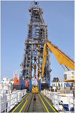
「ちきゅう」船上にそびえる掘削やぐら「デリック」
もしかすると余計にややこしい説明だったかもしれぬ(笑)。再チャレンジします。いろいろな岩をハンマーでぶっ叩いた時、ぶっ叩く力(エネルギー)が全く同じだとしても、実際の岩の破壊の様子や度合いはかなり違っていると言った方がわかりやすいかもしれません。この実際の様子が違うというところがポイント。
そして東北地方太平洋沖地震では、「押し込まれていた日本海溝の陸側のプレート=北米プレート全体が太平洋プレートの上面をものすごい移動量(例えば水平距離で50m、鉛直方向に10m以上)で滑った(滑り過ぎたとも言われています)」こと、そしてその北米プレートの滑り移動量が甚大な被害をもたらした津波の発生原因となったこと、が実際の調査で明らかになってきました。
なぜ北米プレートがそんな大きく太平洋プレートの上面を滑ったのか。それは誰にも分かりません。滑ったところを直接見た人はいないからです。
それを実際に滑ったプレート境界(滑り面)まで掘削して、本当に滑った物理的証拠を得ること、そして実際に滑った現場の岩石試料を採取して明らかにしようとすること、がこの航海の第一目標です。
そんなガチガチの地震発生メカニズム解明航海に、微生物愛好家であり地震シロートのワタクシがなぜか紛れ込んでいること。その理由が今話のマクラなのです。
<その2 「生命は地震から生まれた!」仮説に挑む>
「北米プレートが太平洋プレートの上面を一気に滑ったのだ」と頭の中で想像してみてください。プレートは基本的にはでこぼこザラザラの岩石でできていますので、滑ったプレートとプレートの境界はグガガッ、ゴッゴッという音が聞こえてきそうな激しい摩擦があった、そんなイメージが浮かぶでしょう。
そんなに激しく岩石がこすれたら、こすれた部分はそりゃもう火照っちゃう単純に摩擦熱でアッチアッチになりそうです。実際にそのように予想されており、その摩擦による温度上昇を直接測ることが今回の航海の最大の目標です。
その温度上昇を実測し、こすれた部分の岩石がどのような岩石だったかがわかると、実際のプレートの滑り方が俄然はっきりとわかるようになるというのがこの航海にとっての「幸せのレシピ」です。
ちきゅうの微生物ラボでコアから水素を測定するシミュレーションでニヤニヤするワタクシ。
摩擦で発生するのはもちろん熱だけではありません。みなさんが摩擦で発生する熱以外のモノと言われてすぐ思いつくのはアレ、「静電気バチバチ」ではないでしょうか。
(引用)
静電気バチバチ―――古代ギリシアに現れた記録に残る最古の哲学者タレスによって紀元前600年頃に発見されたと言われる物理現象。タレスはなけなしのお小遣いで買った「横浜銀蝿」や「なめ猫」が描かれたセルロイドで出来た安っぽい下敷きを、授業中髪の毛にこすりつけることで髪の毛を逆立たせる遊びを思いついた。ふだん小難しいことばかり言うネクラなタレスが女子にキャーキャー言ってもらえる唯一の芸であったと言われている。しかし好きな女の子のスカートをめくり上げる程の未知のパワーを秘めていることに気付き、その至福の行為を猛烈に妄想するあまり道端の溝に落ちて笑われたと言う逸話が残っている。
(民明書房「私が恋愛できない理由」より)
もしかして民明書房という有名な出版社をご存じない方もいらっしゃると思いますので、そういう方はぜひググってみてください。それでも「よくわからない」とおっしゃる方は、上記項目を完全に忘れてください。
ただし、摩擦によって生じる静電気は、「異なる物質で出来たモノをこする」ことと「こすったモノを引き離す」ことが必要なので、北米プレートと太平洋プレートの摩擦では静電気の発生は期待できません。
実は地震による岩石の摩擦によって、熱とか音といった物理的現象以外に、水素ガスのような化学物質が発生することが知られています。
ちきゅう船内の研究者ミーティングを度々サボるのを研究支援統括のノブに見つかりお灸を据えられるワタクシ(という設定で研究者ミーティングにて紹介されたが、実は単にブラッシング萌えなワタクシ)。
化学物質の発生がわかったきっかけは、1979年に兵庫県南部で起きた山崎断層群発地震でした。この群発地震の震源となった山崎断層で、周辺の土に含まれるガス成分を測定した研究チームがいました。東京大学理学部附属地殻化学実験施設の研究グループです。その結果、地震が起きる前に比べて、起きた後に土壌ガスの水素の濃度が異常に上昇していることを発見し、サイエンス誌に発表しました。
その後、同じ研究グループによって、「断層運動(ほぼ地震と言ってもいい)による岩石破壊によって岩石のケイ酸結合が切断され、ケイ酸ラジカルが形成されたあげく、ラジカル反応で水が分解されて水素ができるのだ」という学説が提唱されました。
反応の詳細はともかく、「岩石が破壊されると周りに存在する水から水素ができる」という現象がけっこう普通に起きている可能性が知られるようになったわけです。
その後、アメリカ合衆国カリフォルニア州南部から西部にかけて約1300kmにわたって続く巨大な断層=サンアンドレアス断層の地下でも、断層運動によって大量の水素が発生しているという観察結果が得られました。そして、地震と水素の密接な関係は、一部専門家の間では通好みのネタになりつつある状況でした。
しかし「どれぐらいの地震が起きればどれぐらいの量の水素が発生するのか」という定量的な研究結果がなかったので、地震学者と呼ばれる人たちには「ヘッ、地震水素なんて、所詮2軍だろ」的な扱いを受けていたと言っても過言ではありませんでした。
そんな「地震水素=2軍」説を覆したのが、JAMSTECの廣瀬丈洋、川口慎介、鈴木勝彦(敬称略)の3氏による男汁溢れる研究だったのです。
ちなみに廣瀬丈洋はとても爽やかです。あとの2人が男汁をほとばしらせているにすぎません。そして廣瀬丈洋によってJAMSTEC高知コア研究所に組み上げられた「お家で地震を作るマシーン」を用いて、岩石破壊だけでなく、岩石滑り(摩擦)によっても大量の水素が発生することが明らかになったのです。
その研究の最も画期的な点は、地震の規模(マグニチュードや実際の滑り量)と水素の発生量の間に定量性(相関)があることを突き止めたことです。こうして、ある規模の地震が起きたとするとその地震で発生した水素量を予想することができる(逆もしかり)という「地震水素、もしかして天才?」説が脚光を浴び始めたと言えるでしょう。スバリそうでしょう。
そして「水素こそ暗黒生命にとって至高のエネルギー」を唱えるワタクシが、このようなおいしいネタをずっと指をくわえて傍観していたはずがあろうか。いやない(反語)。
いずれこの連載でもクライマックスシーンとして描かれるはずですが、ワタクシの研究グループの一つの研究成果に、「約40億年前、地球最古の持続的生態系は大量の水素を含む熱水で誕生した」とするウルトラエッチキューブリンケージ仮説の完成があります。これは、コマチアイトという太古の火成岩が大量の至高のエネルギー=水素の発生源となったことを意味する仮説です。
そのウルトラエッチキューブリンケージ仮説に至るストーリーや背景が描かれた力作「生命はなぜ生まれたのか――地球生物の起源の謎に迫る」(幻冬舎新書)(←コレは言うまでもなく実在する出版社です。念のため)があります。
実はその本の最後に「大量の水素は約40億年前の地球の地震によって供給された」とする新仮説が紹介されていた驚愕の事実があったのだ!と、息巻いてみても、多分著者であるワタクシ以外誰も知らないでしょう(涙)。
つまりワタクシの研究グループには、ウルトラエッチキューブリンケージ仮説に対するサイズエッチキューブリンケージ仮説(サイズはSeismicity=地震の略)なる対抗馬が存在していたのです。「生命は地震から生まれた!」。東スポ的見出しをつけるとすればそうなるでしょう。その可能性をいよいよたぎらせることになったのが、廣瀬達による男汁地震水素実験の成果だったのです。
しかし、サイズエッチキューブリンケージ仮説提唱の大きな関門として、いまの地球に地震水素によって支えられた海底下深部微生物生態系(いわばサイ・スライム)がちゃんと存在していることを示すことが必要なのです。
ガチガチの地震発生メカニズム解明航海に、微生物学者のワタクシがなぜか紛れ込んでいるその理由。それは、東北地方太平洋沖地震の尋常ならざるプレート滑りによって発生したに違いない超大量の水素の直接的証拠を得ること。そしてその地震水素に活性化されたに違いない海底下深部微生物生態系(サイ・スライム)の存在を証明すること。それらのミッションを成し遂げるためと言えるのです。
実は、このミッションは極秘任務でも何でもなく、正式な統合国際深海掘削計画(IODP)第343次航海研究計画に記されている第二研究目標です。なので、ワタクシがこの任務を明らかにしたからと言って、「ちきゅう」からつまみ出されることは勿論ありません。
しかし、28名も研究者が乗船していながらたった一人、ワタクシだけがその任務を負っているという寂しさから、つい気合いが入りすぎて長くなっちまったぜ。ふう。というわけで、この航海の表ミッションだけでなく、そんな裏ミッションの成果もぜひ楽しみにしていただけると嬉しいかなと思います。
ちきゅうの櫓とワタクシ。どーん。

On the wayMay 8, 2012
After we reached the new world record of scientific ocean drilling depth on 25th April, an unexpected technical trouble occurred on 6th May. The drilling pipe was broken in the C0019C hole near the wellhead and we lost a part of the borehole assembly, including the LWD and MWD tools. This news came more or less as a big shock for all of us. It seems the operating plan we made after thorough consideration last week is also broken.
Fig. 1. The ocean surface seems peaceful, but the drilling operation under the extremely deep (~7000 m) water is full of risks. Photo by Tao Yang.
Even though disappointed, we need to calm down and take rapid response to this terrible setback. In the first 24 hours following the occurrence of the trouble, co-chiefs and EPM did very impressive works for the rearrangement of our operating plan. A detailed new schedule, including the risk assessment, was provided and discussed seriously by all science party members in the afternoon meeting on 7th May. Finally, we came to the consensus that even though this plan is risky, we are still going to carry it, considering both the chances of coring and deployment of MTL observatory are remained. We chose it also because even if we meet another technical trouble, the coring will still be on the table and we would still be able to get samples from the deep. This choice is a fortune for science, since we still remain the very precious opportunity to know the frictional temperature anomaly of the large amount slip of the 2011 Tohoku earthquake.
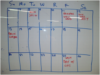
Fig. 2. The white board after the afternoon meeting on 7th May; this brief form, drawn by EPM Sean Toczko, saw our intense discussion about the contingency plan. A lot of things, which we hope are good, will happen in the next three weeks.
I gradually realize that it is the best time to test our group when we meet troubles and difficulties. It is the best time for us to display our strong resolution and recollected decision when we face setbacks. It is the best time for us to be cheered by our scientific willingness and remain positive and hopeful when the thing is not going smoothly. This time, I really feel the strong power supporting the entire group. I believe this power comes from all of us and will carry us to the success of the expedition.
Science is always on the way, and so are us. There might be failures on this way, but we will never give up trying to know the truth and we will never lose our science dream. Any steps on this way, no matter happiness or sadness, will be enjoyed by us. When we look back to this way in the future, we will appreciate all the efforts we made.
Best wishes for JFAST!

Hard workMay 5, 2012
Last week we made headlines around the world when Chikyu’s drill string reached a new record length for ocean scientific drilling: a total of 7768.5 m measured from the rig floor (7740 m below sea level). OK, maybe “headlines” is stretching it but within the scientific drilling community, this was big news! Credit for this record goes to the hard work and ingenuity of the engineers, drillers and crew of D/V Chikyu. Here in the scientists’ library, we were celebrating their achievement by getting to work on the Logging-While-Drilling data that were collected. This was the first look at the fault we came to study, and the first indication of what kind of rocks we would encounter, and the first test of borehole stability in this deep environment.
New drill bit is assembled to the drill pipe on the rig floor. Photo by Tadashi Yoshizawa.
We poured over the data as it came in ? low resolution in real-time, and after the hole was complete and the instruments were back on board. The logging engineers downloaded the data from the instrument memory ? detailed images of the borehole walls, and long wiggly lines which showed the sediment and rock properties. For me, a field geologist, it was my first time seeing this type of data. I tried to imagine what the rocks would look like in an outcrop, or feel like in my hand, and what small features I could see with my hand lens if I had a sample to examine. There were some clues which the logging scientists helped me learn how to read in the data: fracture patterns, the subtle traces of sedimentary bedding. Most exciting were the points in the data which showed big changes in rock type down the hole: the transition from silica-rich sediments to a layer of clay, for example. I hope soon we will recover some core and I will get to find out if my imagined samples are anything like the real thing.
One of the old assumptions we are testing on this mission is whether the deep water sediments that make up the hanging wall of a subduction thrust fault are very soft and weak (and just get pushed around by earthquake slip in the stronger rocks at deeper depths in the fault) or whether they are strong enough to release some elastic energy themselves. We won’t be able to answer this until we have the sediment samples in hand, sometime in a week or two. But in case you’re wondering, this is what 856m of drilling will do to a new drill bit:
After the drilling, damage to the microdiamond-bearing drill teeth.
This probably happened when drilling through hard chert! Photo by Tadashi Yoshizawa.

ターゲットを見つけろ!May 1, 2012
この航海が始まって一月近く経過しましたが、ようやく嬉しいニュースをお届けすることができます。4月24日未明から開始された掘削同時検層(LWD)は順調に進み、4月25日夜半までに目標とする地層を(たぶん)貫通!海底下856mで掘削を完了し、本航海2回目のチャレンジとなる深海掘削は、なんとか無事成功しました。そして、この掘削孔で海洋科学掘削における掘削パイプ長の世界記録(7768.5 m、海面からだと7740m!)まで樹立しました。
私は、この航海では、海底下の地層の特徴を物理データとして計測する掘削同時検層(LWD)の専門家として、またそのデータを用いた分析によりミッションを成功に導くため、科学者サイドと掘削や計測専門会社の技術サイドとの橋渡し役としてプロジェクトに参加しています。50m もスリップした大断層を直接探ろうというのは世界初、そして7000mの深海底から1000m近く掘り進めるのも世界初の試みです。
ここで、この掘削孔で導入した「掘削同時検層」という技術について少し解説しておきましょう。掘削同時検層(英語ではLogging-While-Drilling [LWD]といいます)とは、文字通り、ドリルで掘りながら同時に検層(地層の計測)を行う手法です。各種計測センサー、バッテリー、発電機などが内蔵された直径約20cm、全長約30mの細長いハイテク機器群をドリルビットの直上に連結して深海底まで降ろし、掘削しながら孔の壁を計測します。
この航海の最初にLWDを実施するのはなぜかというと、このあと控えているコア試料の採取や掘削孔への温度計の投入を確実に行うため、地層の掘りやすさや掘削孔の安定性などを判定し、ターゲットの断層帯の深度、厚さ、物理特性を事前に特定する必要があるからです。
掘削同時検層ツールの一つ。装備された電極で孔壁をスキャンして孔内の画像を生成します。
我々がもっとも頼りにしているツールです。
LWDによる掘削中は、電気抵抗や自然ガンマ線などの計測データがツール内のメモリに記録されますが、それと同時に、今まさに掘っている深度の孔内情報を鉄管中の海水を介してパルス信号で船上まで送り(ココ、驚きのワザ!)、リアルタイムで伝送されてきます。
今回は、7000mという深海の、更にその奥から、はたして船上までシグナルが届くのか?という技術的な心配もありました。受信したデータは船内の大型モニターに表示され、技術者や研究者が24時間体制で張り付き、掘削孔の状況や地層の特性、そして「あの断層」がいつ現れるのかを常時監視します。
THE BIG DAY
4月25日午後9時過ぎ。ドリルビットが、最も重要な地層境界があるだろうと想定していた深度にさしかかり、そのリアルタイムデータが届くのを十数人の研究者とともに見守っていました。ところが、どうも予想通りの値を示さない、もしかしてシグナルがちゃんと届いていないのかも、いや、そもそも狙っていた地層境界がここにはなかったのかもしれない、マズイ!どうしようか・・・。
みんなが息をのみながら、2分間に一度表示されるデータを今か今かと見つめていた、その時!ついに地層の電気抵抗と自然ガンマ線を示す値が明らかな兆候を表示しました!
Wahoo!
研究室の興奮は最高潮に達し、まさに現場のサイエンスの醍醐味を感じた瞬間でした。そして、来る日も来る日もトラブルシューティングが続いた3週間におよぶ長いトンネルを抜け出し、ようやく航海成功への突破口が見えた瞬間でもありました。
その後、数時間で掘削を完了し、4月27日の午前、LWDは無事に日本海溝の海底下から船上に帰還。現在、船上研究者がLWDから回収された歴史的データの解析に着手したところです。
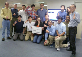
Hole C0019Bでの掘削を完了し、
この航海でようやく達成した最初の成功を喜び合うサイエンスパーティのメンバーたち。
斎藤実篤(前列右端)、ジム・モリ(首席研究員、前列右から2番目)
フレッド・チェスター(首席研究員、前列左端)
私は、これまでに数々の科学掘削航海に乗船してきましたが、今回の航海は、これまでとは少し違った思いで乗船しています。こんなにチャレンジングで、しかも日本中、そして世界中の期待を背負ったこの航海を成功に導くために、自分は今、船上で何ができるかを考える日々が続いています。
あの地震と津波はどうして起こったのか?1年前にそこで何が起こったのか?を明らかにするため、地震断層の直接観測を行い、今後の地震発生帯研究に生かしていくことが、地球科学・掘削科学に携わる研究者としてできる貢献です。
世界各国から集まった精鋭の研究者達、そして陸上から支援してくださる方々とともに知恵を絞り、技術的困難を乗り越え、最大限の科学成果を出し、巨大地震の解明に貢献するこの研究航海をなんとか成功させたい、出航した時の思いを新たにしました。航海は、後半戦に突入します。


