A site survey is a pre-drilling review of the proposed drill site to assess the safety of drilling operations. All available past survey reports and geological data, either from this site, or from nearby sites, are reviewed as part of this safety assessment. Seafloor bathymetry and water depths are checked for suitable drilling locations and sea floor hazards. Piston cores collected from the drill site are used for geotechnical analysis to make sure the seafloor is strong enough to support the heavy Blow Out Preventer (BOP). Multi-channel seismic reflection surveys are used to assess potential geological and drilling hazards such as fractures and possible gas reserves. Other operational risks, like historical records of weather and sea currents, and future predictions of the same, are also part of the risk assessment.
-
Survey purpose Survey methods Collect geological data Collect past survey reports and geological data. Seafloor map Multi narrow beam acoustic survey  produces a seafloor map from acoustic reflection waves.
Formation strength of the seafloor Piston core samples used to measure the strength of the seafloor formation.Geohazards Multi-channel seismic reflection survey which are used to interpret subsurface geology.Weather and metocean (Records of wind speed, typhoon, wave height, etc) Collect past records of weather and metocean data. Sea currents Collect past records of sea currents. Survey with mooring system and analyze data. Sea currents are measured during the cruise with laser doppler anemometer by Chikyu and by supply boat. -
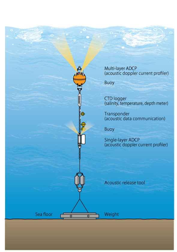
A schematic diagram of a typical data-sampling mooring system.The mooring system is fixed by a weight to the sea floor. A buoy supports the sensors in the water column. After the survey is complete, the system is recovered by releasing the anchor (via acoustic signal).
Mooring system survey data are available from JAMSTEC’s DARWIN data website
