"Heavy rain caused flood in Bengkulu"
Seven districts in Bengkulu were submerged by the flood during night on 22 to early morning on 23 November, local newspaper "Rakyat Bengkulu" reported on 24 November (Fig. 1, withdrawn).
Daily rainfall of 161.0 mm was observed at Giri Mulya Station, and 58.0 mm was observed at Bengkulu Meteorological Observatory for 22 November.
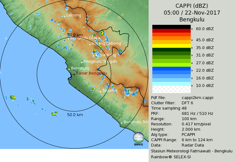
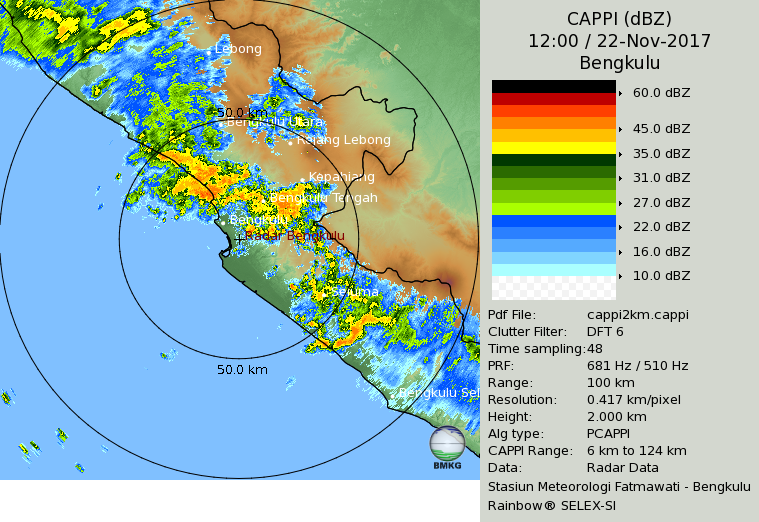
Radar observations showed that convection was initiated near noon over the mountainous areas of Sumatra Island (Fig. 2, 12 LT).
Later, the convection consolidated into cloud lines, orientated northwest-southeast along the slope of the mountains, with a southwestward migration.
As the storm lines developed further, the intensity of the radar reflectivity reached its maximum during 19-20 LT (Fig. 3, 19 LT).
During the daytime, the upslope winds driven by diurnal heating at the slope surface of the mountains on the island reinforce the sea breeze, with the result that a notable thermally induced local circulation develops on the western coast, which causes occurrences of convection over the mountains of the island in the afternoon.
Therefore, to elucidate the local circulations, the diurnal cycle of convection and their influence on precipitation in the region, further studies should be performed, using data from surface meteorological observations, radar observations, balloon soundings at intervals of three hours, and other data that obtained from the YMC field campaign. (Wu)


