"Bengkulu was hit by surface wind gust"
In the evening on January 5, 2018, Bengkulu was hit by a surface wind gust.
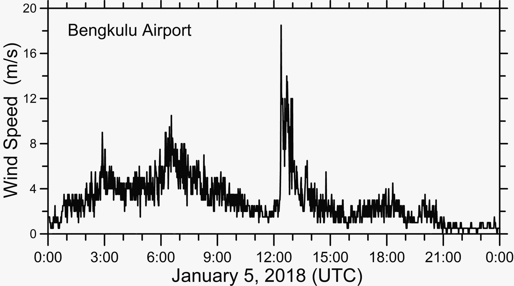
A sudden strong northwesterly wind occurred at 19:20 LT (12:20 UTC), and continued for about 30 minutes, with a maximum wind speed of 18.5 m/s (Fig.1).
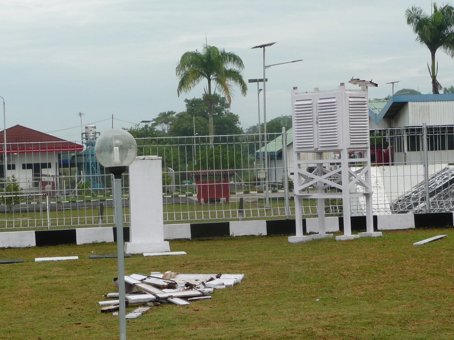
One of the ventilated case for meteorological instruments of BMKG was sadly crushed by the strong wind (Fig. 2).
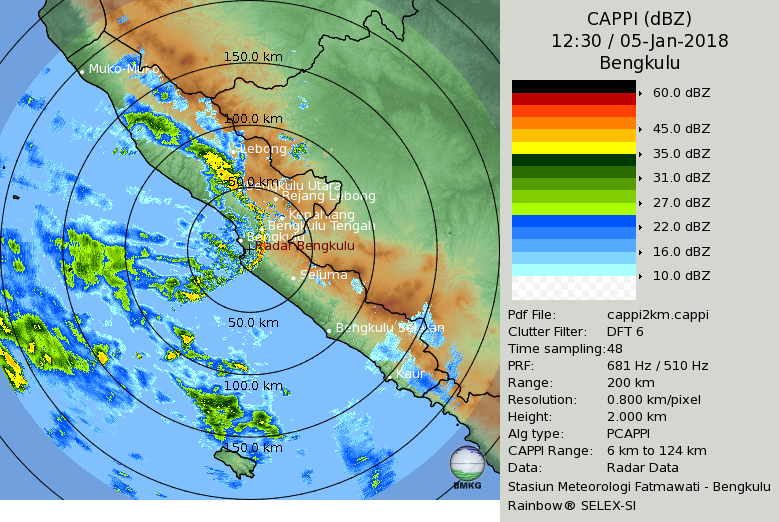
Radar observations showed that at 17:00 LT, a squall line which was orientated northeast-southwest over the sea to the northwest of Bengkulu moved southeastward, approaching to Bengkulu.
Then, at 19:20 LT, the squall line passed over Bengkulu Meteorological Observatory (Fig. 3, 19:30 LT), accompanied by the strong gust of wind.
Often, gusts of wind have large influence on landing and takeoff of airplanes.
Therefore, observation data obtained from the YMC field campaign are useful for study of the mechanism of surface wind gust formation, improving our knowledge and prediction of strong winds.
(Dyah, Dodi and Wu)


