|
|
|
Thursday, Nov. 30, 2017 : JAMSTEC/YES
"Cyclonic vortex simulated in NICAM"
In JAMSTEC, modeling team also joins the YMC Sumatra campaign.
Forecasts using a global nonhydrostatic model (Nonhydrostatic Icosahedral Atmospheric Model, NICAM; Satoh et al. 2014, PEPS) are conducted on daily basis.
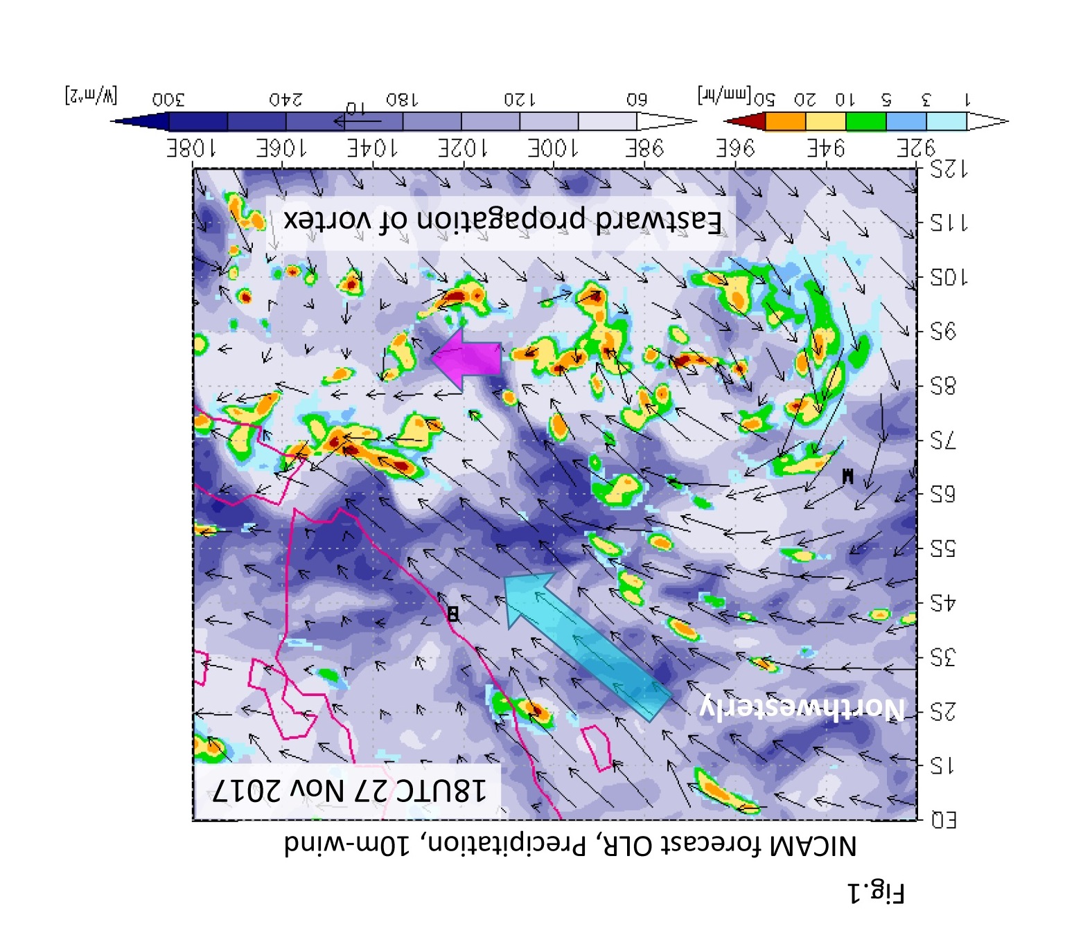
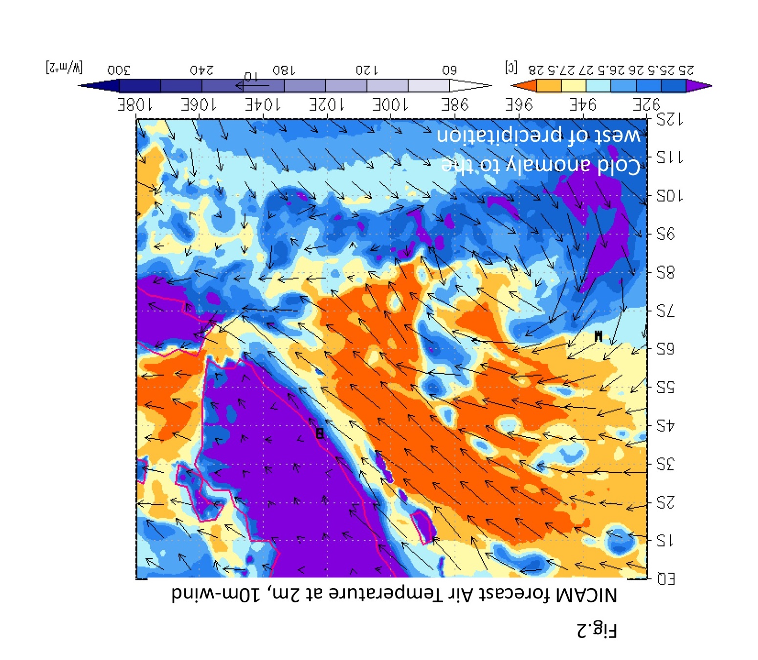
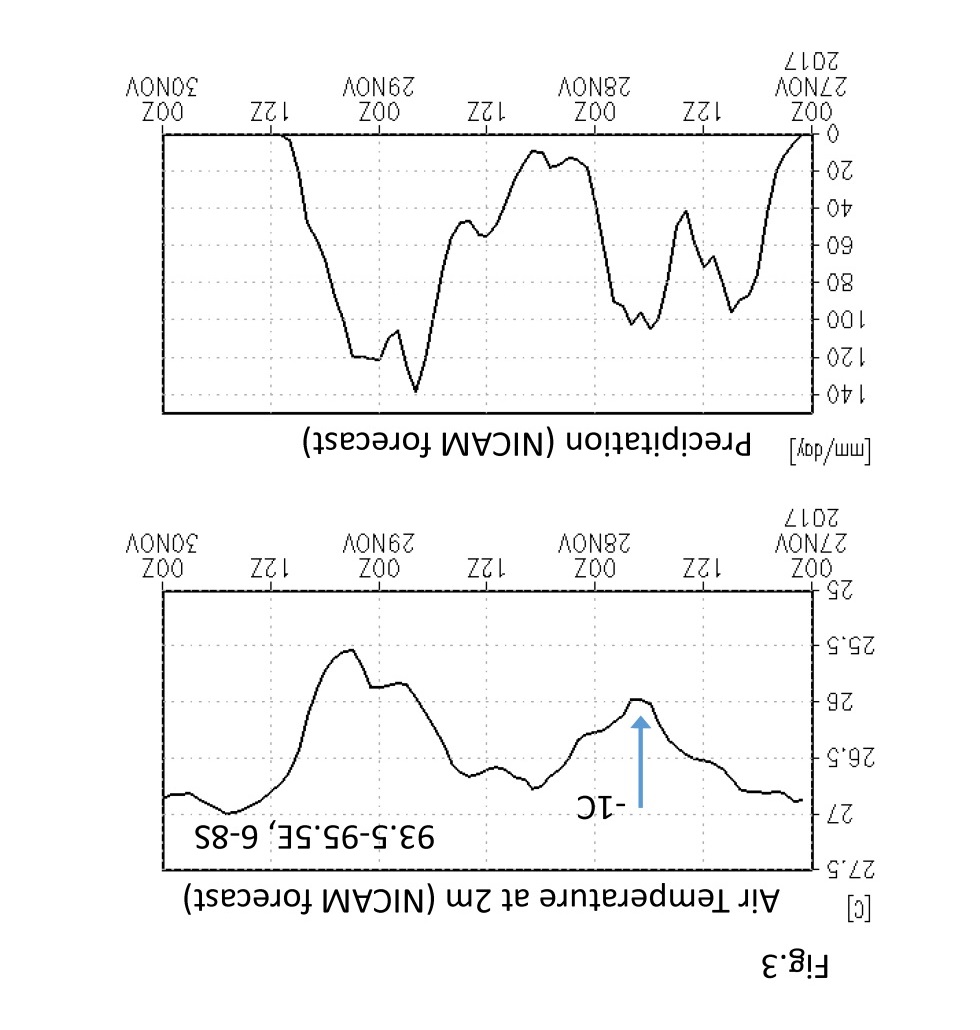
NICAM captures the cyclonic vortex passing over MIRAI (Figs. 1, 2) and surface cooling associated with rainfall (Fig. 3).
Close examination between the observed SST and air temperature and those simulated are important to understanding the physical process.
Interestingly, cold anomaly was peaked to the west of the eastward-propagating vortex (Fig. 2).
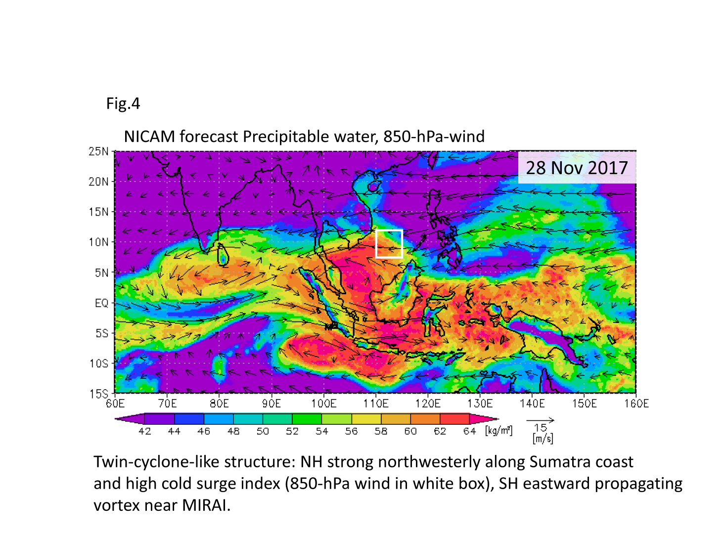
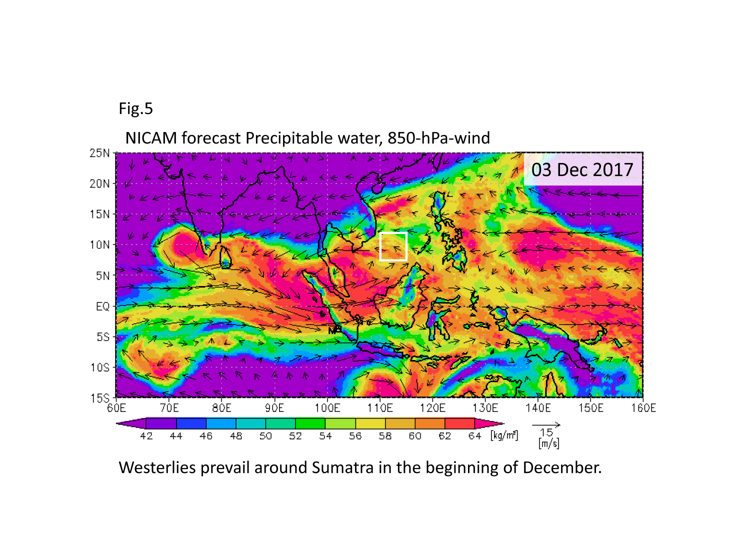
NICAM also simulates large-scale moisture and flow fields (Figs. 4, 5).
On 28 November, twin-cyclone-like structure: strong northwesterly along Sumatra coast and strong easterly to the west of Philippines in the NH, and an eastward propagating vortex near MIRAI in the SH are found. These may be relevant to the convective events observed in these few days.
In our forecast, westerly tends to prevail in the beginning of December.
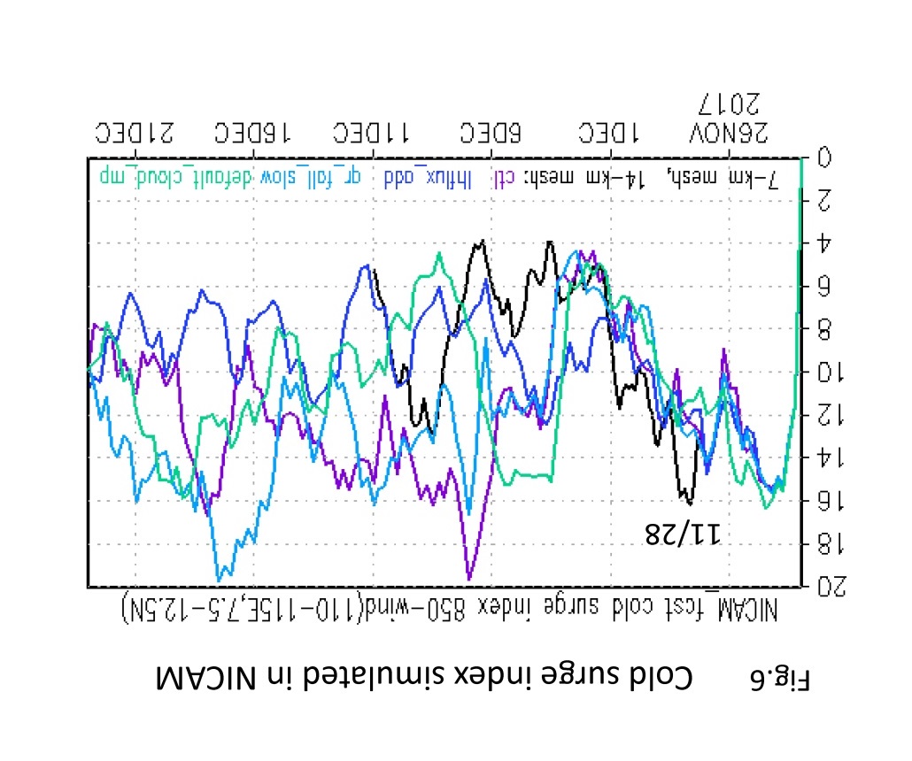
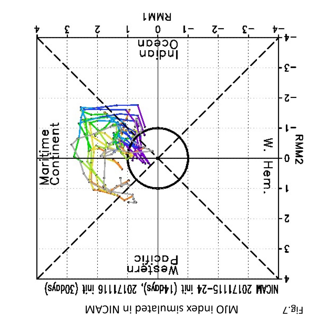
Cold surge index (Fig. 6) peaked during 28-29 November, and will be weakened afterwards. The enhanced convection and low-level westerlies may be related to the Madden-Julian Oscillation coming around (Fig. 7).
(T.N.)
