"vortex!"
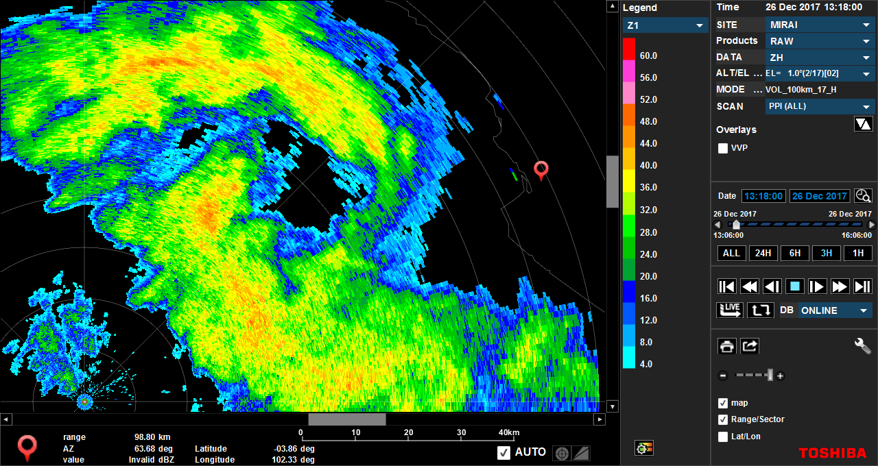
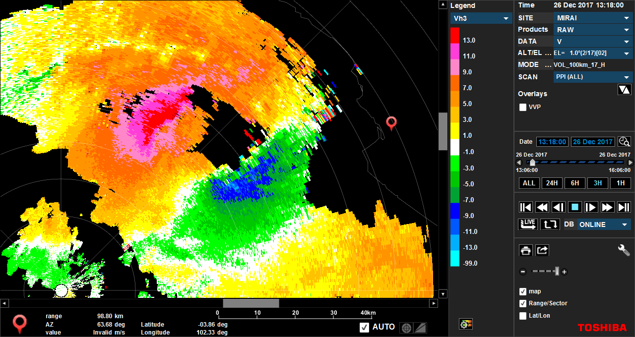
We just captured a vortex in between Mirai and Bengkulu !
First figure (left), named "reflectivity", means radar reflectivity, an alias of the rainfall intensity. You can see the circular pattern between Mirai (small blue/red circle in lower-left) and Bengkulu site (red marker on the right).
Second image (right), named "velocity", is the velocity of the air motion in the radial direction from Mirai. Red (positive) means the motion away from Mirai, while blue (negative) means motion toward Mirai. The pair of the red and blue means there is a vortex.
After that, the vortex moves southeastward. I guess Bengkulu experienced heavy rain and strong wind. In contrast, around Mirai, we have no precipitation under the weak wind.
It is very beautiful image (for us meteorologist), but we need further analyses the mechanism of the vortex.
(reports by M.K.)


