セミナーのお知らせ

[北極環境気候研究特別セミナーのお知らせ]
- 日時
- 10月4日(木)16:00〜16:30
- 場所
- 横須賀本部 海洋研究棟4階会議室(401号室)
- 発表者
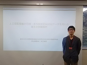
- 矢口 春吾 (東京大学大学院 新領域創成科学研究科)
- タイトル
- 人工衛星搭載可視・赤外放射計MODISデータを用いた海氷の挙動解析
- 概要
- 海氷運動は大気や海洋の影響を受け変動する一方、海氷量の変動や大気海洋間のエネルギーの交換に大きく寄与している。現在、海氷観測に主に使われているマイクロ放射計のデータより算出された海氷漂流速度は、解像度が60kmと大きいため海氷が減少して来た際のミクロな運動を捉えることができない。そのため、マイクロ波放射計より解像度が優れている可視・赤外放射計MODISを用いて5km解像度の海氷漂流速度を算出した。今回は、季節海氷域でありメソスケールの現象が多く確認されているチュクチ海・カナダ海盆において、海氷縁付近の海氷運動および海氷運動から見られる海域の特徴の検出を行った。

[北極環境気候研究セミナーのお知らせ]
- 日時
- 10月4日(木)15:00〜16:00
- 場所
- 横須賀本部 海洋研究棟4階会議室(401号室)
- 発表者
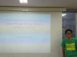
- 木村 仁 (北極環境変動総合研究センター 北極環境・気候研究ユニット)
- タイトル
- On the warming of the Chukchi slope through the Barrow Canyon outflow in January 2017
- 概要
- The shallow Chukchi Sea is a gateway to the Arctic Ocean for the Pacific-origin water. While a substantial portion of the Pacific-origin water flows through Barrow Canyon, located in the northeast corner of the Chukchi Sea, little is known on the pathways of the Barrow Canyon outflow in winter. We present profiles of wintertime hydrography on the Chukchi slope from the McLane Moored Profiler (MMP), an autonomous profiling instrument, and the mooring records in the Barrow Canyon starting in 2002. The profiles show warming in December 2016 - January 2017, and the water properties coincide with the central and western sectors of the Barrow Canyon outflow 0-30 days before. Although the south of Barrow Canyon (e.g. the Gulf of Alaska and the Bering Sea) has been anomalously warm for the last few years, this is the first time that such warming is recorded on the Barrow outflow. We speculate that this is due to the combination of the outflow favourable wind pattern over the Barrow and the hydrography of the Gulf of Alaska and the Bering Sea.

[北極環境気候研究セミナーのお知らせ]
- 日時
- 10月4日(木)14:00〜15:00
- 場所
- 横須賀本部 海洋研究棟4階会議室(401号室)
- 発表者
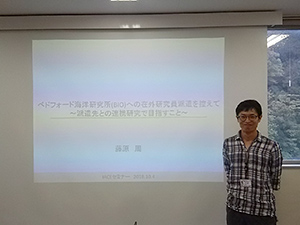
- 藤原 周 (北極環境変動総合研究センター 北極環境・気候研究ユニット)
- タイトル
- ベドフォード海洋研究所(BIO)への在外研究員派遣を控えて
〜派遣先との連携研究で目指すこと〜 - 概要
- 近年の北極海では夏季、新規季節海氷域や昇温が進んだ海域が大きく広がる海へと変化した。そのため、海洋生態系と人類が接する機会も増加しており、自然科学的な枠組みを超え、産業や人文社会学的にも北極海利用の国際的関心はますます高まりをみせている。これに対して、特にecosystem approachを重視した国際的な海洋利用を管理・制限する動きがあり、海洋生態系の「多様性」や「脆弱性」を指標とした現状・動態の把握が急務となっている。海洋生態系の中でも環境変化に対して最も鋭敏に応答するのが植物プランクトンであり、海色衛星観測は彼らの面的なモニタリングを実施する上で強力なツールである。その一方で、北極海特有の種々の制約により、最も一般的な植物プランクトンの観測指標であるクロロフィルa濃度でさえ、環北極スケールの標準的な観測手法(アルゴリズム)は未確立である。そこで、JAMSTECやBIO、アメリカ、フランスの研究グループが現場観測を実施し取得してきた、環北極を網羅する光学データおよび植物プランクトン色素データを統合し、北極海に標準的に適用できる海色リモートセンシングアルゴリズムの開発研究を実施する。中でも植物プランクトンの主要分類群(Phytoplankton Functional Type (PFT):珪藻類、ハプト藻類など)の組成分布を推定するアルゴリズムを開発することを主課題とし、衛星観測による植物プランクトン分類群の時空間的多様性という新しい視点のモニタリング実現を目指す。これにより、クロロフィルaという生物量指標だけではなく、分類群組成といった「多様性」の観点から北極海の海洋生態系の動態の理解が進むことが期待される。

[北極環境気候研究特別セミナーのお知らせ]
- 日時
- 2月2日(金)15:00~16:00
- 場所
- 横須賀本部 海洋研究棟4階会議室(401号室)
- 発表者
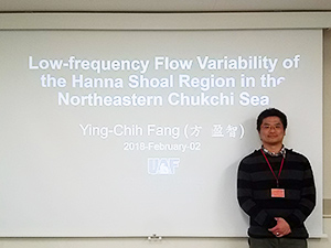
- Ying-Chih Fang (University of Alaska Fairbanks)
- タイトル
- Low-frequency Flow Variability of the Hanna Shoal Region in the Northeastern Chukchi Sea
- We analyze velocity and hydrographic observations derived from 23 moorings from 2011–2014 on the northeastern Chukchi shelf. The focus is on subtidal circulation dynamics in the Hanna Shoal region. Along the east side of Hanna Shoal the velocity field is often strongly vertically sheared with the upper layer flow to the northwest and the lower layer flowing southward. The sheared flow is a result of heavy stratification induced by dilute ice meltwaters overlaying cold, salty winter-formed waters. In sharp contrast to the shelf west and south of Hanna Shoal, the stratification east of the Shoal likely persists year-round, especially if ice persists over the Shoal through late summer. Wind-forced Ekman currents and a baroclinic pressure gradient are responsible for the mean upper-layer flow. Whereas bottom currents are southward and arise as a consequence of the barotropic forcing due to the sea-level difference between the Pacific and Arctic oceans. Along the western side of the Shoal, the flow is weakly sheared and seasonally stratified, with complete stratification breakdown in early winter. In winter, a seasonally-variable, along-isobath density gradient develops that impels a cross-isobath flow along the bottom, while the mean flow in the upper water column suggests convergence on the northern side of Hanna Shoal. Both features imply that shelf-basin exchange may occur north of Hanna Shoal.
At shorter periods, the circulation around the Shoal is altered by the passage of barotropic, topographic waves of ~3 day period, triggered by strong surface stress impulses. The waves propagate clockwise around the Shoal from the east side, but the signal is damped along the northwest side of the Shoal and near Barrow Canyon. The absence of the wave in these regions is likely due to scattering, convergence in potential vorticity (PV) contours, and/or blocking by large PV gradients.
