
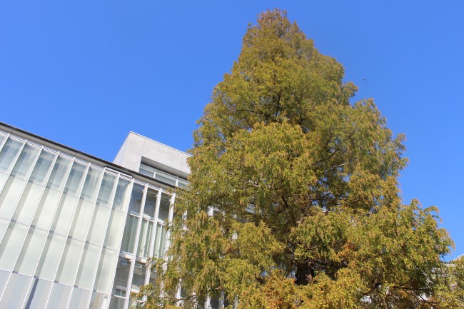

It’s the season for fall colors, and even the metasequoia tree on the JAMSTEC Yokohama Campus is starting to follow suit. Soon the fall foliage will be past its peak [which is typically late November in these latitudes] and the year will be drawing to a close. So what is the outlook for the (northern hemisphere) cold season (December through February)? According to the SINTEX-F model, surface air temperature will be above normal in many parts of the world. In the tropics, the current La Niña Modoki will be weakening while the negative Indian Ocean Dipole will breathe its last, with conditions returning to average in the region. Water temperatures off northwestern Australia will become warmer than average, a phenomenon known as Ningaloo Niño. Let’s take a closer look.
Air temperature and rain forecast for the period December through February
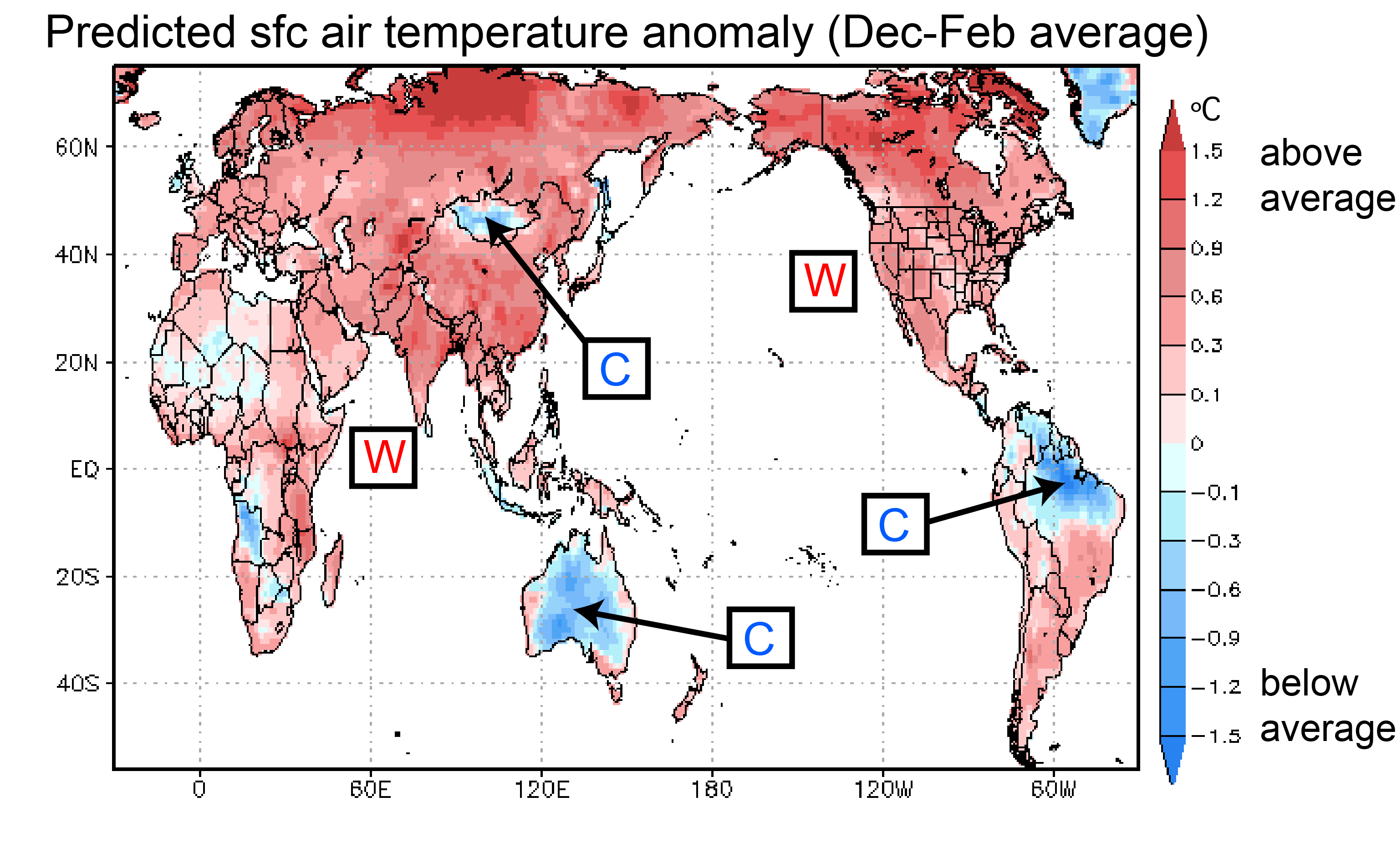
The surface air temperatures for the period December through February are expected to be warmer than average in many areas of the world (Fig. 1). Exceptions are northern Brazil, Australia, and Mongolia, where temperatures are expected to be cooler than average. One difference to last month’s forecast run is that warmer than normal temperatures are now also predicted for the whole of Europe (forecast skill in these latitudes is limited though).
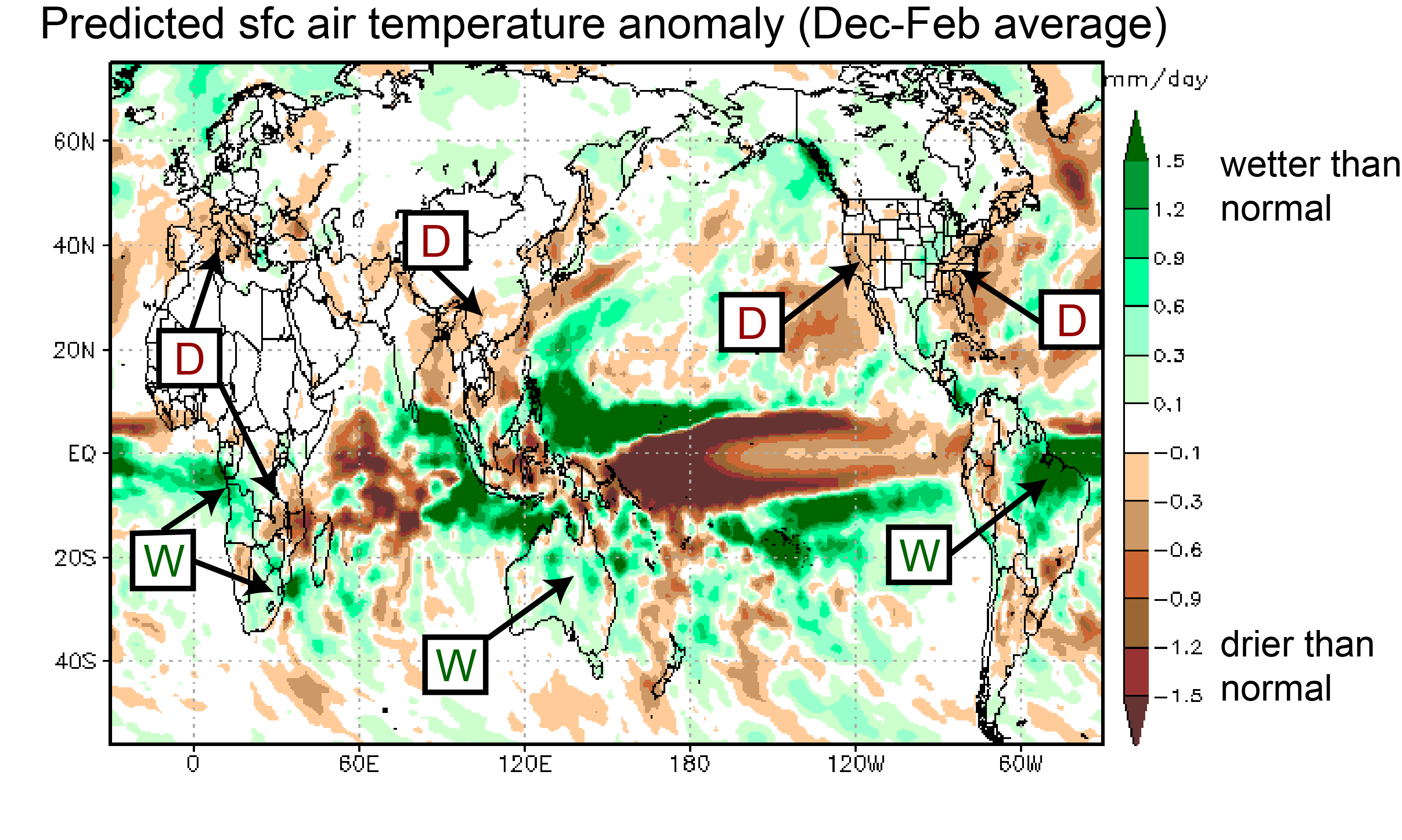
Rainfall is forecast to be below average in southeastern Africa and in many regions of the northern hemisphere, including southern Europe, East and Southeast Asia, and the West and East Coasts of the United States (Fig. 2). Above average rainfall is forecast for Brazil, Australia, and southwestern Africa and South Africa.
For Japan, the model indicates lower than average temperatures and reduced precipitation for the northern part, and higher than average temperatures for the southern part. Please bear in mind though that the model’s forecast skill in the mid and high latitudes is limited.
Ocean temperatures for the period December through February
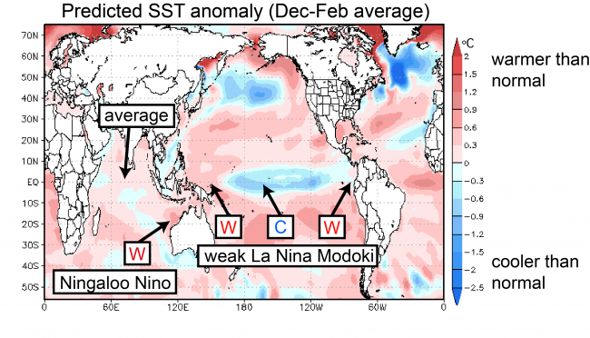
In difference to daily weather fluctuations, seasonal climate variations are strongly influenced by changes in sea-surface temperatures (SSTs). Particularly in the tropics, where the SSTs are warmer than in other regions, even small changes in temperature can produce far reaching effects.
According to the SINTEX-F prediction, weak La Niña Modoki conditions should continue, with cooler than normal SSTs in the central tropical Pacific and warmer than normal SSTs to the west and east (Fig. 3). In the Indian Ocean, the negative phase of the IOD (marked by warmer than average SST in the east and cooler than normal SST in the west) that persisted from summer through fall will terminate, with conditions returning to average. Off the northwest of Australia, ocean temperatures are expected to warm, indicating the development of a Ningaloo Niño event.
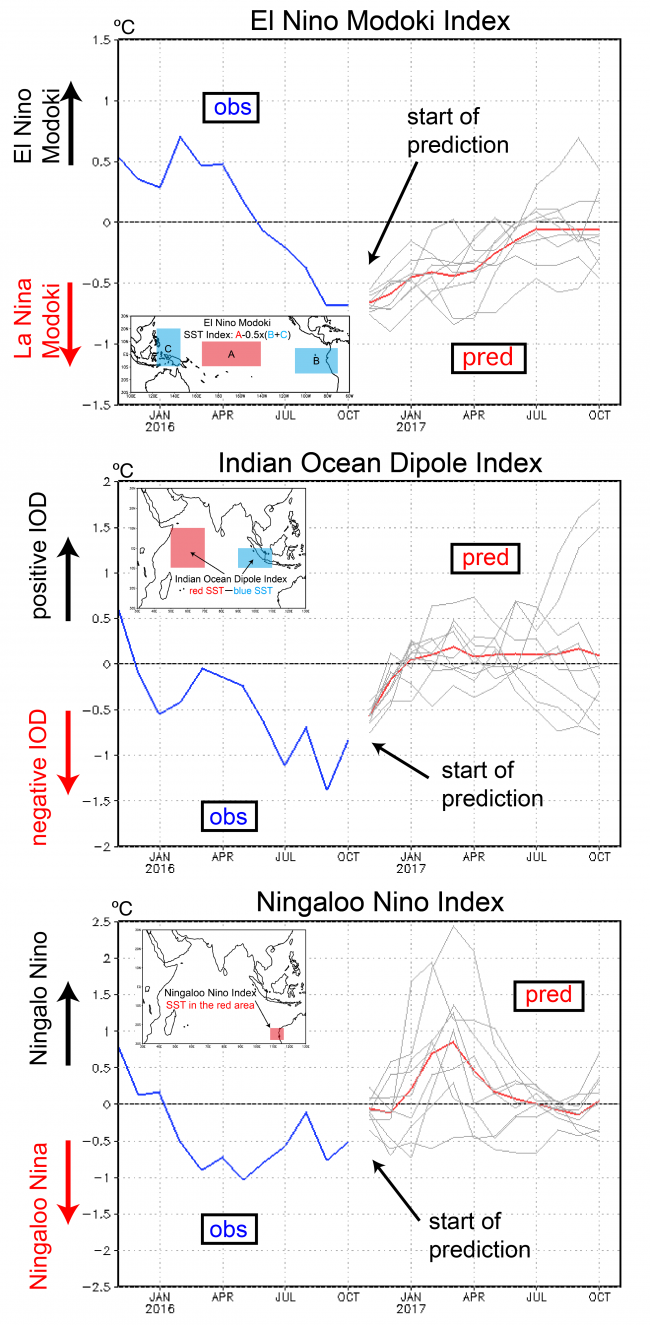
Finally, let’s check the extended outlook for the tropics. Figure 4 shows three indices of interest. The El Niño Modoki index is predicted to be below -0.5 ºC in November (red line in Fig. 4), indicating a weak La Niña Modoki. The anomalies will weaken over the next several months but a very weak La Niña Modoki should carry on until spring.
The IOD index, which was below -0.5 ºC at initialization time will increase toward average values and will be close to 0ºC in January. Thus the current negative IOD event should rapidly terminate over the next 1-2 months.
The Ningaloo Niño index shows a rapid increase of SSTs during January and February with a similarly rapid decay in April and May.
That’s it for now. We will keep you updated with another post in December/early January. In the meantime, Happy Holidays!