

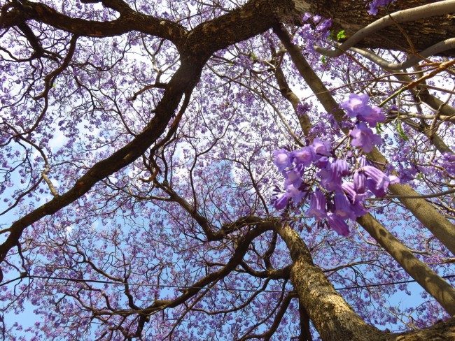
I’m currently in South Africa for a project on infectious diseases (see here for English description) The photo, taken from the research institute we are visiting, shows a blossoming Jacaranda tree. Being in the southern hemisphere, South Africa is in the middle of spring and flowers are blooming left and right. It is already late October, and so only two months are left of the current year. This means it’s about time to take a look at the predictions for the coming winter. According to the SINTEX-F model, the period December through February will be marked by warmer than average surface temperatures in many regions. The weak La Niña Modoki in the central Pacific will continue to scrape by, while the negative Indian Ocean Dipole event will terminate, with conditions returning to average. Let’s take a closer look.
Air temperature and rain forecast for the period December through February
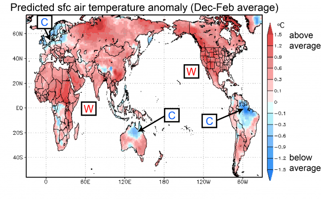
Warmer than average temperatures are expected in many areas of the world (Fig. 1). Exceptions are northern Brazil, northern Europe and northern Australia, where temperatures are expected to be cooler than average.
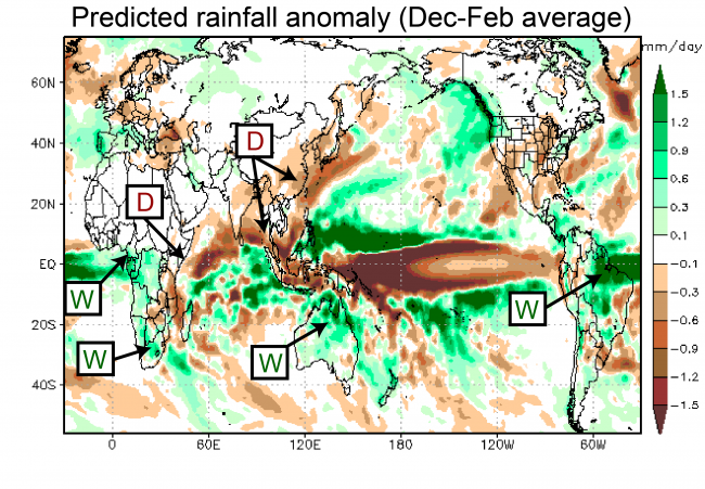
Regarding rainfall, the SINTEX-F prediction indicates drier than normal conditions over eastern China, Mainland Southeast Asia, and eastern Africa. Above average rainfall is expected over northern Brazil, northern Australia, and the western portions of equatorial and southern Africa.
As for Japan, the period December through February is forecast to be warmer and drier than usual. Please keep in mind, however, that forecast accuracy for mid and high latitudes is limited.
Ocean temperatures for the period December through February
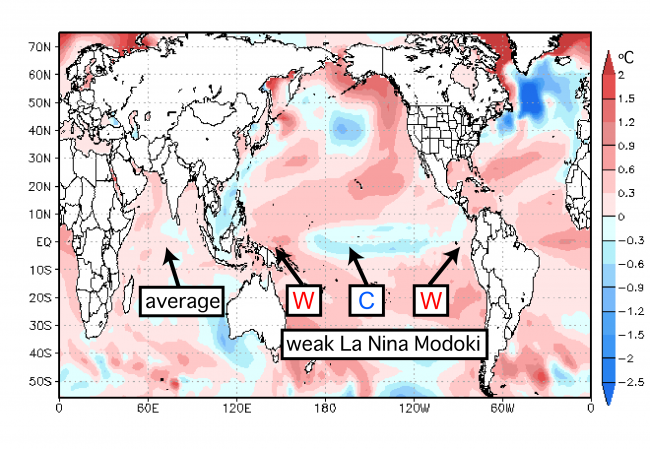
In difference to daily weather fluctuations, seasonal climate variations are strongly influenced by changes in sea-surface temperatures (SSTs). Particularly in the tropics, where the SSTs are warmer than in other regions, even small changes in temperature can produce far reaching effects.
According to the SINTEX-F prediction, weak La Niña Modoki conditions should continue, with cooler than normal SSTs in the central tropical Pacific and warmer than normal SSTs to the west and east (Fig. 3). In the Indian Ocean, the negative phase of the IOD (marked by warmer than average SST in the east and cooler than normal SST in the west) is expected to weaken, with conditions returning to average.
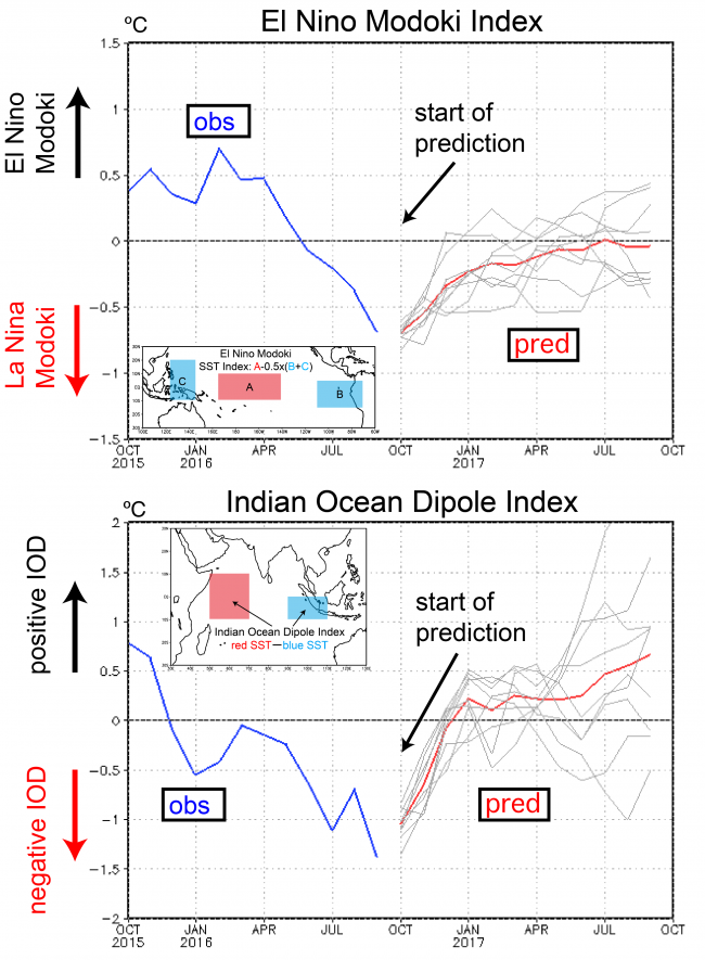
Finally, let’s check the extended outlook for the tropics. Figure 4 shows two indices that characterize the state of the tropical Pacific and Indian Ocean. The El Niño Modoki index is predicted to reach its minimum of -0.7 ºC in October, after which it will gradually return to neutral conditions.
The IOD index, which dropped below -1 ºC in September, is predicted to weaken in the coming months and should return to neutral conditions by the end of the year.
Thus the two major ocean indices do not suggest unusual conditions this winter. Let’s keep a close look on how this actually turns out.
Finally, a note on the definition of seasons. The reason we discussed the period December through February is that this is the meteorological definition of winter. The meteorological calendar divides the year into four seasons, namely spring (1 March – 31 May), summer (1 June – 31 August), fall (1 September – 30 November), and winter (1 December – 28 February). And, by the way, in the southern hemisphere everything is, of course, reversed. So 1 December – February 28 is known as summer there.