
Quick summary:
- neutral conditions in the tropical Pacific predicted until end of the year
- strong positive Indian Ocean Dipole predicted to develop until fall
- enhanced risk of drought in Indonesia and Australia
- outlook for Japan: slightly warmer and drier than average in fall
After taking a little break, hot summer temperatures are back in Japan. According to the JMA, temperatures in northern and western Japan were above average in July, with northern Japan also having above average sunshine hours (link to the Japanese website). From early to mid-August, however, unseasonably cool temperatures occurred in eastern and northern Japan. This appears to have been due to the strengthening of the Okhotsk High (a high pressure system over the Sea of Okhotsk, north of Japan), which is linked with cool northeasterly winds blowing toward Japan (also known as Yamase winds; link to JMA explanation [in Japanese]).
In western Japan, on the other hand, hot temperatures have continued unabated throughout August. This is at least partly due to the influence of the positive Indian Ocean Dipole (IOD) that continues developing in the tropical Indian Ocean.
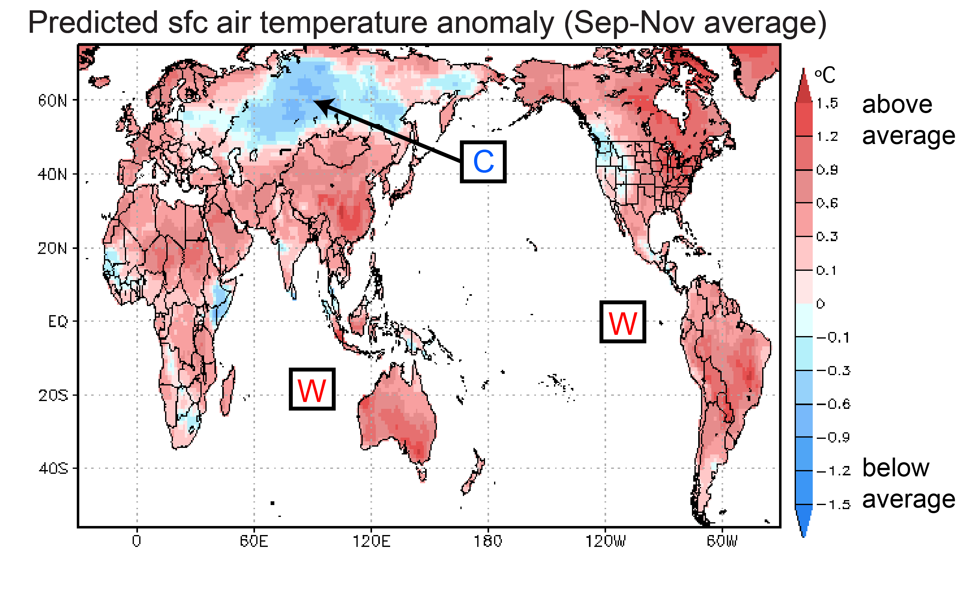
Let’s take a look at the latest predictions. According to the SINTEX-F model, surface air temperatures over land will be above average over most land areas from September through November. One notable exception is central Russia. In difference to last month’s forecast, only slightly cooler than average temperatures are predicted over the US.
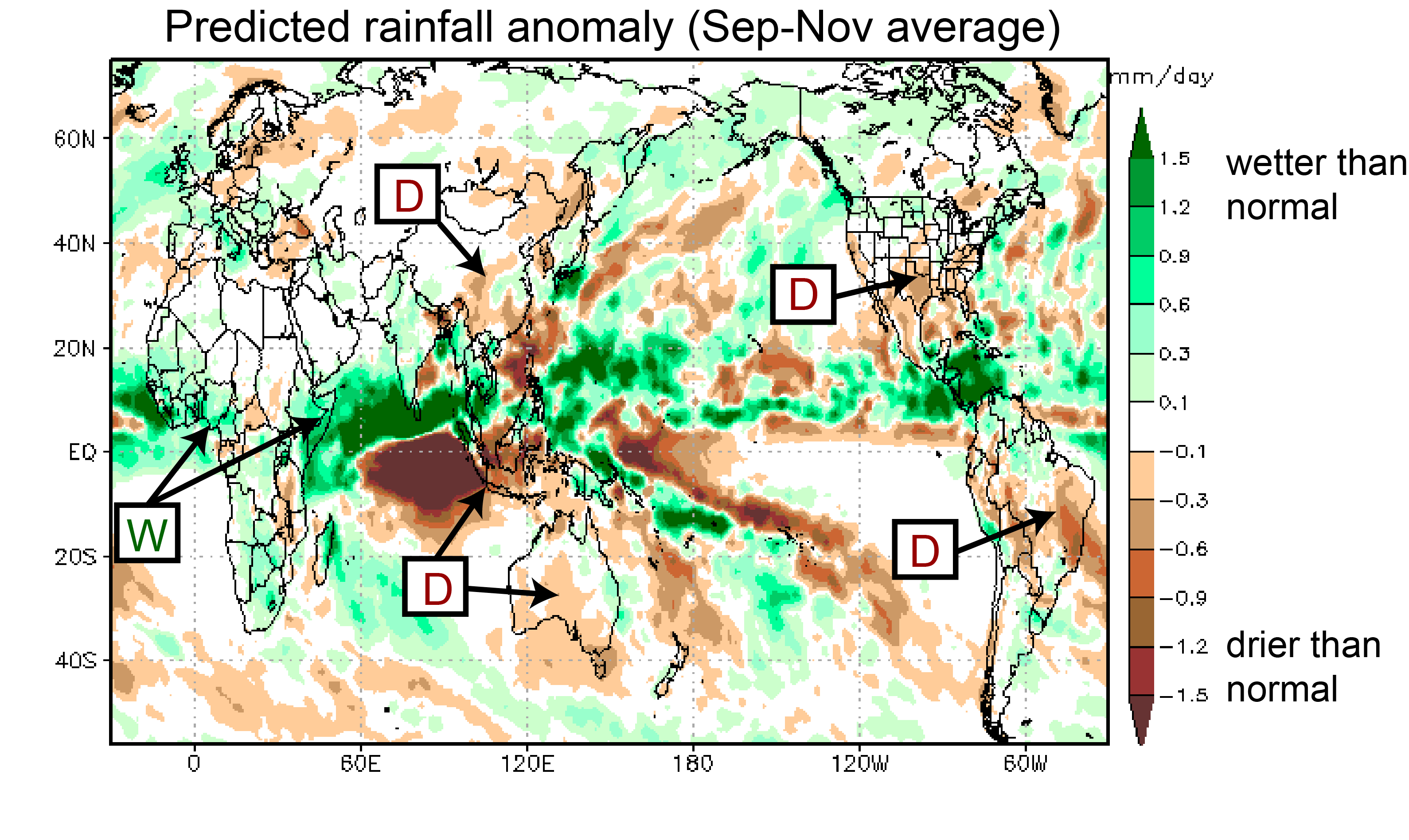
Rainfall predictions have not changed much from last month. For the period September through November above average rainfall is predicted over tropical Africa. Below average rainfall is predicted for Indonesia, Australia, and most of Brazil.
For Japan, the model predicts warmer than average conditions in fall. Please bear in mind though that the model’s forecast skill in the mid and high latitudes is rather limited.
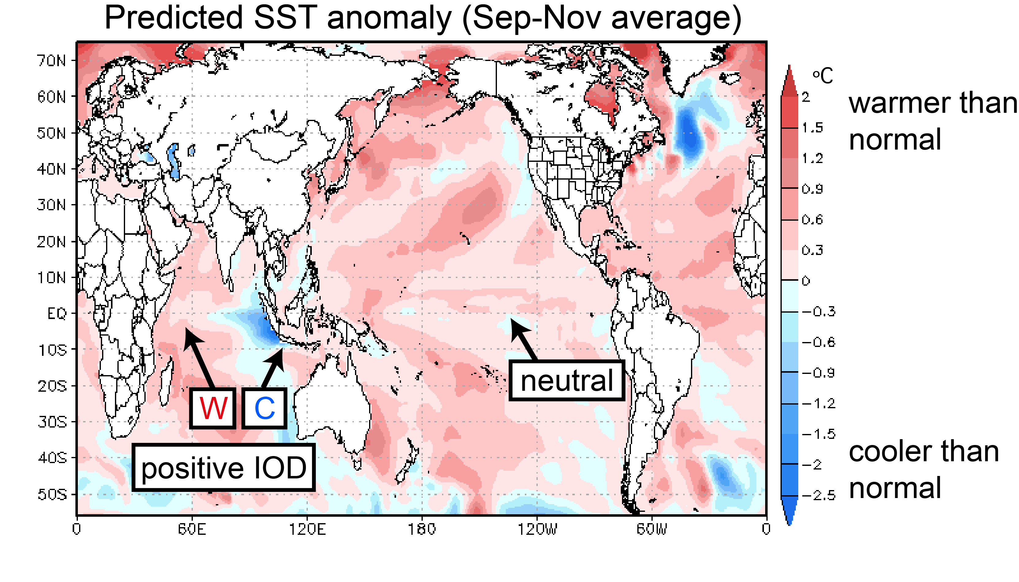
Sea-surface temperatures (SSTs) in the tropical Pacific are predicted to be just slightly above average during September through November. This is somewhat weaker than last month’s prediction so we decided to call for neutral conditions.
In the Indian Ocean, on the other hand, the model continues to predict the development of a strong positive Indian Ocean Dipole (IOD) event, with cooler than average SSTs in the east, and warmer than average SSTs in the west. Positive IOD events typically lead to warmer than average temperatures in western Japan. The model prediction suggests that the remote impacts of the positive IOD will continue to strengthen the Ogasawara High (also called Bonin high), leading to warmer than average temperatures in western Japan during the fall (not shown).
What is the extended outlook for the tropical oceans?
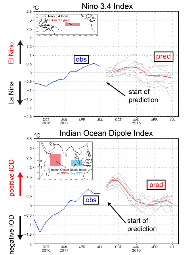
Figure 4 shows two SST indices of interest. The Niño 3.4 index is predicted to be slightly above average until spring of next year (red line in the upper panel of Fig. 4). Thereafter, temperatures are expected to be slightly cooler than average until the end of the forecast period. The weakness of the predicted temperature anomalies suggests that neutral conditions will prevail until the summer of 2018.
The IOD index is predicted to exceed +1 °C in August (Fig. 4, lower panel) and peak at about +1.3 °C in September and October.
A few more remarks on the remote impacts of the IOD. As noted above, positive IOD events tend to bring high surface pressure to Japan, with warmer than average temperatures and lower than average rainfall. The currently predicted tropical SST pattern (neutral Pacific + positive IOD) has precedents in the recent past. In 1994, Japan was under the influence of high pressure systems that reduced rainfall and contributed to record breaking heat waves. In 2006, Australia was hit by an extremely severe drought that devastated the wheat harvest. The current predictions therefore raise the concern for droughts in Indonesia and Australia.