
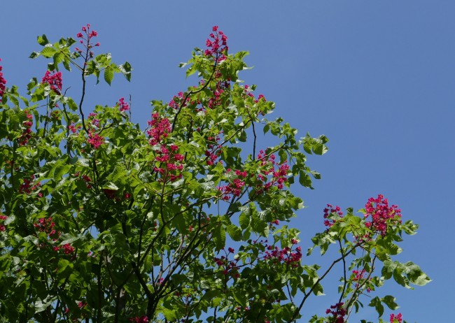

Crimson red flowers dotting the blue sky – the Yokohama campus is steeped in the mirth of early summer, with horse-chestnut trees blooming vividly (see photo). According to the JMA, temperatures and rainfall in eastern Japan were around average in April, while sunshine hours were above average (link to the Japanese website). Before long, we will enter into the muggy rainy season, followed by intense summer heat. So how will this year’s summer be compared to the average?
According to the SINTEX-F model, surface air temperature will be above average in most parts of the world, except for eastern Russia and northern Australia. Rainfall is predicted to be above average in several places, including the Philippines, Mexico and West Africa. Below average rainfall is predicted for many other regions, including Indonesia, Australia, India, eastern China, South Korea, northern Brazil and Peru.
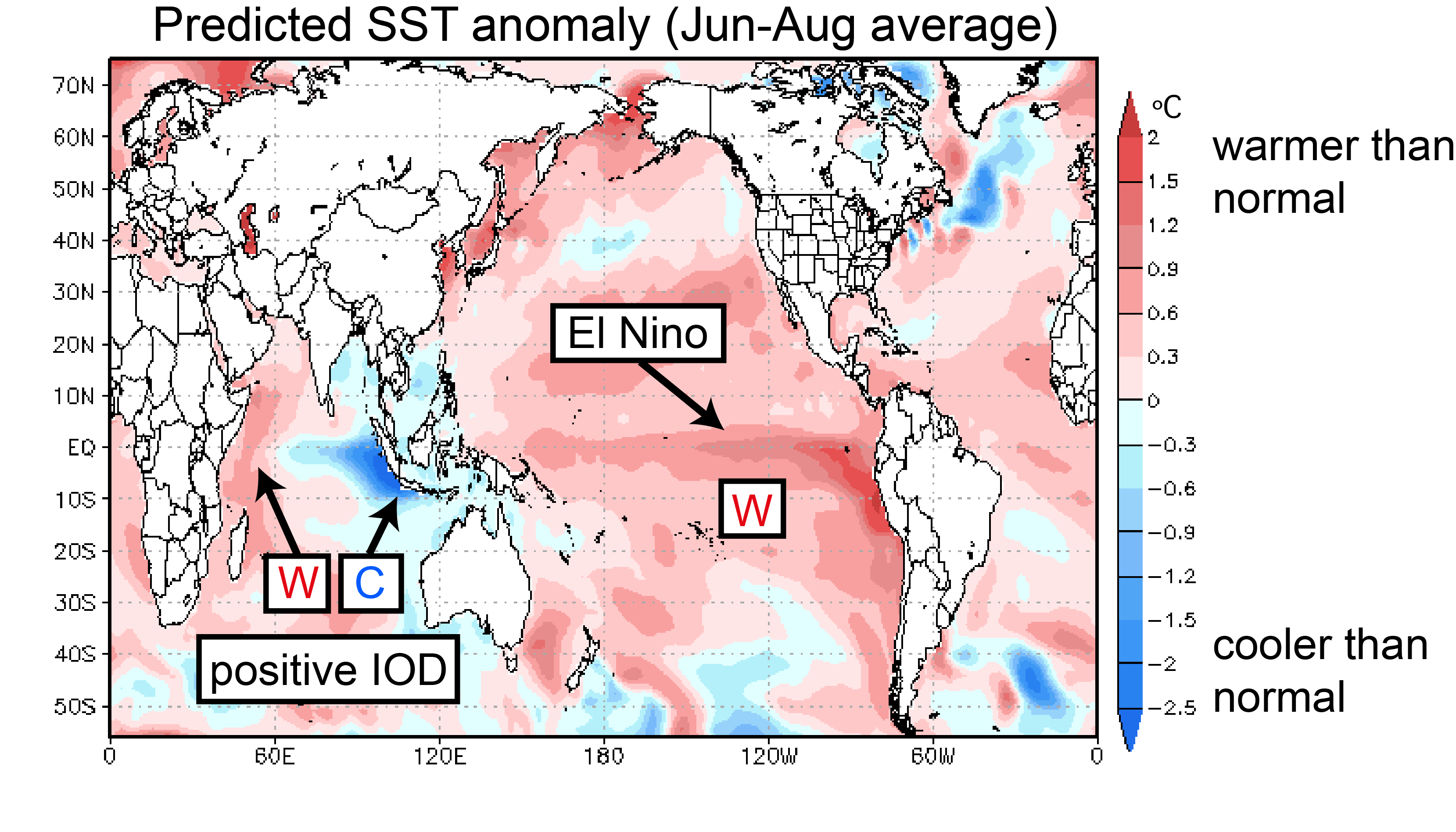
The tropics may play an important role in these climate patterns. Temperatures in the eastern tropical Pacific are predicted to rise, which constitutes an El Niño event. In the tropical Indian Ocean, a positive Indian Ocean Dipole event is predicted to occur, with ocean temperatures warmer than average in the west and cooler than average in the east. The combined influence of these events should suppress convective activity over the eastern Indian Ocean and the Maritime Continent.
Based on the previous simultaneous occurrence of El Niño and positive Indian Ocean Dipole in 1997 and 2015, we expect warmer than average temperatures to occur in many locations around the globe.
Air temperature and rain forecast for the period June through August
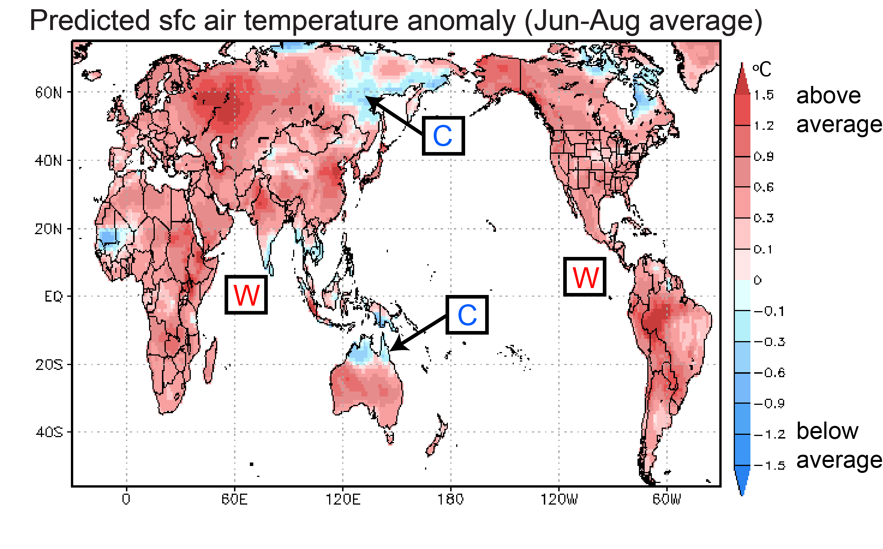
As stated above, surface air temperature (Fig. 1) is predicted to be above average in most locations around the world, with colder than average temperatures predicted in a few locations only, including eastern Russia and northern Australia.
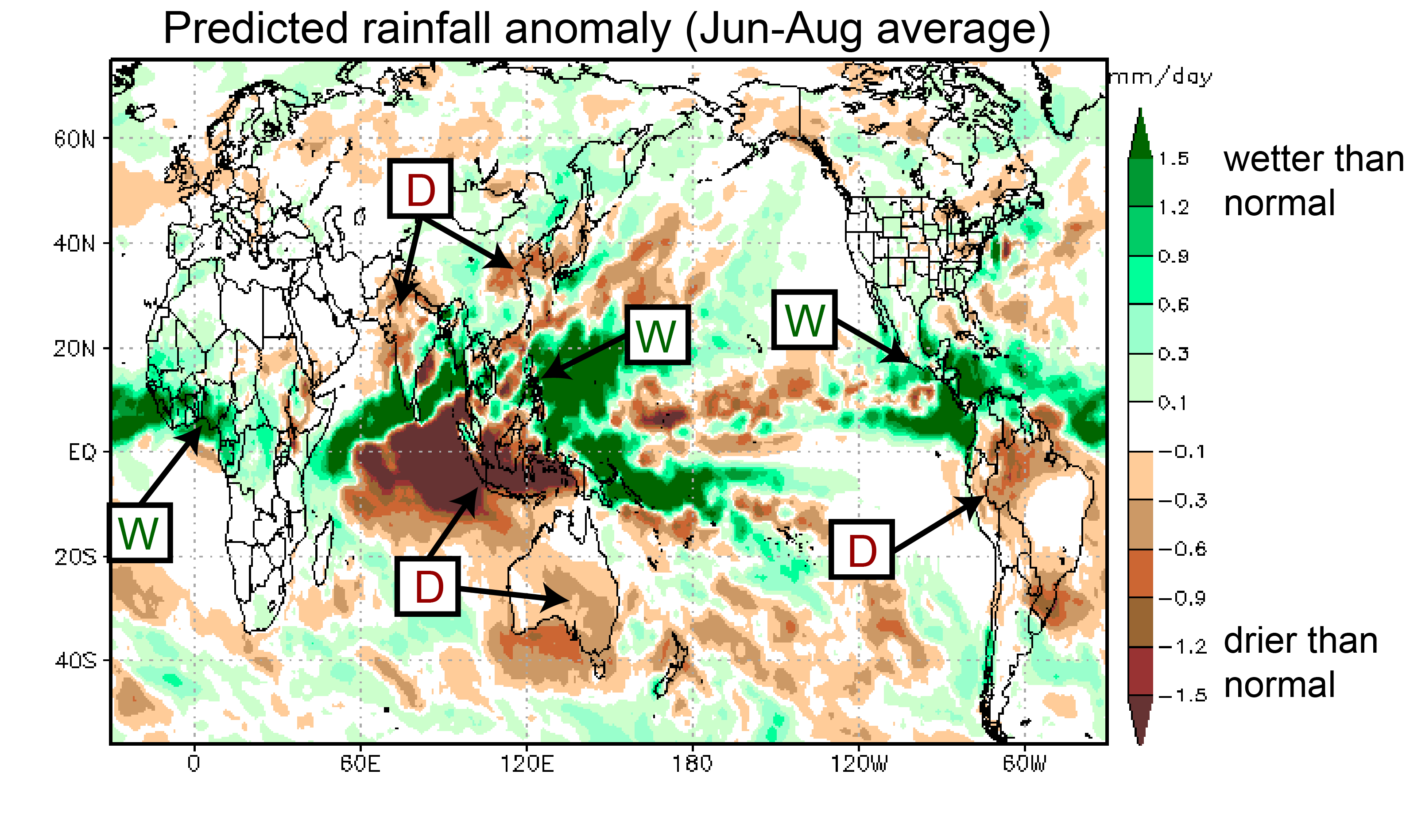
Rainfall for the period June through August (Fig. 2) is predicted to be above average in the Philippines, Mexico and Central America, and West Africa. Below average rainfall is predicted for Indonesia, Australia, India, eastern China, South Korea, northern Brazil and Peru.
For Japan, the model predicts warmer than average temperatures in summer. Rainfall is predicted to be above average in western Japan and below average in northern Japan. Checking individual months (rather than the seasonal average), it appears that the wet west/dry north pattern will be dominant in June only (not shown). In July, on the other hand, high pressure will dominate all of Japan, which should lead to lower than average rainfall and higher than average temperature. Please bear in mind though that the model’s forecast skill in the mid and high latitudes is rather limited.
Ocean temperatures for the period June through August
In difference to daily weather fluctuations, seasonal climate variations are strongly influenced by changes in sea-surface temperatures (SSTs). Particularly in the tropics, where the SSTs are warmer than in other regions, even small changes in temperature can produce far reaching effects.
According to the SINTEX-F prediction, SSTs in the eastern tropical Pacific will rise above average during the summer, indicating the development of an El Niño event (Fig. 3). The eastern tropical Indian Ocean will become cooler than average, while the west will become warmer. This suggests that a positive Indian Ocean Dipole (IOD) event will develop.
A simultaneous El Niño and positive IOD have only been observed twice: in 1997 and in 2015. Knowing which of the two phenomena will develop more rapidly will be crucial for predicting climatic anomalies around the globe. Let’s take the Japanese summer as an example. El Niño tends to weaken the Ogasawara High (a high-pressure system southeast of Honshu Island; also sometimes called “Bonin High”), and this tends to produce instability, rain, and cooler temperatures over northern Japan. Western Japan, on the other hand, is dominated by the positive IOD, which overrides El Niño’s influence and leads to hot temperatures. Depending on the relative strengths of El Niño and the IOD, this balance of impacts will shift.
So which of the two phenomena is favored by the SINTEX-F prediction?
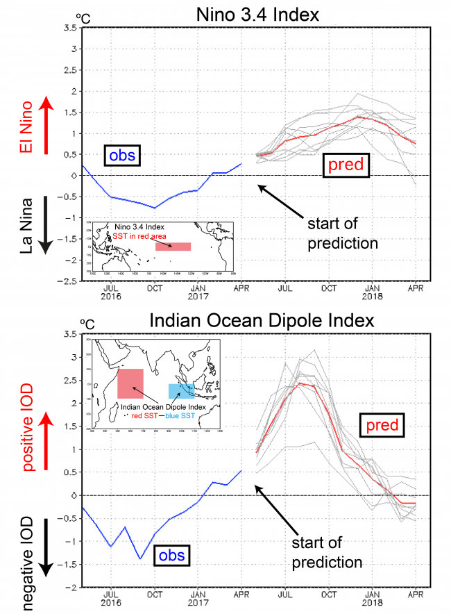
Figure 4 shows two SST indices of interest. The Niño 3.4 index is predicted to exceed the +0.5 °C El Niño threshold in June, exceed +1 °C in September, and peak in winter (red line in the upper panel of Fig. 4). As we mentioned before, if indeed another El Niño were to develop in 2017 it would likely put an end to the spell of La Niña-like conditions that have prevailed over the last 10 years or so. Instead, we might be entering a prolonged period of El Niño-like conditions. This would most certainly mean the end of the so-called “hiatus” in global warming and usher in a period of accelerated warming.
The IOD index is predicted to exceed + 1 °C in May, and + 2 °C in July, with the peak occurring in late summer/early fall (Fig. 4, lower panel). So it looks like the IOD is going to win out over El Niño. As a result, we expect the Japanese summer to be dominated by high pressure, with warmer than average temperatures and less than average rainfall in July and August.
Abnormal weather and climate events are not only influenced by El Niño/La Niña but also by the Indian Ocean Dipole. The simultaneous occurrence of El Niño and a pronounced positive Indian Ocean Dipole raises the concern for droughts developing in Indonesia and Australia. Further development should be closely monitored.