Survey Systems
Atmospheric Research
Doppler Radar
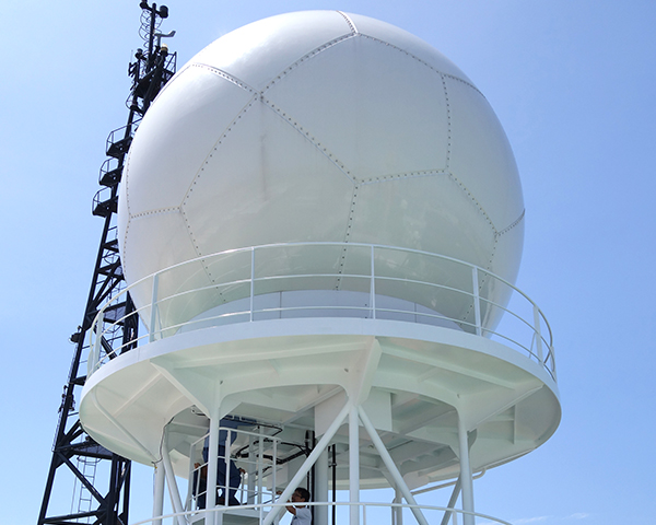
Looking at Clouds with Radar
Doppler radar measures wind speed in rain clouds and the amount of rain drops by emitting radio waves from a parabolic antenna to the targeted clouds, and processing the reflected waves coming back from the target. The collected data assist the analysis of the structure of the clouds, their development and rain creation.
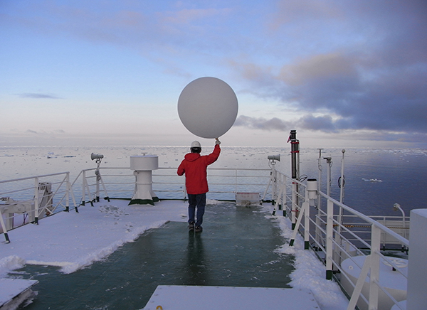
Radiosonde research
A radiosonde is a device that integrates a small and lightweight measuring instrument (atmospheric pressure, temperature, humidity) and a small wireless transmitter payload. This payload is attached to a rubber balloon filled with helium and collects & transmits data from up to 20 km above the sea surface.
In addition, the research ship is equipped with a comprehensive marine meteorological observation device, a Solar–terrestrial radiant-energy observation system (SOAR), a cloud height measuring instrument (ceilometer), a wave height meter, etc., and acquires a wide array of meteorological data.
Oceanographic Research
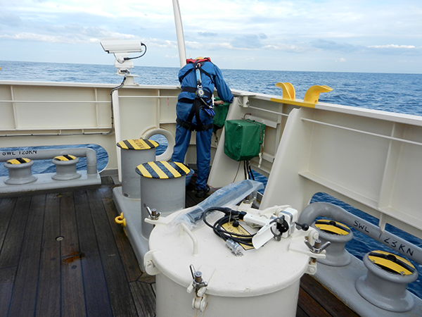
CTD (conductivity [salinity], temperature, depth [pressure])

Sensors to investigate the ocean at selected depths
A CTD is a tool that measures the conductivity (salinity), temperature, and underwater pressure (depth) of the ocean.
The CTD deployed into the ocean is suspended by a cable that measures vertical profiles of temperature and salinity. These data are used to analyze the characteristics of seawater and currents.
Water samplers
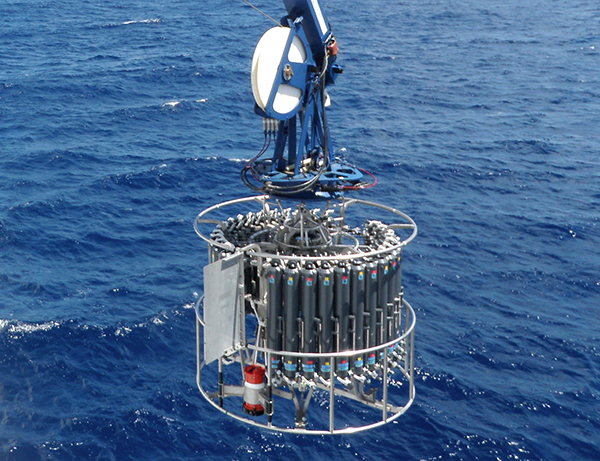
Seawater sampling and analysis
The CTD (conductivity, temperature, depth [pressure]) carousel is used to collect seawater samples from specific depths in the ocean. In general, the CTD carousel is comprised of a collection of plastic tubes with lids at either end.
In general, the water sampler is an open pipe with lids at both ends. An array of water samplers with opened lids are lowered by an umbilical cable into the water until the desired sampling depth is reached. A signal from the ship is sent down the cable and the lids are closed; this is repeated until all required samples are collected. Once sampling is finished, the water samplers are raised back onto the ship. Water samples are analyzed using various equipment on board to precisely determine salinity, carbon dioxide (total carbonate), nutrients and dissolved oxygen. These data are used to analyze the characteristics of seawater and current in conjunction with CTD data.
Acoustic Doppler Current Profiler (ADCP)
Measuring Ocean Currents with Acoustic Signals
Acoustic signals emitted from an Acoustic Doppler Current Profiler (ADCP) into the ocean are reflected by and other living animals and objects in the water column. The direction and speed of ocean currents at a particular depth can be detected by the acoustic Doppler shift from the received reflected acoustic signals. There are many kinds of ADCPs used for different purposes, such as devices that can be moored in the ocean, those that can be lowered from a ship via a cable like the water samplers, and those that are attached to the bottom of a ship's hull in order to perform surveys over wide areas while the ship is moving.
eXpendable Bathy Thermograph/ eXpendable CTD(XBT/XCTD)
Sensors for instant seawater observations
Although there are times when ocean surveys are performed at a set location, sometimes it is more efficient to perform them while cruising. XBTs (eXpendable Bathythermographs) and XCTDs (eXpendable Conductivity, Temperature and Depth) are probes composed of a canister and sensors. The devices are dropped from a ship, and determine temperature for XBT (temperature and salinity for XCTD) using the included sensors in the same way as a CTD, transmitting their data back to the ship by small wires. The probes’ depth is calculated from the time of release and assumes a constant free-fall speed through the water. As their names suggest, the probes are expendable and do not have to be recovered. They therefore have the advantage of facilitating surveys while cruising along or in rough weather.
Seafloor Research
Multichannel seismic reflection survey
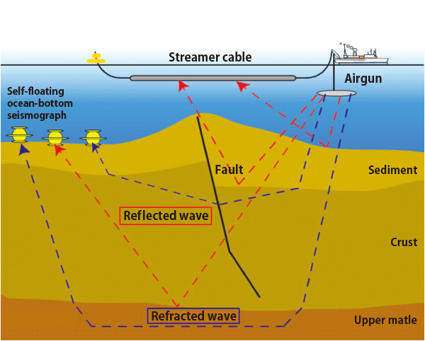
Studying underground geological structures by sound waves
Powerful sound waves are generated using a tool called an air-gun. These sound waves travel through the water, and every time they pass through an interface, through an interface such as seafloor, sediments or various geological strata, the density differences and other properties affect the propagation of the sound waves. The reflected and refracted waves are recorded in hydrophones, located within the streamer cable of the ship, and also in sea floor ocean bottom seismometers (OBS), which sit on the sea floor collecting data until they are released to float to the surface for recovery. Processing the data from the air-gun provides images of underground structures, including geologic strata, as well as faults ten to twenty kilometers below the seafloor.
Refraction and wide-angle reflection survey
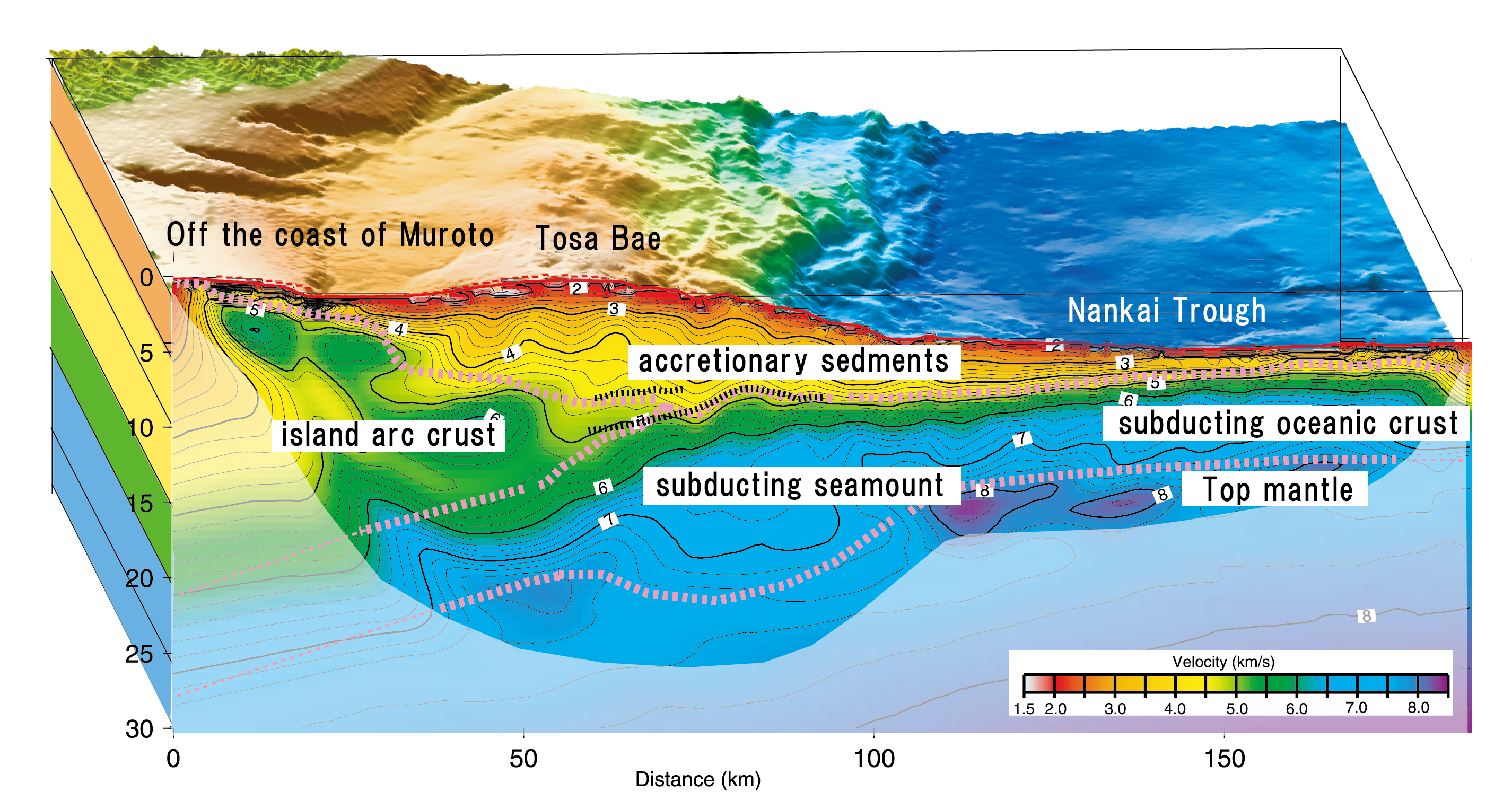
Studying sub-seafloor geologic structures using sonic waves
Powerful sound waves are generated by air-guns and are recorded by Ocean-Bottom Seismometers. These signals are refracted and reflected from deeper parts of the Earth’s crust, and generally provide deeper structural images than those obtained by the seismic-reflection survey. The data can be used to resolved images down to more than 50 km deep, although resolvable depth depends on complexity of the specific underground geological structure.
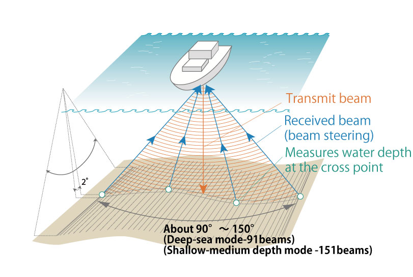
Multi-narrow Beam Echo Sounder
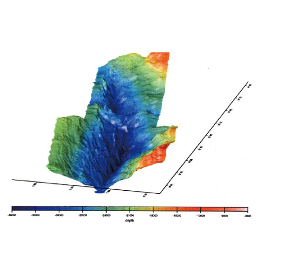 A seafloor topographic map is created based on data collected by multi-narrow beam echo sounder.
Measuring seafloor bathymetry and strata by acoustic beam survey
This system uses a sonar beam transmitted to the seafloor from the bottom of the vessel; a hydrophone array will receive the sonar beams reflected from the seafloor and measure the distance between the vessel and the seafloor. A bathymetry map of the seafloor is created based on this data. The sub-bottom profiler can reveal subsurface strata and items to a depth of several tens of meters. Since the seafloor bedrock is relatively free from weathering or erosion, its history is well preserved, and researching seafloor bathymetry provides clues to the history of volcanism and plate tectonics.
Piston Corer
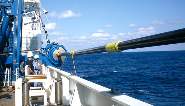
Recovering marine sediments
Marine sediments consist of plankton and all kinds of detritus that gradually settle out of the water column onto the seafloor. Layers of sediments accumulate over time trapping information of the past environments. Younger, more recent deposits are closer to the surface of the seafloor, and older (including the distant past) deposits are found deeper below the seafloor surface. These records include clues about past environmental conditions and help researchers expand the understanding of global climate change. Piston corers are used to unlock the story buried below the seafloor.
A piston corer is a long, heavy metal tube with top weight, used for collecting these shallow sediments in a form of core samples. Core sample analyses include the examination of color, structure, microorganism fossils, and rock fragments. All this knowledge give researches the necessary information on the past environmental conditions such as age, rate of sedimentation, water temperature records, and life biota.
Dredge
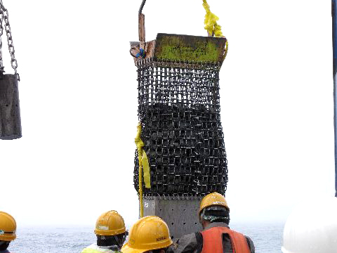
Collecting rock samples
A traditional method of collecting sediment or rock samples from the seafloor is by using dredges. Dredges come in many shapes and sizes, but essentially they are metal boxes connected to the ship by a chain or cable, and are dragged along the seafloor, collecting sediments, rocks, or whatever is caught inside. The samples are collected non-selectively, unlike the pin-point sampling by an ROV. The major advantage is that this simple, easily-handled system can be used on any ship, large or small.